Campsite at Mile 840.60 to Large campsite, near Piute Creek
It was really cold last night. Even though I was so tired from yesterday's hike, I had some trouble sleeping. Because it was so cold I slept way inside my sleeping bag, but that kept making me a bit claustrophobic which kept waking me. I finally had some really good sleep from 4:00 AM till I awoke at 6:15 AM. I peaked out of my tent and Brad and Share Bear were still in theirs, so I laid back down and relaxed. We usually all rise at 6:00 AM, but after getting into camp late last night, plus it being really cold this morning, plus no one wants to put on our cold, still wet shoes, everyone is staying put inside their tents.
Finally at 6:30 I thought I better get moving, so I got my stuff together and left the tent. There was frost on my rainfly, so it must have been below freezing last night. Tonight will be warmer since we will be hiking down below 9,000 feet today...something to look forward to.
Finally Brad and Share Bear emerged from their tents. We broke camp, ate breakfast, and we're ready to hike at 8:00 AM.
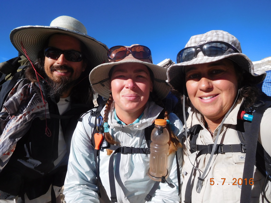
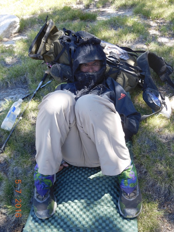
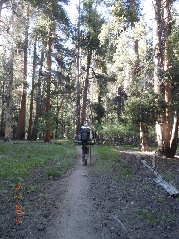
Ready to hike.
Today seems like a day off since we don't have a pass to climb over and it looks like the terrain is going to be mostly a gradual decline from our current 11,435 to 8,077 feet. There is one river crossing that has us a bit worried because we have heard that the water level could be chest high. But, before worry about that, we are enjoying the view as we left our campsite:
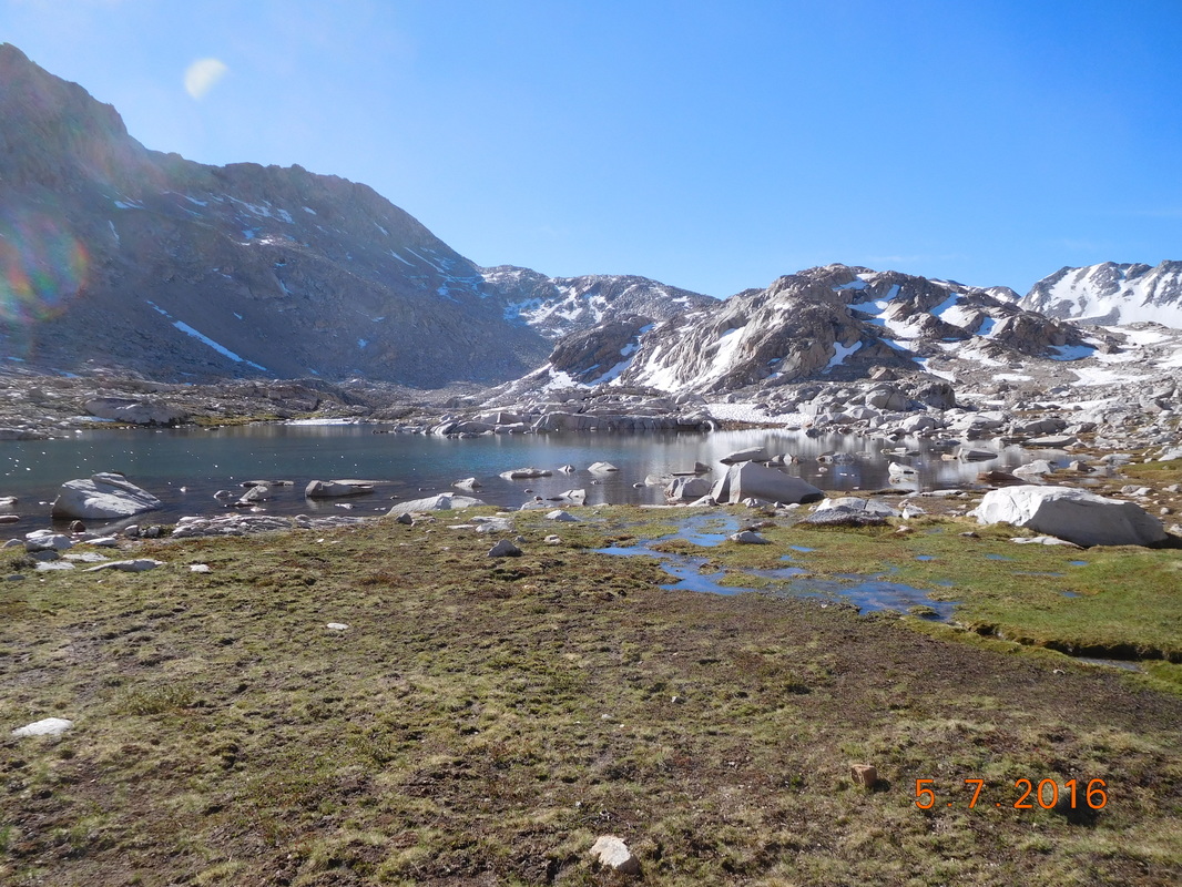
The high Sierra.
As we hiked, the trail was covered with water from snow melt. We usually walked around it, or jumped rocks that others put in the path. We got to one section that walking around wasn't possible and there wasn't any stones, so Share Bear decided to jump over it. The first jump was a success, but the second she slipped head over heels and landed on her backside and, like a turtle, couldn't get up. Brad came to the rescue and helped her up. Here is the aftermath of her slip...a wet bottom and the socks she had drying were now covered in mud.
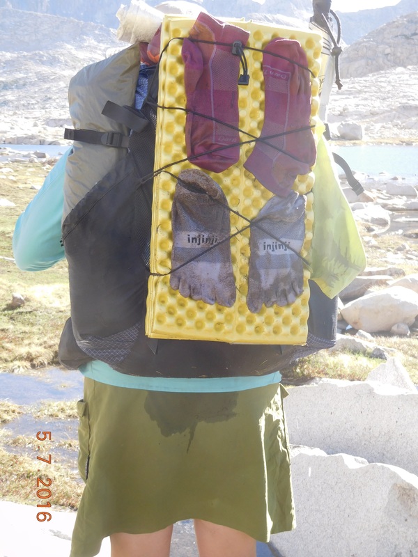
Share Bears accident.
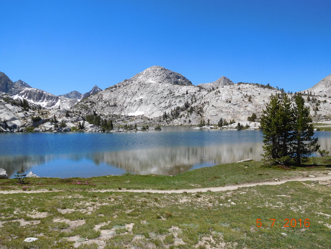
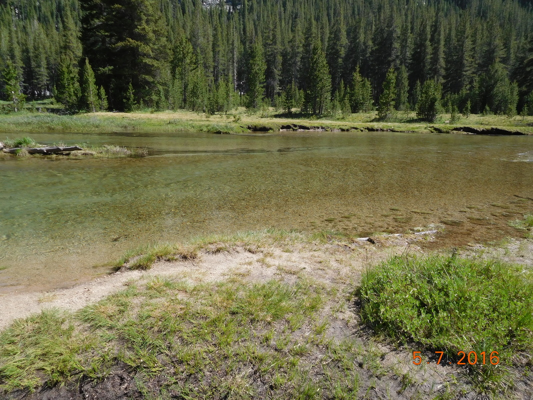
We continued hiking past Sapphire Lake with still water that allowed for an incredible reflection of the mountains above:
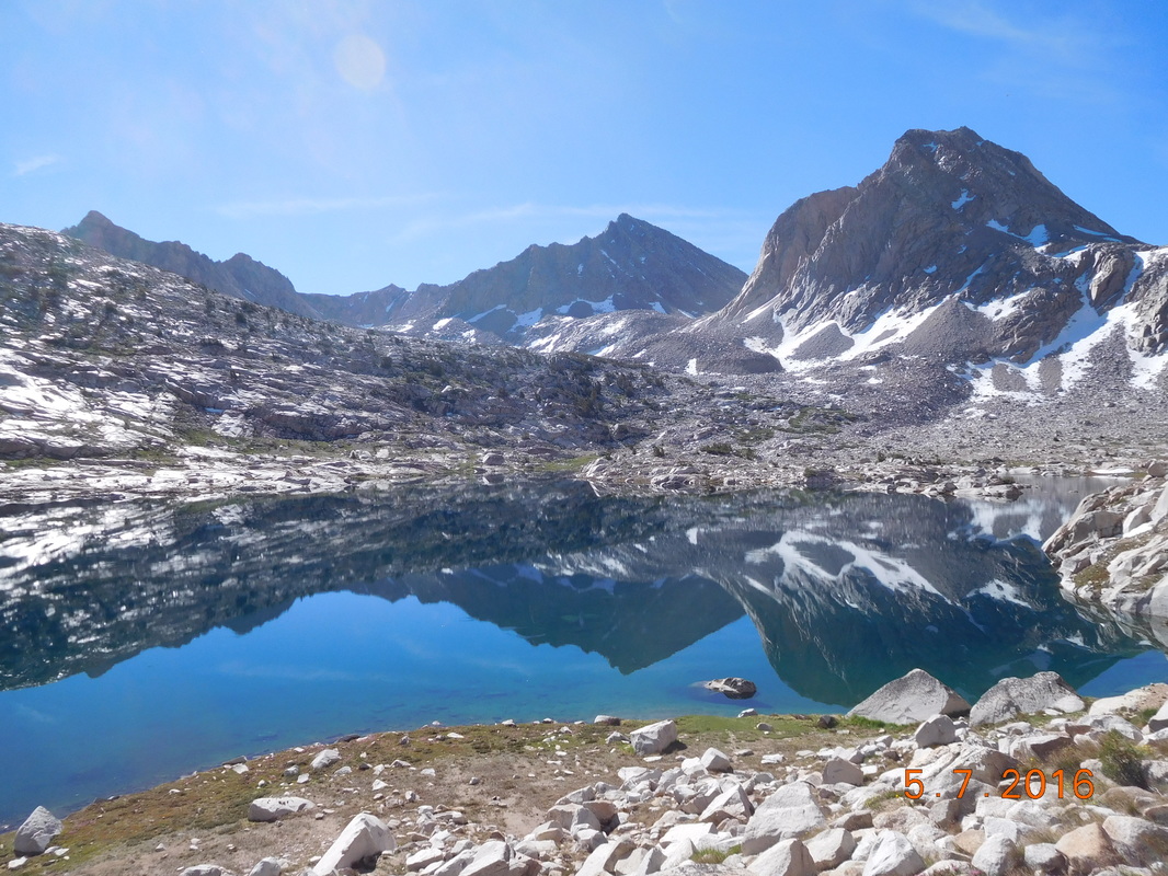
Sapphire Lake.
After about 3 hours of hiking, Share Bear needed a break, so we stop along Evolution Lake. It was a beautiful area, but the mosquitoes were out in full force. Brad dresses to avoid them:
Brad armored up against mosquitoes.
This was our view during the break with the trail going right along the lake:
Evolution Lake.
After much descending we decided to break for lunch just before McClure Meadow. I was pretty happy that I got to cook and eat last nights mac & cheese since I ate today's lunch for dinner last night. During this time I also finished last nights blog since I was way too tired and cold to complete it last night.
After a pretty long lunch break, we arrived at McClure Meadow...beautiful...
After a pretty long lunch break, we arrived at McClure Meadow...beautiful...
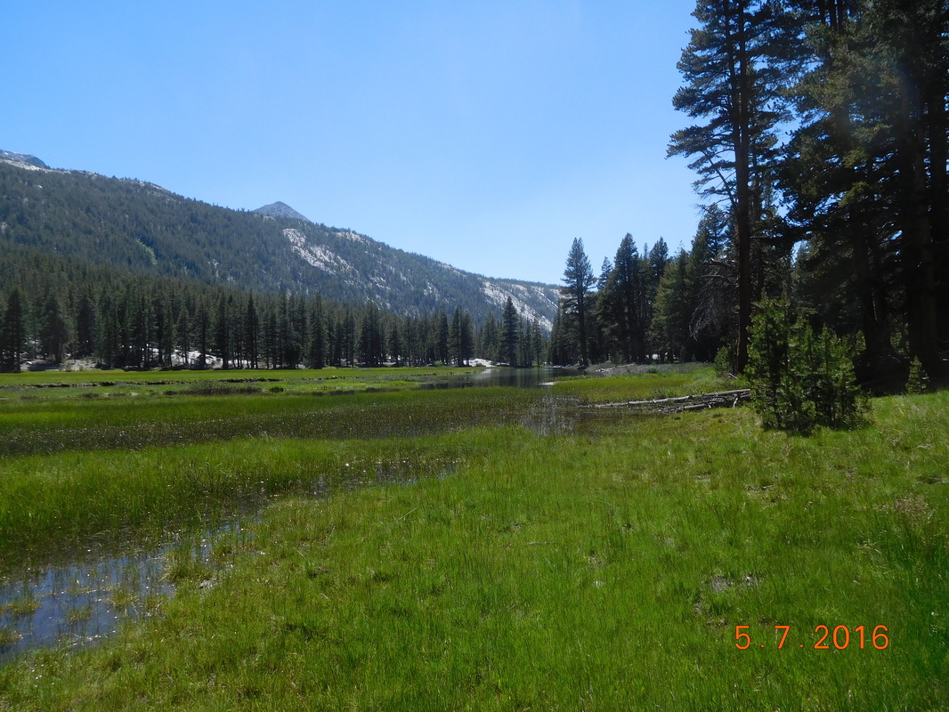
McClure Meadow
We were now close to the deep water crossing we have heard about. Just before the crossing we came across this sign:
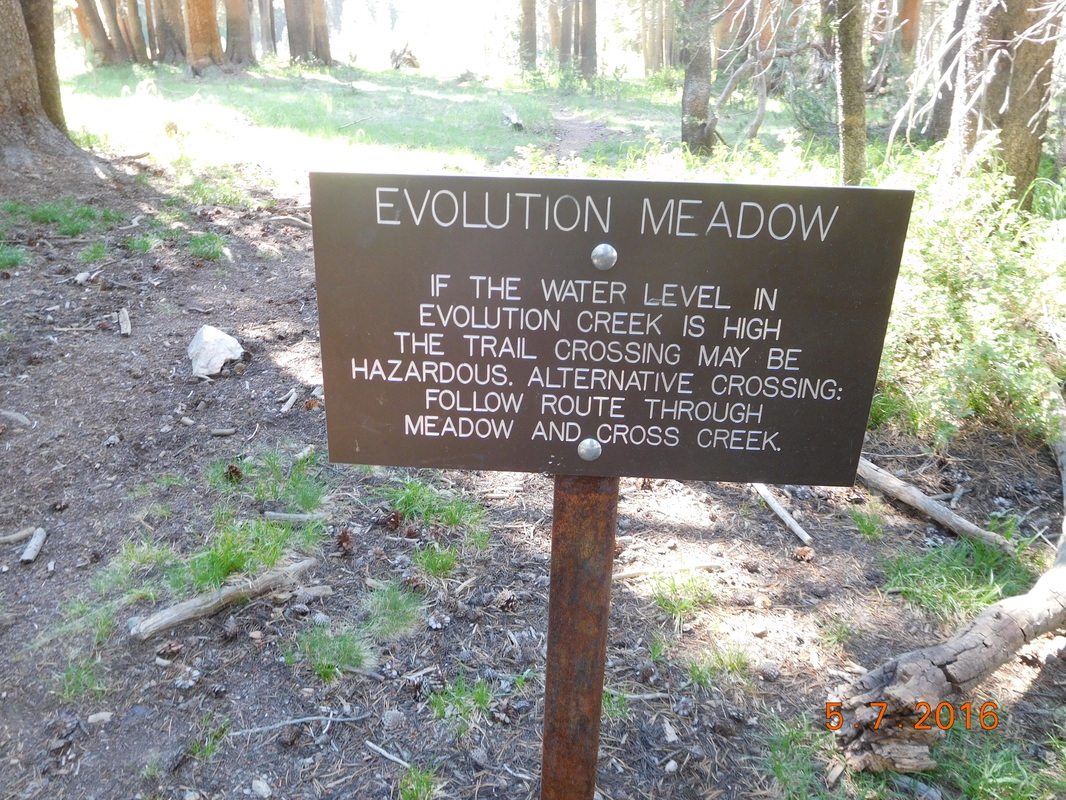
Warning
I declared that we take this alternate route since I wasn't looking forward to chest high water that could get my backpack wet. The others agreed, so off we went.
We very shortly arrived at Evolution Creek that looked tame and wonderful. I just took off my shoes and walked across it with the deepest part being thigh-high.
We very shortly arrived at Evolution Creek that looked tame and wonderful. I just took off my shoes and walked across it with the deepest part being thigh-high.
Evolution Creek crossing.
After the crossing we continued on the alternate route back to the trail where we saw the actual trail crossing...glad we took the alternate!
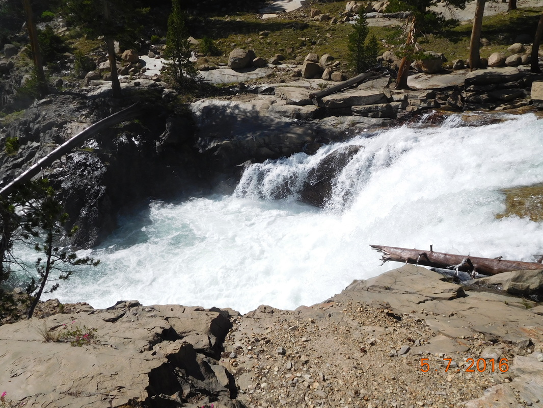
Evolution Creek in full swing.
Just kidding...although this is the same Evolution Creek further down creek, the actual crossing looked quite tame, just very deep. We made the right decision by taking the alternate.
Continuing down the trail the scenery did not disappoint.
Continuing down the trail the scenery did not disappoint.

Looking down a valley from above.
Oh...I keep telling you how difficult this trail is to hike on, so I took a picture to show you:
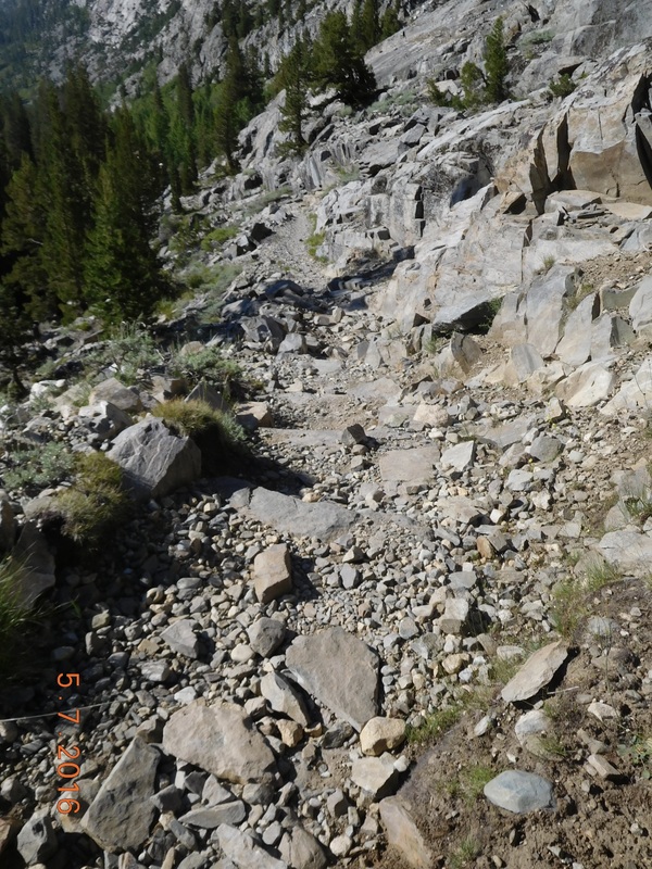
Yes...this is the trail.
About 2.5 miles before we stopped for the night we crossed this cool wooden bridge that crosses the South Fork San Joaquin River:
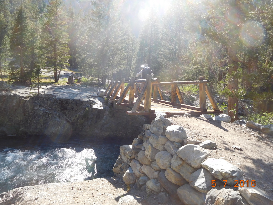
Brad crossing a bridge.
After crossing the bridge I called for a "backpack-off" break. My back was killing me. Having to carry this darn bear canister is not fun! It doesn't fit in my bag horizontally, so I have to carry it vertical which throws the balance of my bag off...not very good for the back.
After about 10 minutes we started back on the trail for the last 2.5 miles of the day. Not too much fun for me, but I was able to keep up anyway.
After about 10 minutes we started back on the trail for the last 2.5 miles of the day. Not too much fun for me, but I was able to keep up anyway.
Following Brad close behind.
Luckily I had some awesome views to look at to try to keep my mind off my aching back.
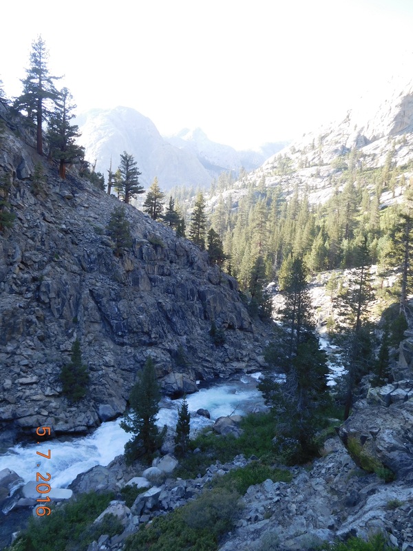
Trail above raging river.
Finally, before 7:00 PM we found a really nice campsite. Thunder Pass was here already eating dinner. By the time our tents were setup and we were ready for dinner, he was already in his tent.
This site is so nice. There is the sound of the river, a deer walked right through our site as we are dinner, the temperature is perfect, and my tentsite feels pretty flat. All of this should make for a great night.
This site is so nice. There is the sound of the river, a deer walked right through our site as we are dinner, the temperature is perfect, and my tentsite feels pretty flat. All of this should make for a great night.
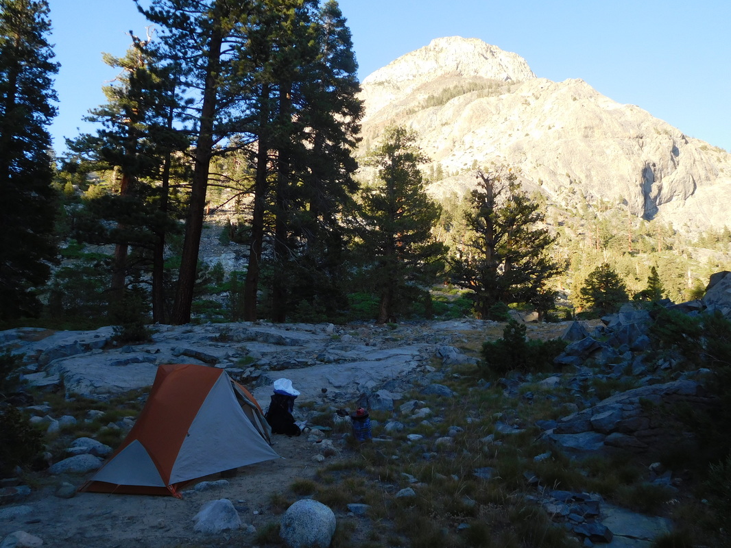
A great tent site.
 RSS Feed
