Unpaved Road at Snoqualmie Pass to Campsite at mile 2404.84
Another morning waking in a hotel room. We planned on getting up at 6:00 AM, but my alarm went off at 5:30 AM since that's what time we have been waking up. Of course my watch was across the room so I had to get up and turn it off...not cool. Finally the correct 6:00 AM alarm went off but no one wanted to move. We all went to sleep way too late last night and we could all use more sleep, but we have 15 hard miles of hiking, so let's go.
We dressed and went downstairs for the typical hotel breakfast then hit the road for the 50 minute drive back to Snoqualmie Pass. When we got there we met Jazzman at the coffee shop and Share Bear loaded him up with ramen and bars that might last him to Canada. We then got our food together for the next 3.5 days and were ready to hike at 10:12 AM.
We dressed and went downstairs for the typical hotel breakfast then hit the road for the 50 minute drive back to Snoqualmie Pass. When we got there we met Jazzman at the coffee shop and Share Bear loaded him up with ramen and bars that might last him to Canada. We then got our food together for the next 3.5 days and were ready to hike at 10:12 AM.
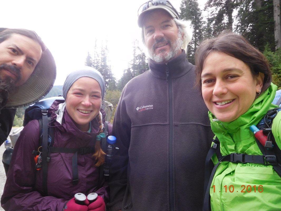
Ready to hike
Today's hike is only 14.55 miles due to the later start, but will be a doozy. In the 14.55 miles we have 5,656 feet of climbing. Actually, in the next 3.5 days (71 miles) we have over 19,000 feet of climbing and over 18,000 feet of descending...quite a challenging section.
But first, before the climbing begins, we have to cross under I-90, the last interstate before Canada.
But first, before the climbing begins, we have to cross under I-90, the last interstate before Canada.
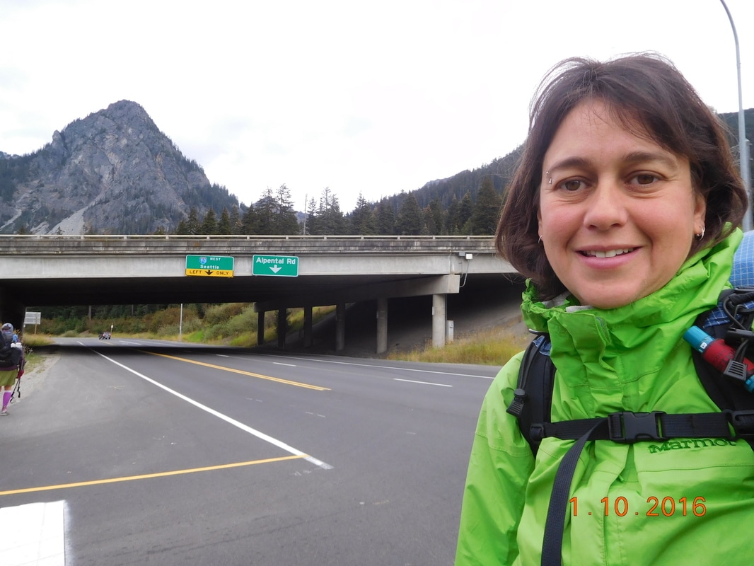
Self-portrait "Interstate-90"
After the interstate we came to a trailhead where this sign was posted stating that this trail is "most difficult". I also like the "Snoqualmie Pass" sign below it being eaten by the tree.
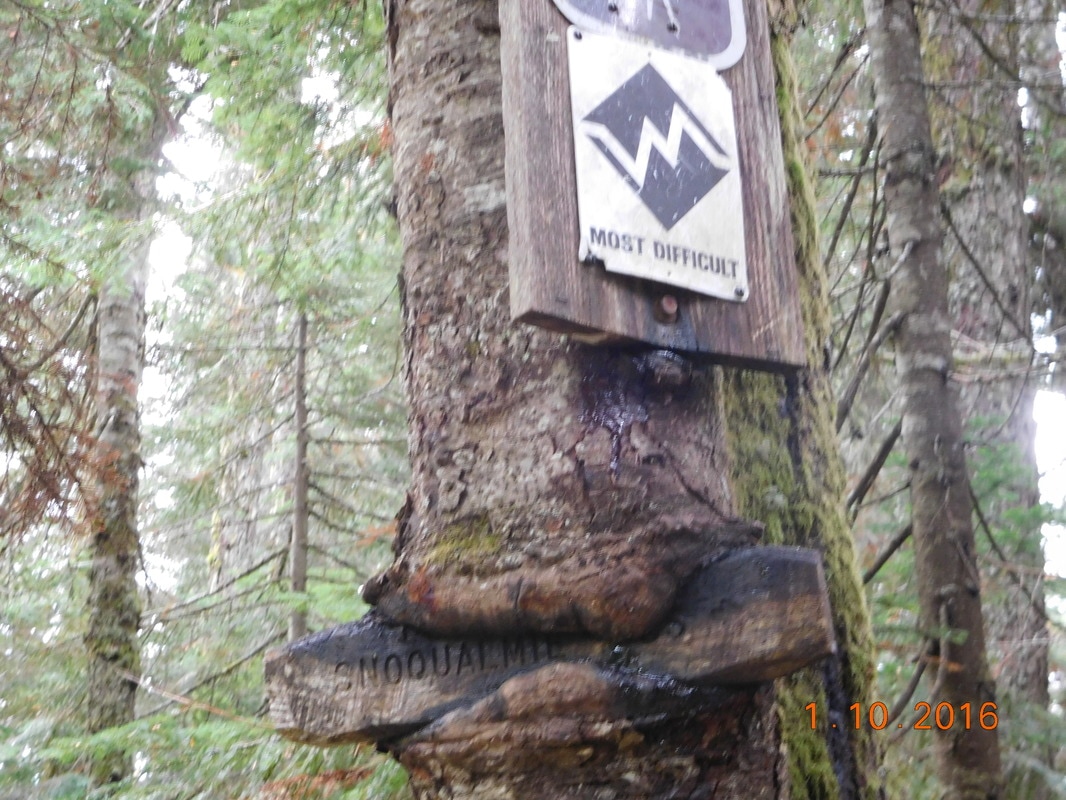
Most difficult trail ahead
At this point we entered Alpine Lakes Wilderness Area.
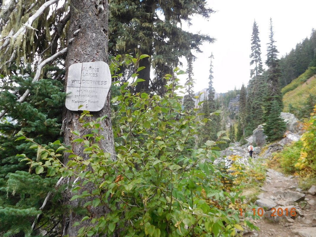
Alpine Lakes Wilderness Area
There is rain in the forecast for the next 4 days or so. The rain started falling today around 11:30 AM so I stopped and put on my rain gear. Not 10 minutes later the sun came back out and there was a rainbow behind the clouds:
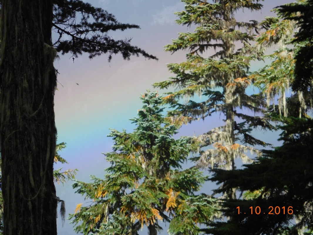
Cool rainbow
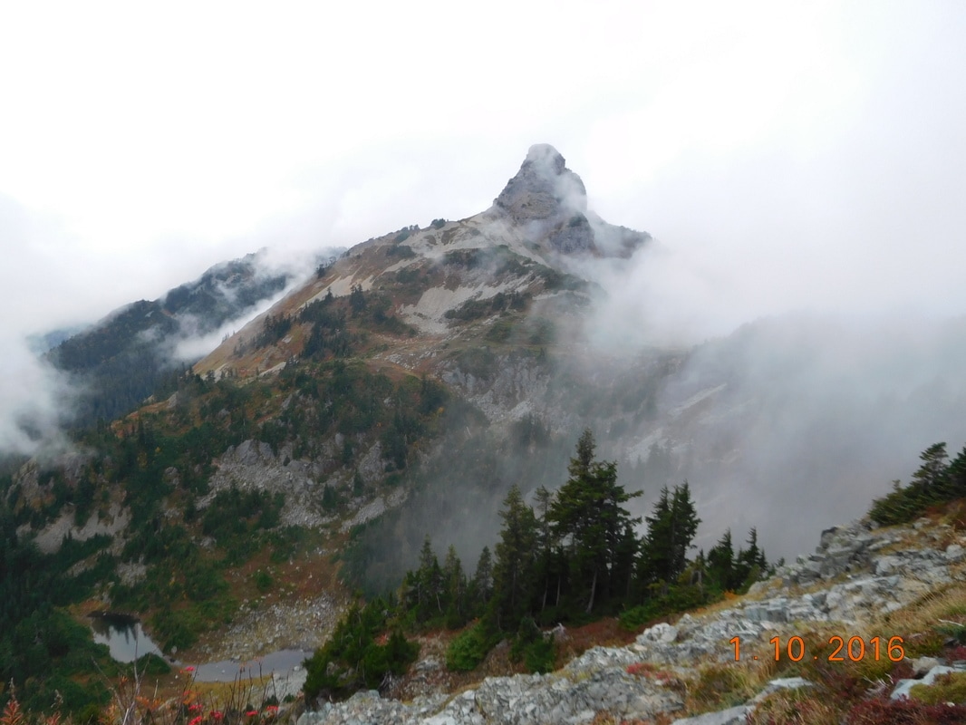
After 6 miles of climbing we came to Kandel's Katwalk...at least that is what a local hiker told us it was called. There was a great view up there:
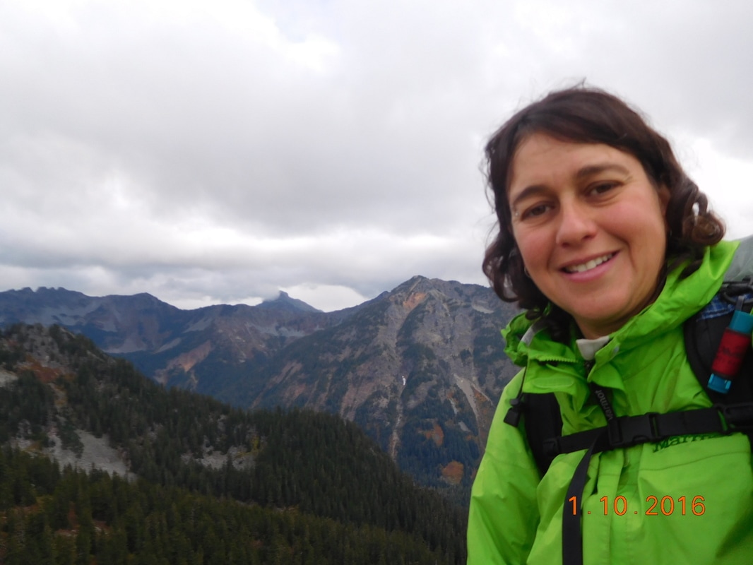
Self-portrait "View from Kandel's Katwalk"
After the Katwalk we hiked around a bend and had an awesome view of an alpine lake:
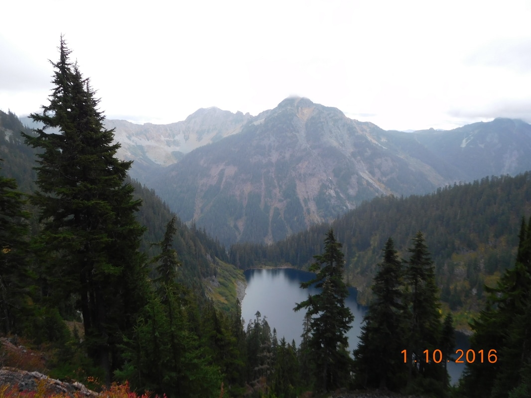
Beautiful
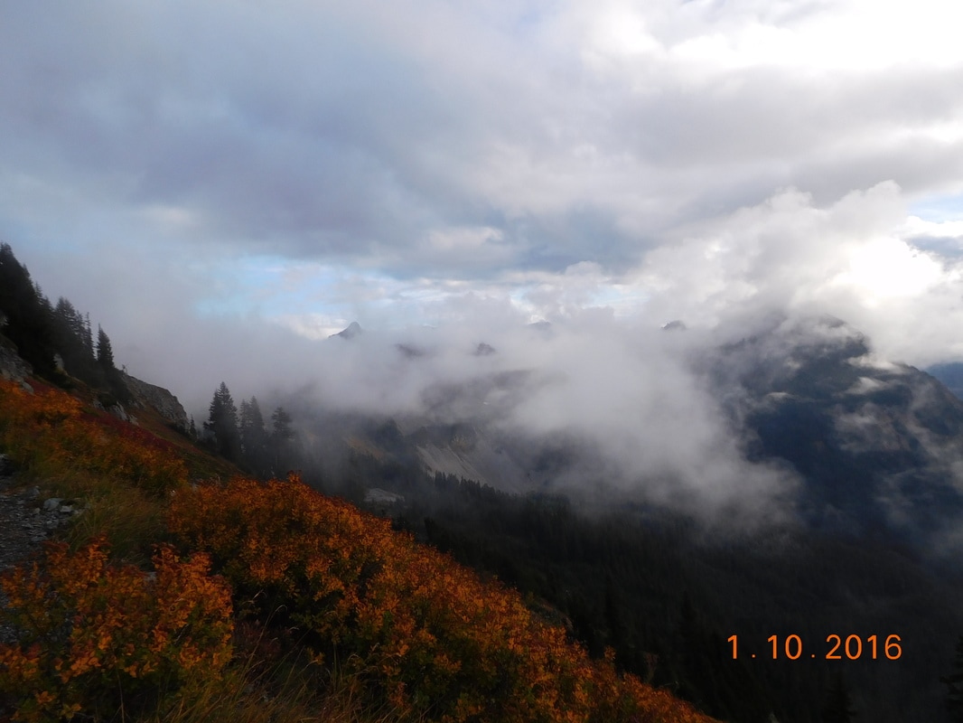
Then the clouds started rolling in making for some spectacular scenery:
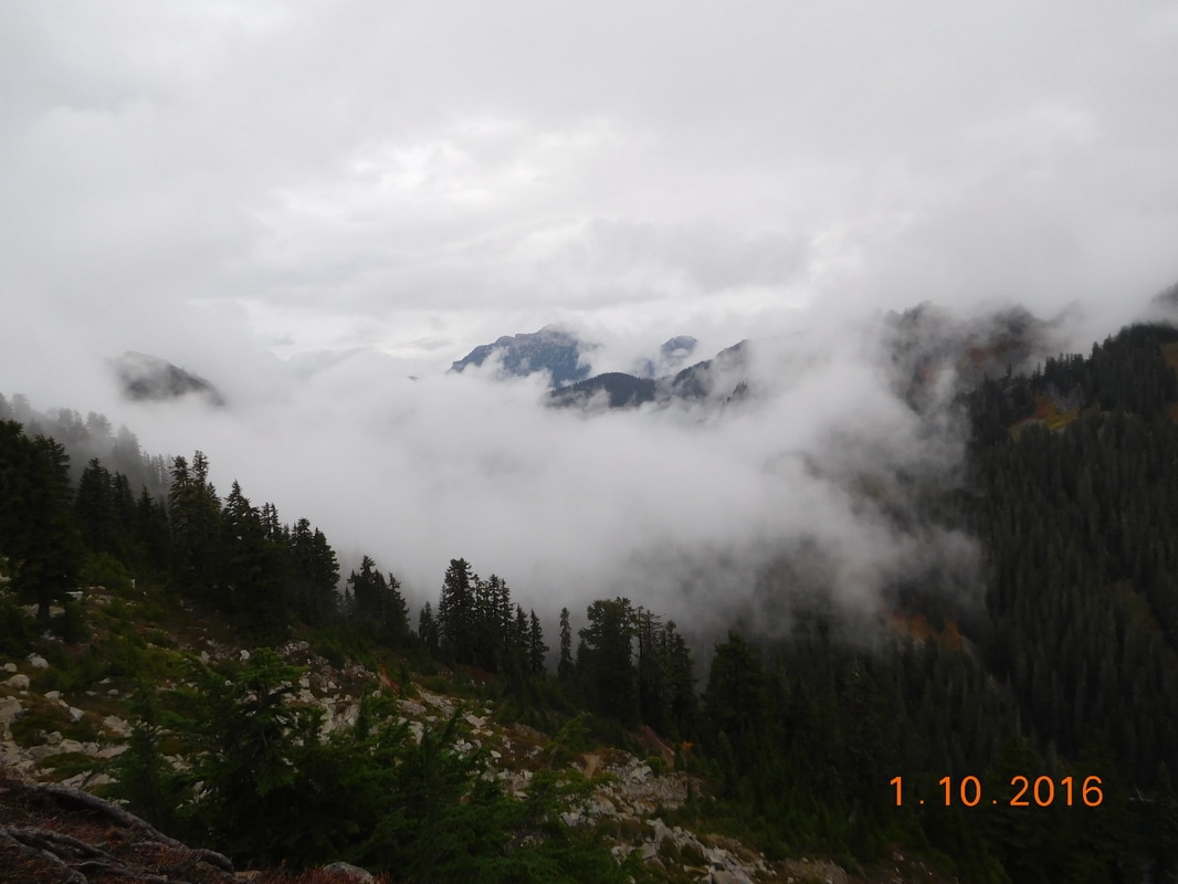
Rolling clouds
Oh...yet another milestone was hit today...2,400 miles! Only 250 miles to go!!
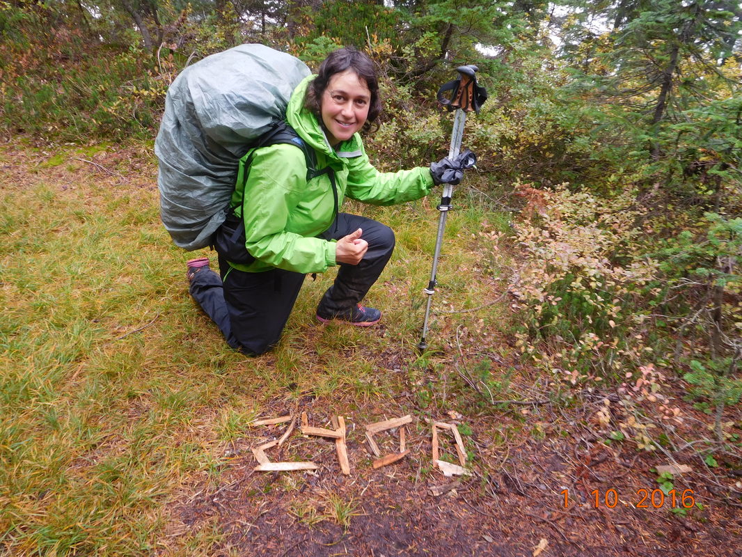
My 2,400 mile pose
Here are some more photos of the amazing clouds rolling in throughout the afternoon:
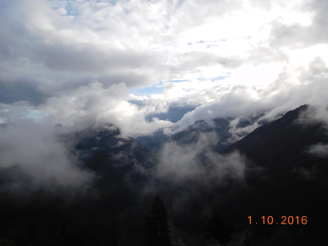
Breaks of blue skies
Not only was today's hike challenging because of some pretty steep climbs, the terrain was very rocky and challenging as well.
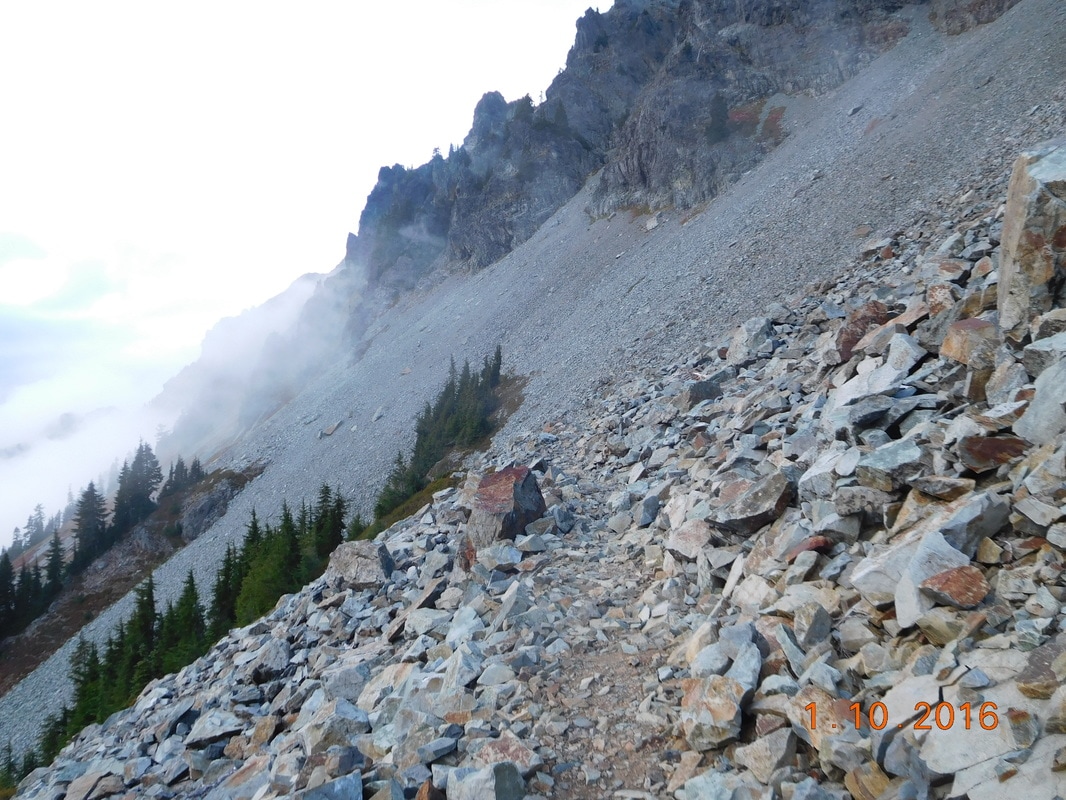
Trail made of rocks
How hard was the hike today? The last 4.84 miles took me 2.5 hours. Usually I can hike this distance in just over 1.5 hours, and at worst I should be able to hike this in under 2 hours. Yes, it was very slow going.
I finally made it to our planned campsite at 6:30 PM and quickly setup my tent in case it started raining. For a day that it was supposed to rain all day, we got lucky and it only rained lightly on and off. Not really enough to get wet.
While eating dinner the sky cleared and stars were visible. Maybe we will get lucky this whole stretch and the predicted rain will not fall.
Due to the difficulty of this section, tomorrow we have around 20 miles planned. Right now I am cold and very tired due to not enough sleep last night, so I will be ending the blog now and getting to sleep. Until tomorrow...
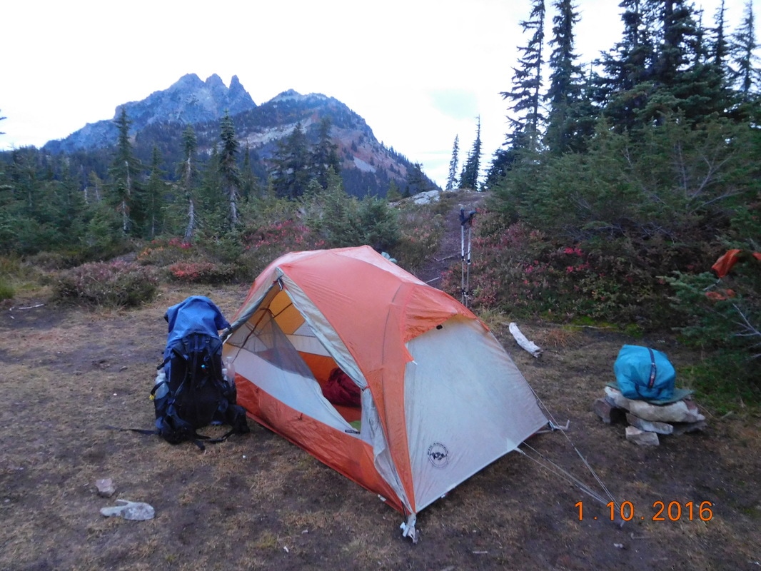
My home for the night
 RSS Feed
