Mammoth Lakes, California
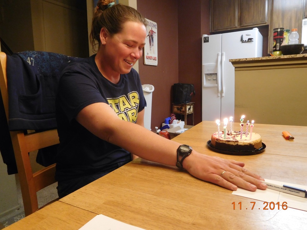
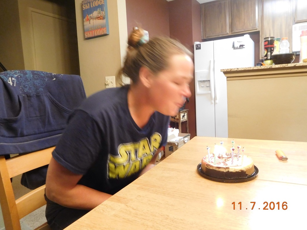
Happy Birthday Share Bear!!!!
|
|
|
Mammoth Lakes, California Happy Birthday Share Bear!!!!
0 Comments
Mammoth Lakes, California Ahhh. The first of two zero days in Mammoth Lakes, California. As usual, we have a lot to do in the next two days. Zero means we hike zero miles, not that we do zero things all day. After 82 days on the trail we all need to replace some clothes, so we went shopping. Of course we had to go to all three of the outfitters in Mammoth Lakes. We followed up shopping with pizza. After lunch Brad and Share Bear wanted a nap. This was the perfect time for Tim and I to visit one of the local breweries, Black Doubt Brewing Company: 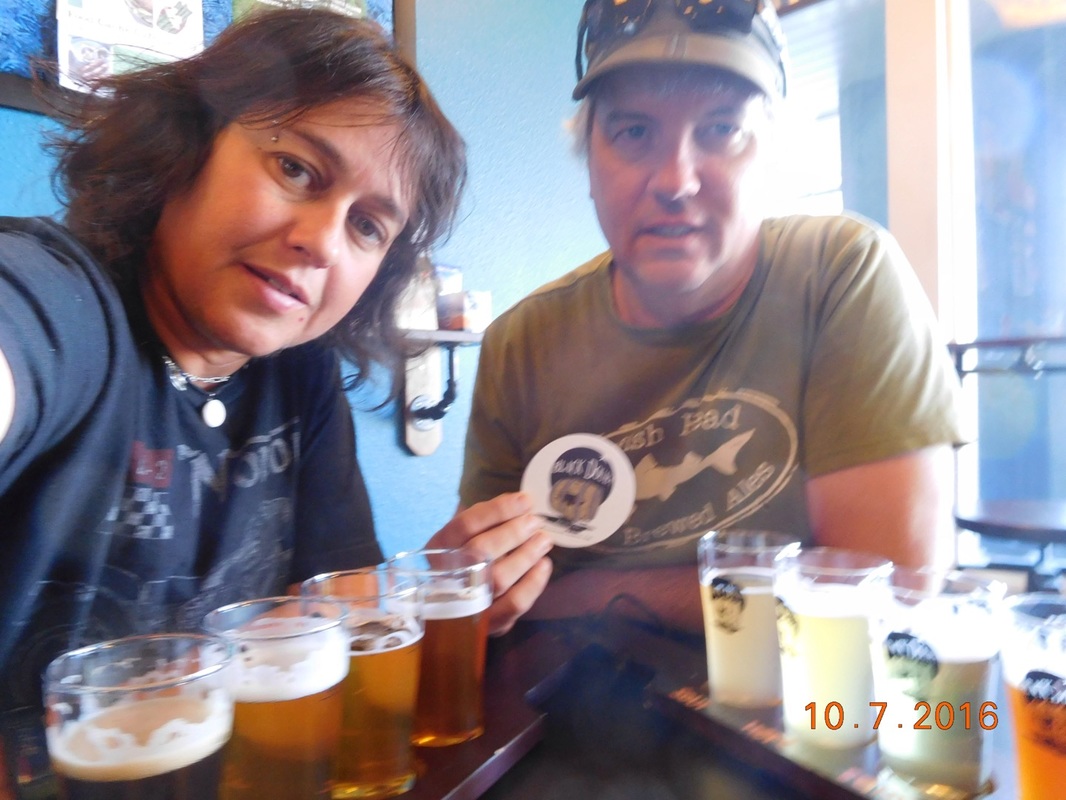 Flight of beers at Black Doubt Brewing Company We arrived back to the condo and relaxed some before we all went to Mammoth Brewing Company for some appetizers and a flight of their beers: 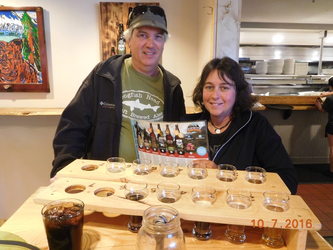 Flight of Beer at Mammoth Brewing Company After Mammoth Brewing Company we returned to the condo and watched the movie "Deadpool" (highly recommend it, but not for children) and shared a bottle of wine.
What a perfect zero day...except for the shopping. I could have done without that. Campsite on Lake Virginia to Red's Meadow (Staying in Mammoth Lakes) We woke up with excitement that we will be in an actual town tonight with beds, a shower, good food, breweries, and of course, Tim. We all woke at 6:00 AM as usual, but were ready to go by 7:40 AM...a lot sooner than most mornings...we really are anxious to get to town!  Ready to hike to Mammoth Lakes. Today we have about 15 miles to hike. There are a couple of ups and downs, but in general, today should be a somewhat easy day, especially since we don't have a pass to go over. First we say goodbye to Lake Virginia:  Morning view of Lake Virginia After an up and then a down we arrived at Purple Lake. Wow...so beautiful. 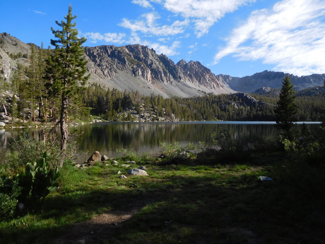 Purple Lake We sure are spoiled with this beautiful scenery as we hike: 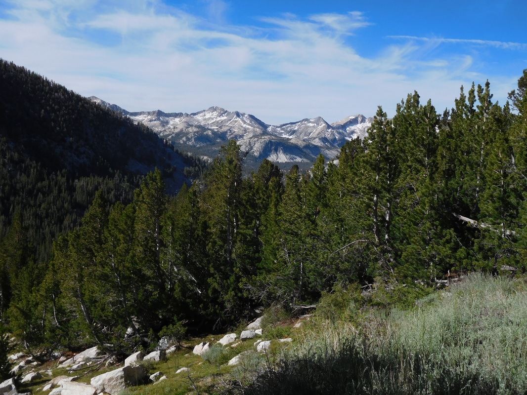 Mountain view Just after noon, we hit a new milestone...900 miles!!! 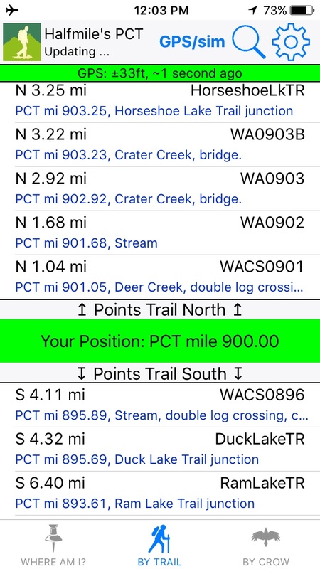 Proof I'm standing at PCT mile 900. 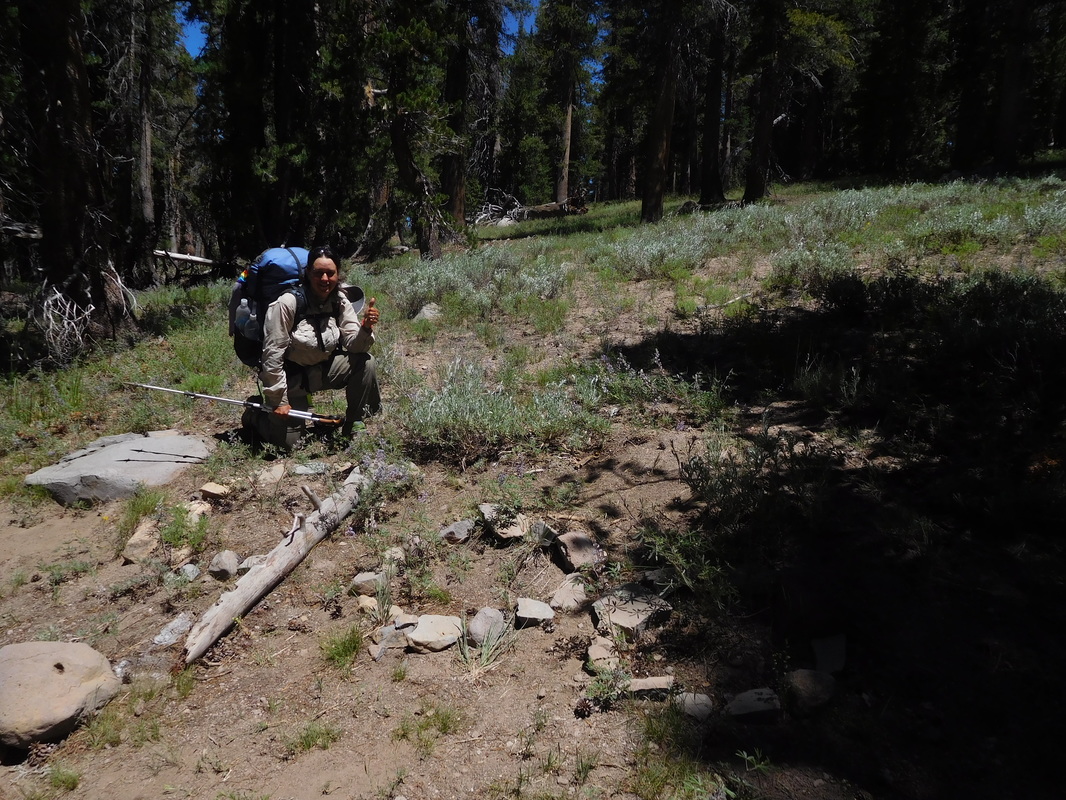 Mile 900 pose. We were anxious to get to town, but we needed to take a break for lunch. We found a nice shady spot and was lucky that there were no bugs to bother us. Share Bear made a tuna sandwich between 2 corn tortillas. I knew there was no way she could pick it up and eat it without the entire thing falling apart. She then picked it up inside the corn tortilla bag. Touché Share Bear...touché. 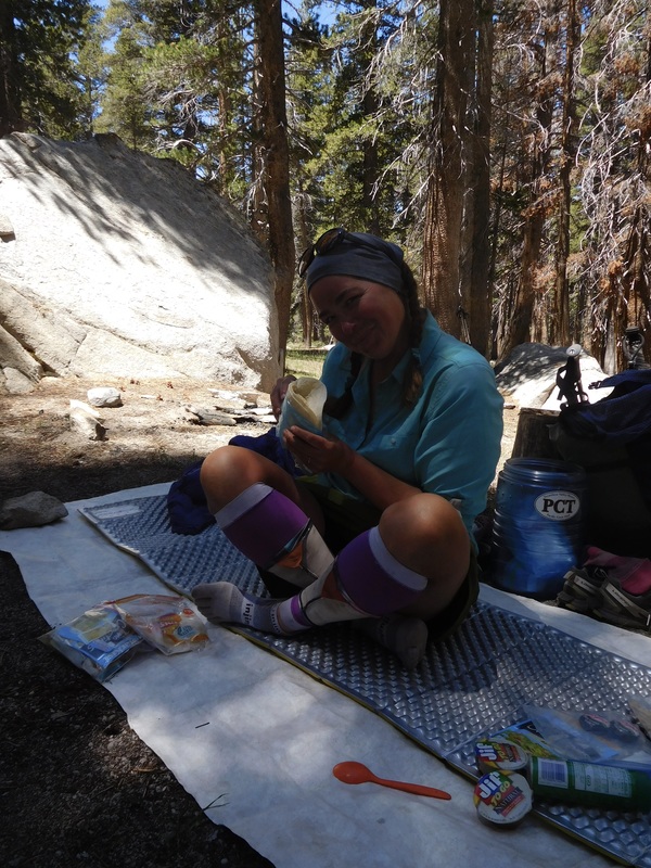 Share Bear showing how it is done. Our lunch break went way longer than we planned. We didn't get going until almost 2:00 PM The spot was just too perfect to leave any sooner. Less than 1 hour later we arrived at Horseshoe Lake trail junction. Less than 3.5 miles to Reds Meadow! 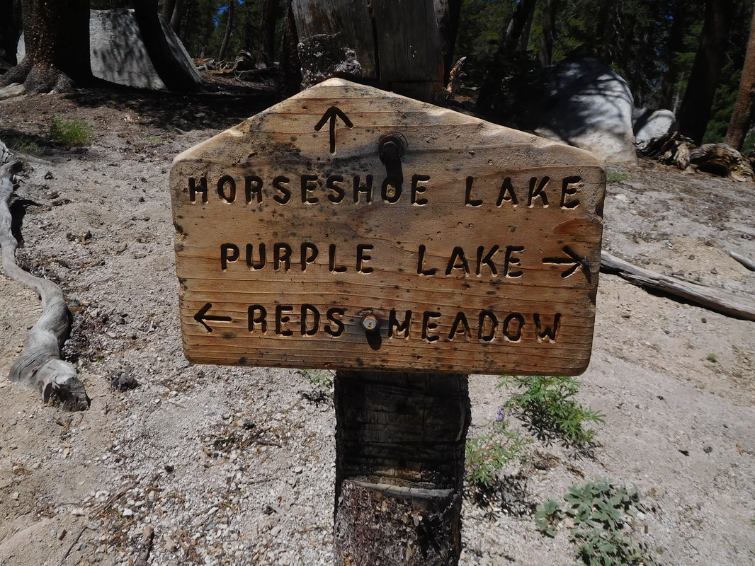 Almost to Reds Meadow We were quite surprised to see this Pacific Crest Trail sign at Horseshoe Lake trail junction: 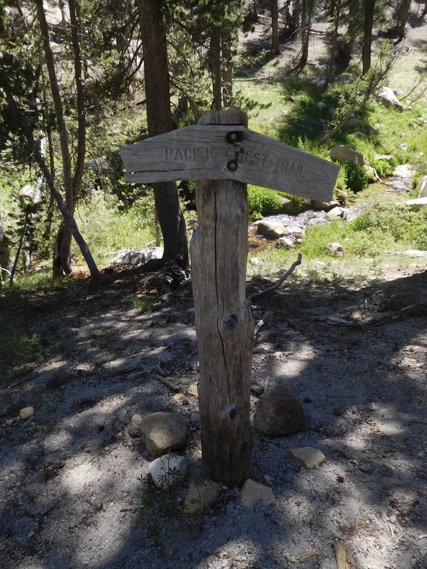 Limp but cool PCT sign of the day When crossing logs we usually watch each other cross to ensure we made it over safe. When we are this close to town we...Brad...just keeps on walking. 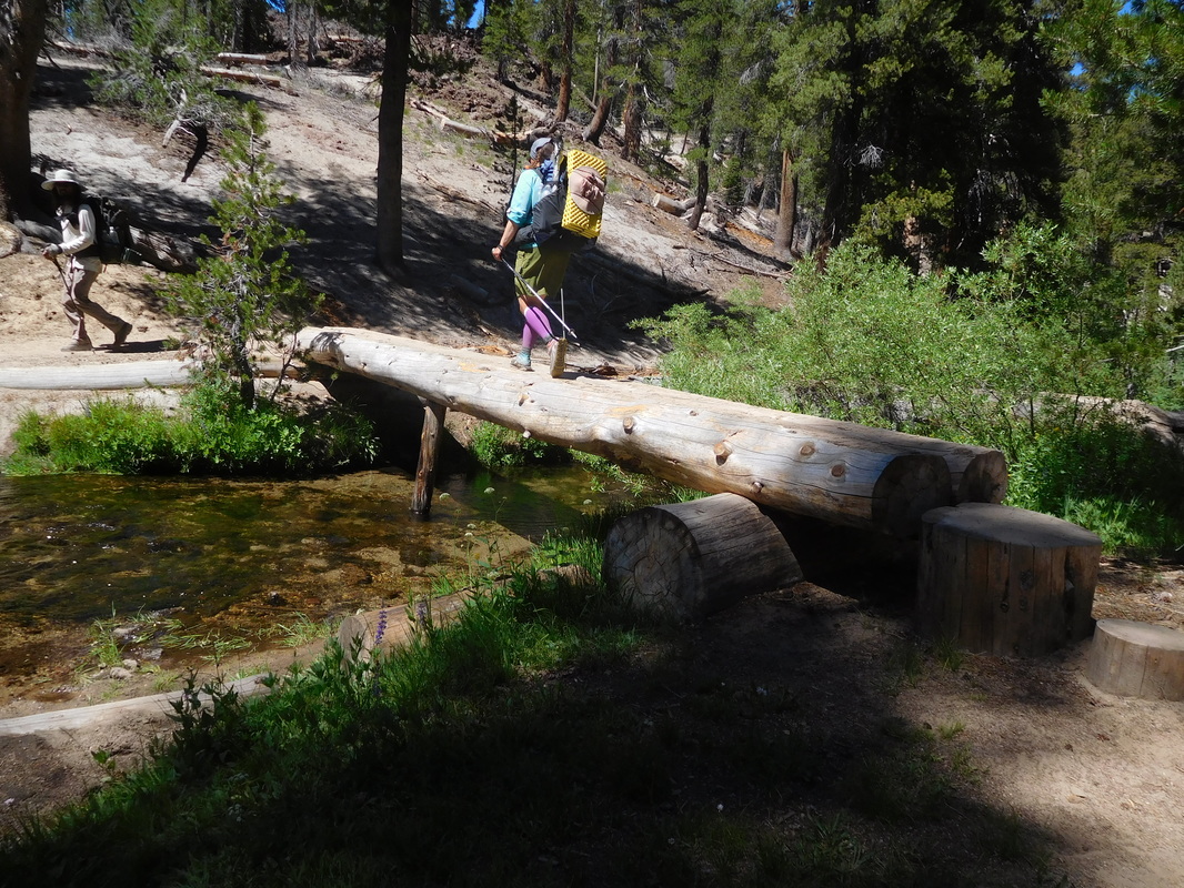 Brad just caring about getting to town. The last 2 miles always seems like they take forever and never end. With the beautiful scenery we are OK with that. 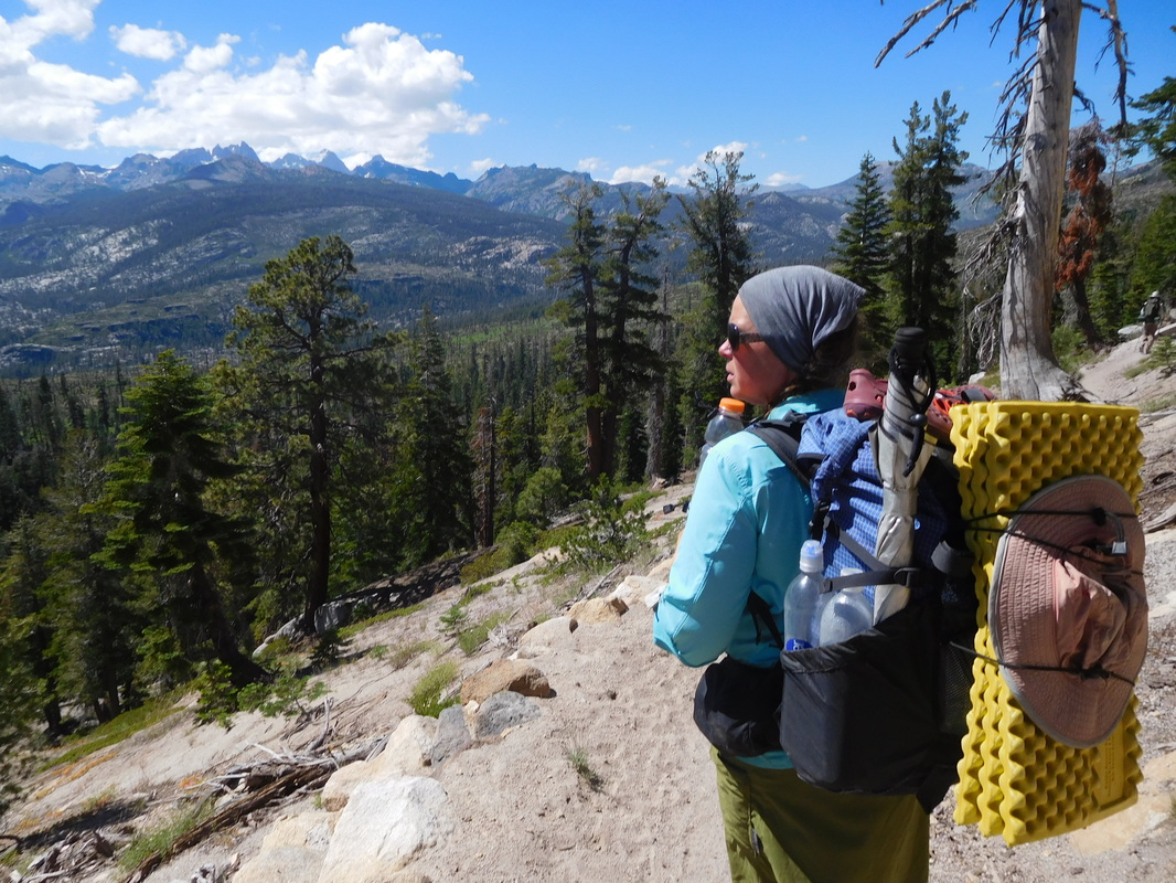 Share Bear admiring the scenery When we were 1 mile out from Red's Meadow, Tim appeared on the trail. He hiked up the trail to meet us. We hiked together towards Red's Meadow and was stopped by a gentleman just as we arrived. He is working with a group of trail maintenance volunteers and wanted to know if we wanted a cold drink...well...of course. Brad and Share Bear had a root beer while Tim and I had a beer. It was great meeting and thanking a PCT volunteer in person. 15 minutes later we arrived at Red's Meadow. We saw Mountain House here who was hanging out in from of the store. He had a great stay in Mammoth Lakes and can't seem to get back to hiking. I think we will feel the same in a couple of days. 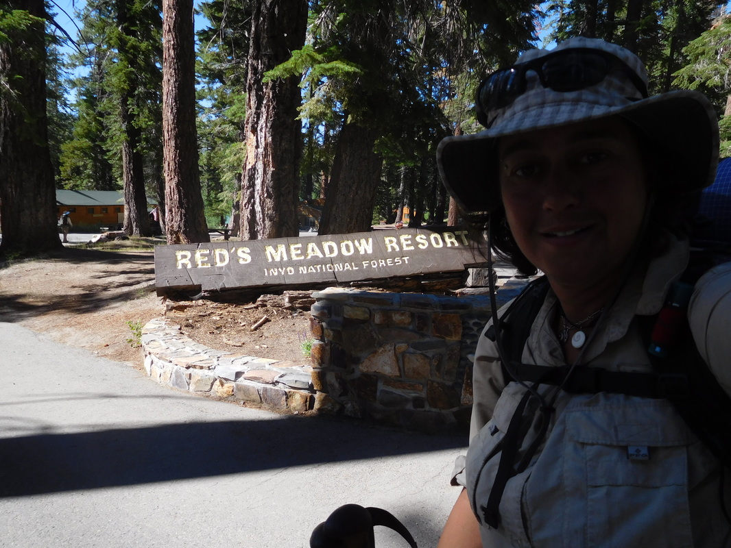 Arrival to Red's Meadow. I love when they have signs that tell how much further to Canada. I can't believe we are almost half-way done i time, but still are closer to Mexico than Canada. We have some serious hiking to do. 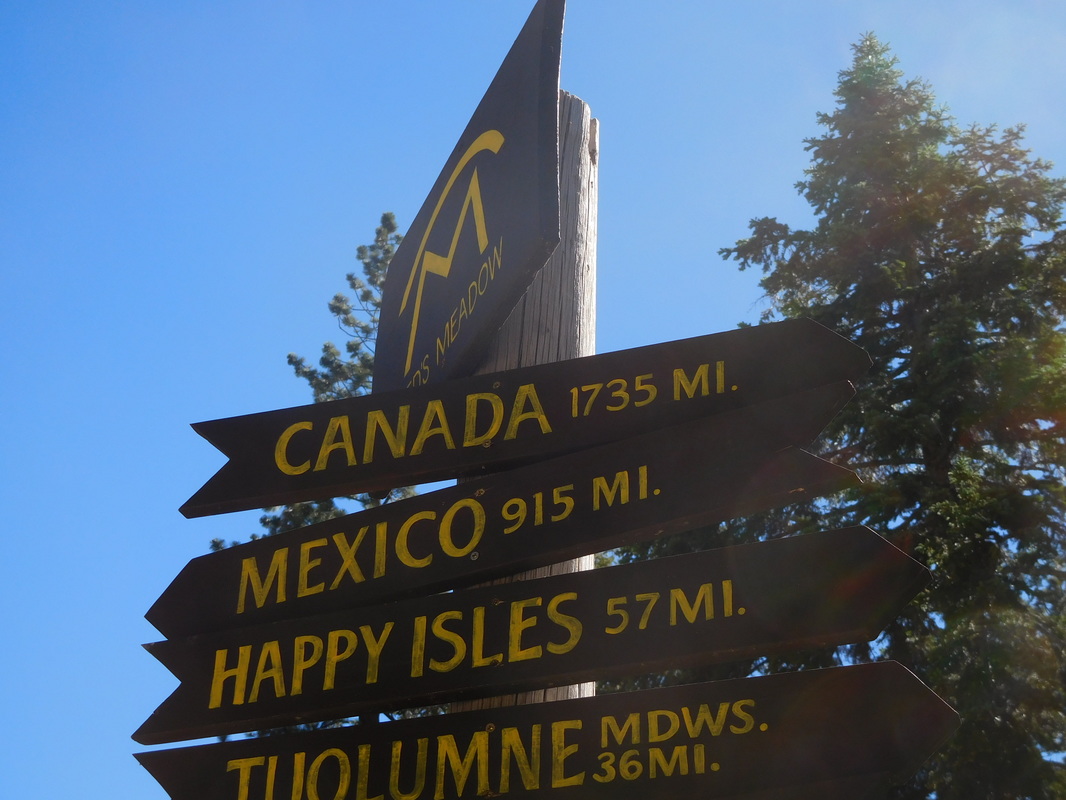 Getting there, but slowly Tim rode his motorcycle back to the condo and we took the bus. The road to Red's Meadow is closed to cars during the day unless you are staying at the resort, so we had to take the bus. No big deal...we were just happy to be heading into town for showers and good food. Plus, we are staying in a condo that sounds awesome. We got to the condo and made ourselves at home....showers around, followed by going out for dinner, followed by sleep. We are taking the next 2 days off, which we really need after a really hard 9 days of hiking we just finished. Thank you Jodie and Don for the use of your condo...you guys are incredible!  Our home for the next 2 days. Vermilion Valley Resort to Campsite on Lake Virginia Wow...here I am on day 80 on the trail. Incredible! Sleeping in a bed and not having to pitch the tent last night was great. The springs in the mattress were a bit springy and it was pretty cold in the canvas tent we slept in, but in the morning it was easy to throw everything into our bags and be all packed. Breakfast was served at 7:30 AM, so we arrived right when they opened the doors. It was nice to not have Carnation Instant Breakfast and a protein bar for a change. I had a breakfast burrito and split pancakes with Brad. It was pretty good. 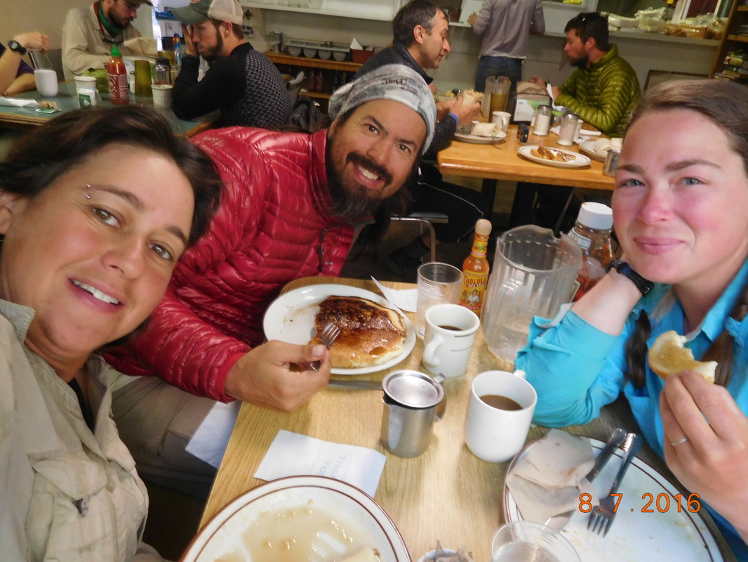 Breakfast at VVR  Outside VVR store. I love the "Hikers! Please loiter" sign. After breakfast we went up to the canvas tent and grabbed our bags. By the time we got back to the store the people taking the first ferry back to the trail had departed, so we had to wait for the next one that departed just after 9:30 AM. 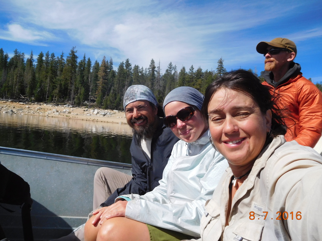 Riding the ferry back to the trail. 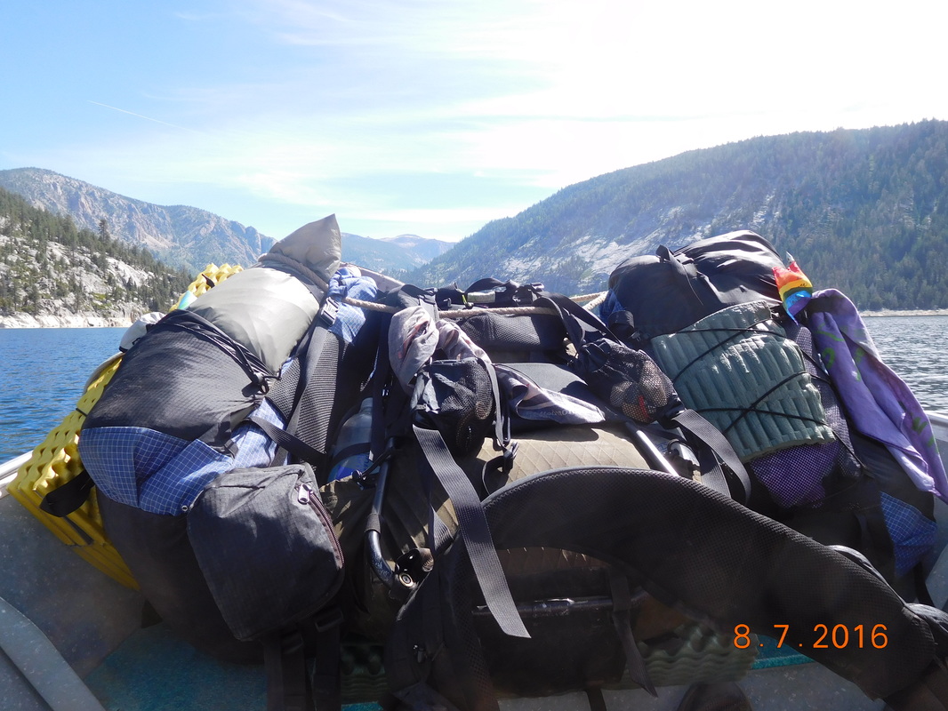 Our bags in the front of the boat. After the ferry ride. We got ourselves together and were ready to hike just after 10:00 AM. 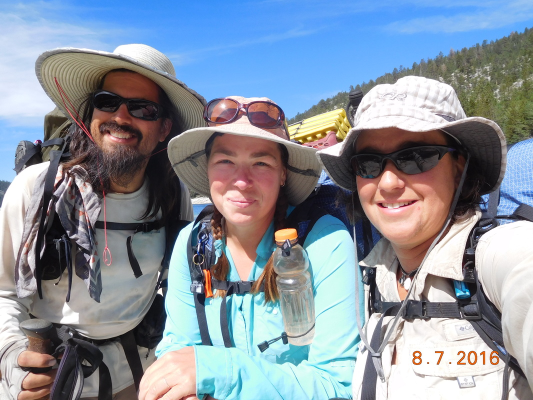 Ready to hike. Even though we had a late start, we still plan on hiking 14-15 miles so we have less than 15 miles to hike to Mammoth Lakes tomorrow. The first thing standing in our way is Silver Pass. This pass consists of a 6 mile, 2,902 feet climb that started right when we got back to the PCT. The climb was long and steep at times, but the views were great: 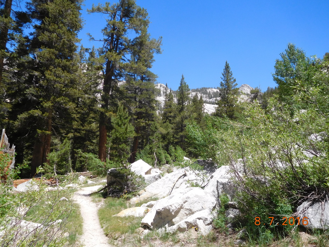 Looking up trail 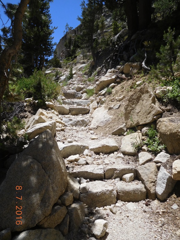 The trail consisted of stairs for a while. Finally, after about 4.5 miles of climbing, the pass was visible....at least I think that is the pass we are climbing in the background. 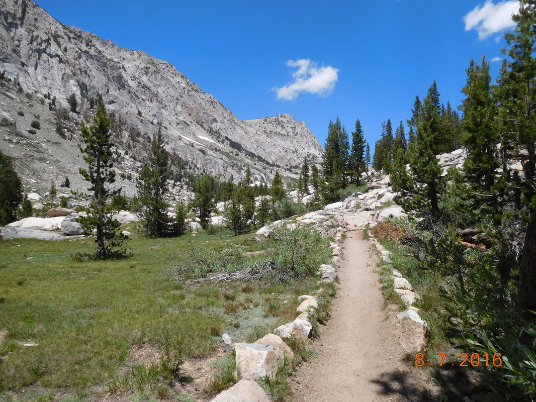 The beautiful PCT/JMT. 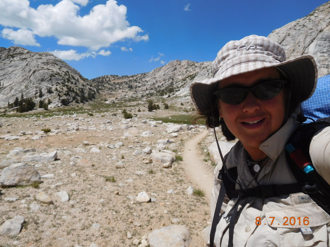 Self-portrait "Silver Pass behind me" Just under the pass was an amazing looking lake. The color of it was just incredible. 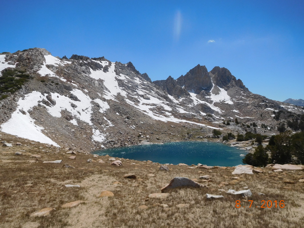 Unnamed alpine lake. Finally, we made it to the top around 2:30 PM. 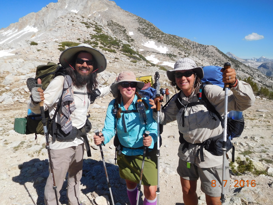 Silver Pass, 10,937 feet. 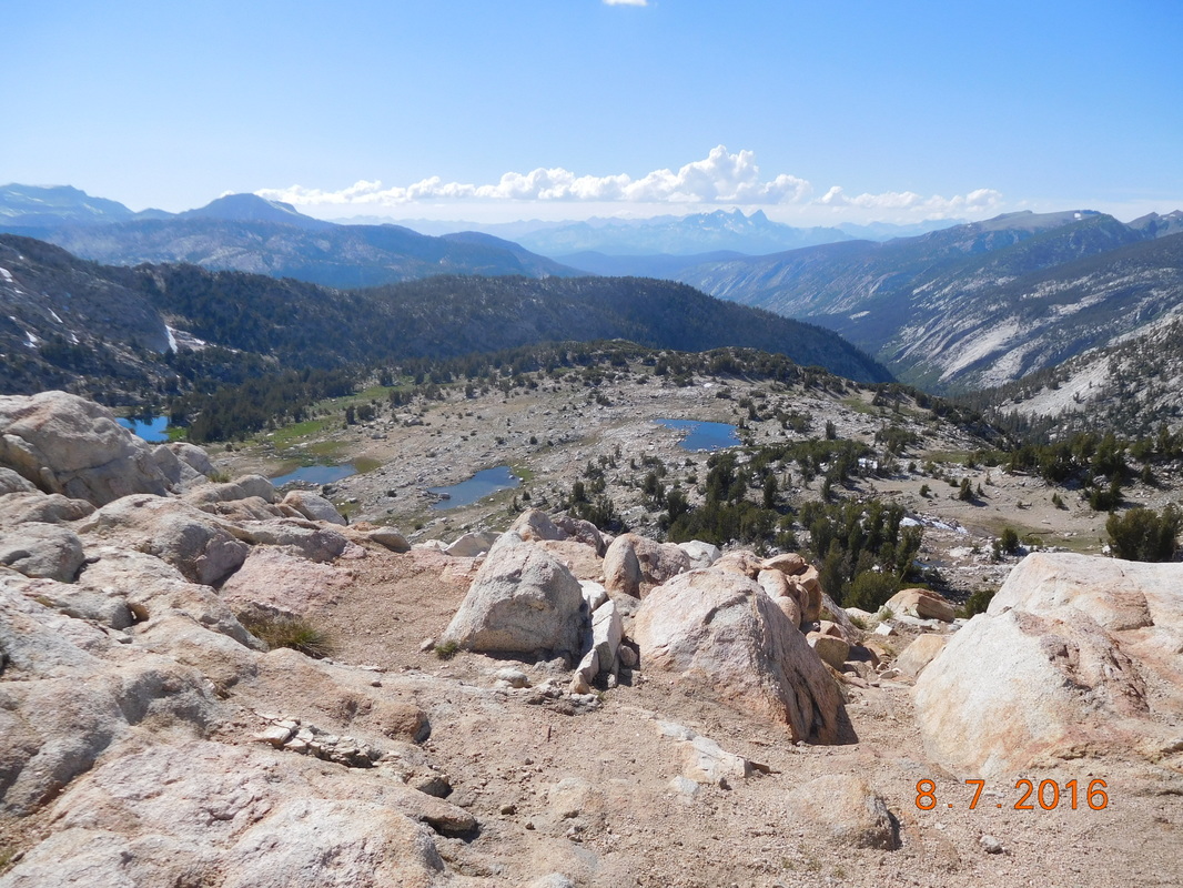 View to the north of Silver Pass. The pass was very busy today. When we arrived up there, Trout, Legs, and Caral were already there. We then noticed a family of four making their way up the other side. When they arrived we were surprised to see two kids, age 10 & 12 with their parents. They are hiking the entire JMT....amazing. The kids were very inquisitive and asked many questions about our time in the trail. Of course they loved my rattlesnake story. This was one time I didn't mind telling the story again. The family left and two 19-year-olds showed up. They are hiking the JMT in honor of a friend of theirs they was diagnosed with muscular dystrophy. There sure are many hikers on the JMT/PCT at this time. We figured we better get going since it was now after 4:30...what the heck are we doing hanging out on the pass this late when we still have almost 7 miles to go to make or goal of camping on Lake Virginia. Share Bear was the first to finally get going: 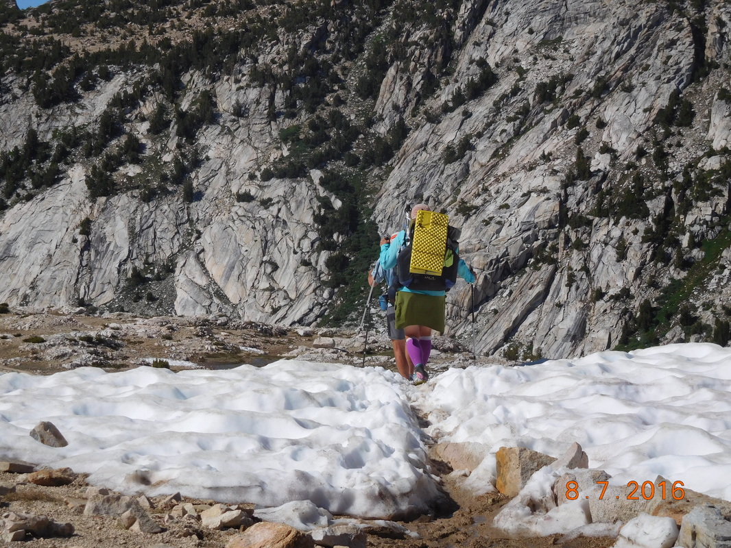 Share Bear takes on a snow field Here is a view of Squaw Lake...I can't believe how beautiful these alpine lakes are. 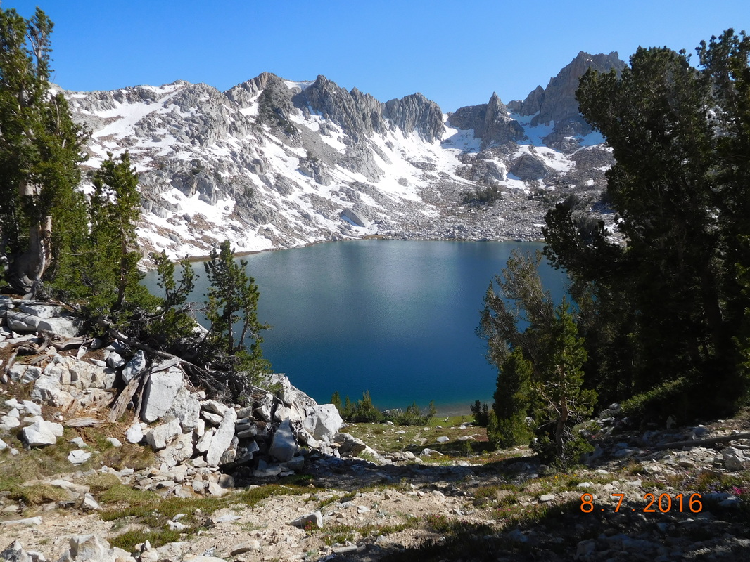 Squaw Lake Since we were headed downhill on a very rocky trail, the going was slow. 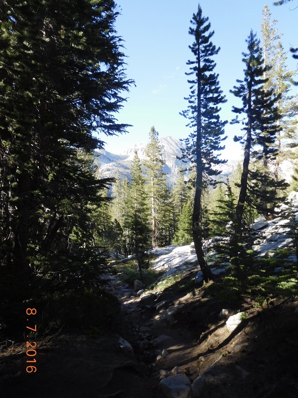 Rocky trail heading downhill. Over 1.5 miles later we made it to Fish Creek marking the bottom of the pass. 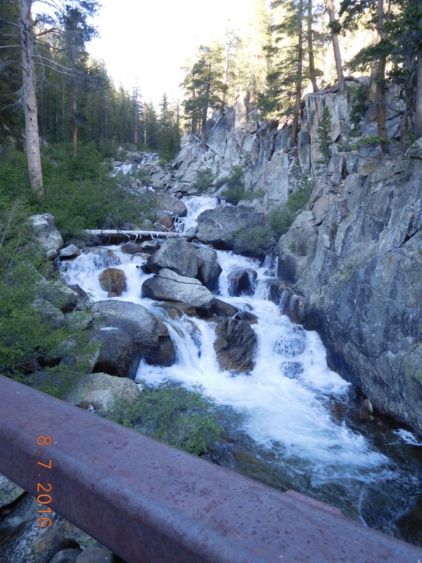 Steel bridge over Fish Creek. Now we have to climb over 1,200 feet and 3 miles to get to Lake Virginia. Although it was a couple of hours before sunset, the sun goes behind the mountains and makes for some wonderful lighting for pictures: 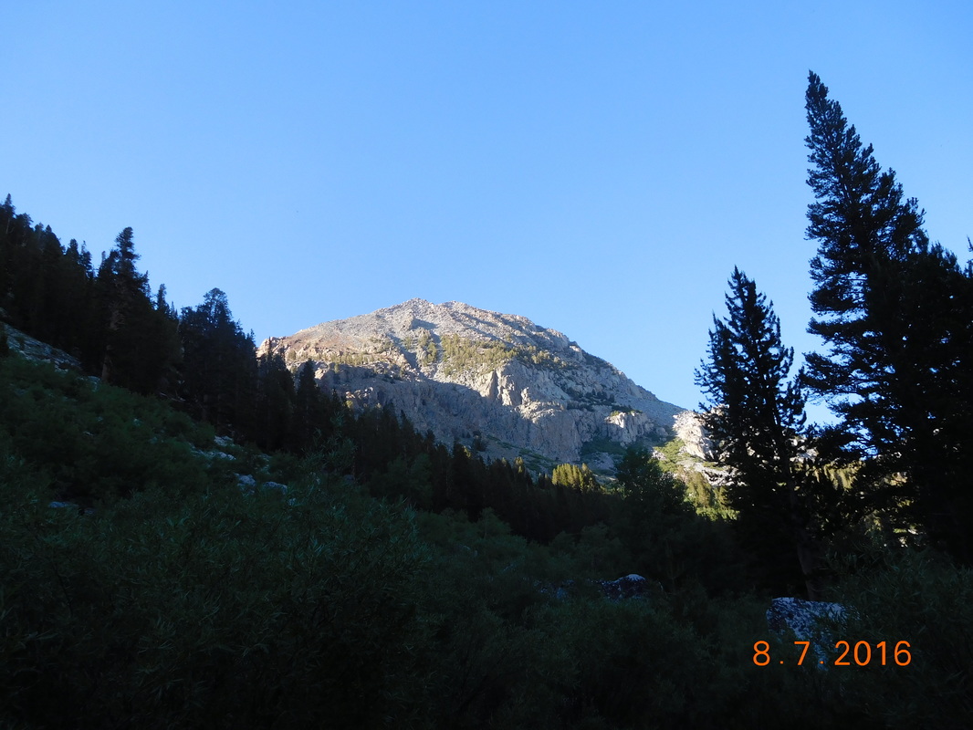 Great view. 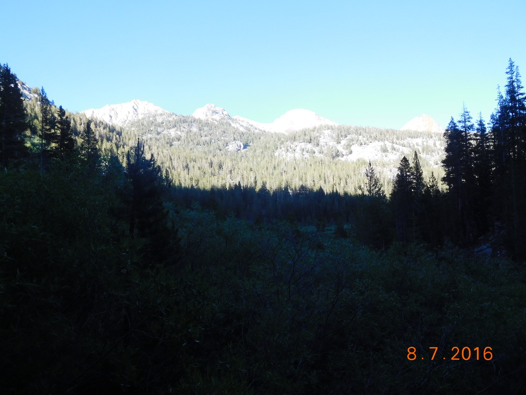 Mountain view The climb kept going and going. 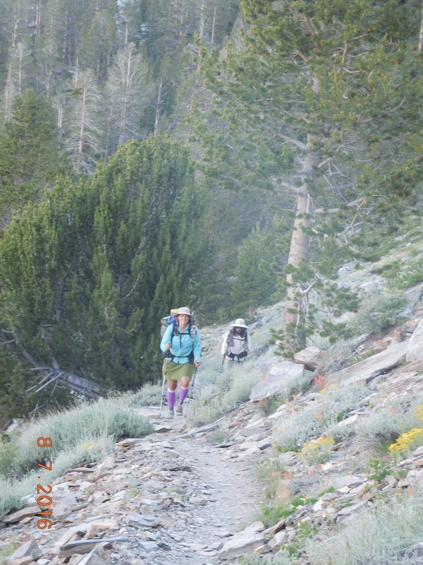 Share Bear and Brad climbing for almost 1 hour. Finally, we had a view of Lake Virginia: 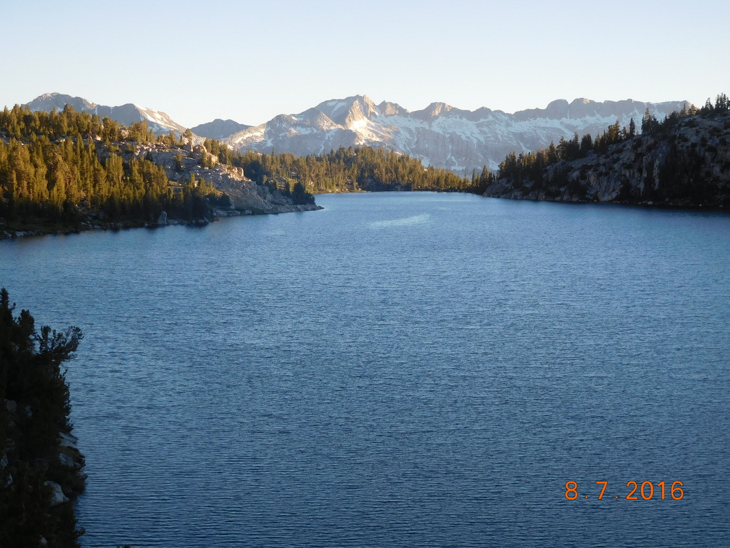 Lake Virginia There were many campsites close to the lake that were already taken by the time we got there. We were lucky enough to find a nice spot with the help of another hiker that pointed out a spot for us. Here is the view from our campsite: 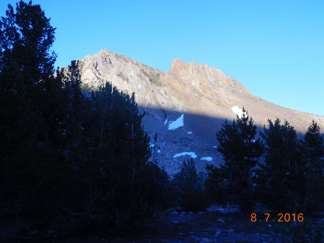 Campsite view Tomorrow we make it to Red's Meadow and Tim. From there, we take a bus into Mammoth Lakes and stay at Brad's cousins condo...we can't wait! Until then... 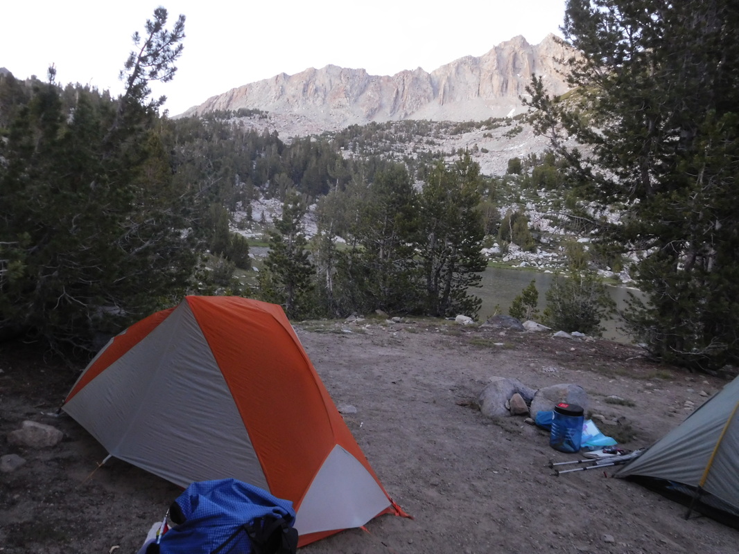 My home for the night Campsite by Seasonal Stream to Vermilion Valley Resort Another good night sleep on a nice flat tent site. I awoke just after 6:00 AM excited to get going. Today we hike under 7 miles and go to Vermilion Valley Resort, a place on Edison Lake that caters to PCT and JMT hikers. We must have been excited because we were all ready to hike before 7:30 AM, almost 30 minutes faster than other mornings. 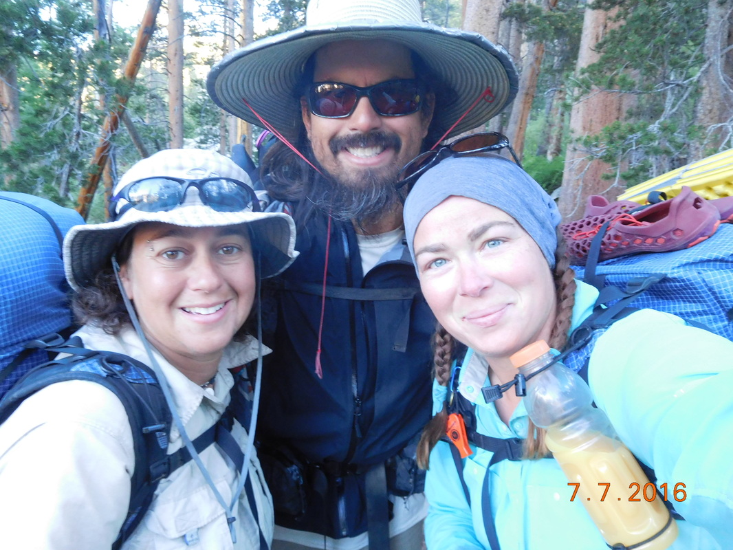 We are ready to go! The hike started out climbing over 800 feet in the first 1.5 miles. Share Bear had a little zip in her step this morning. As soon as we hit the climb she took off and we didn't see her till the top. As we climbed a mountain view appeared in the distance: 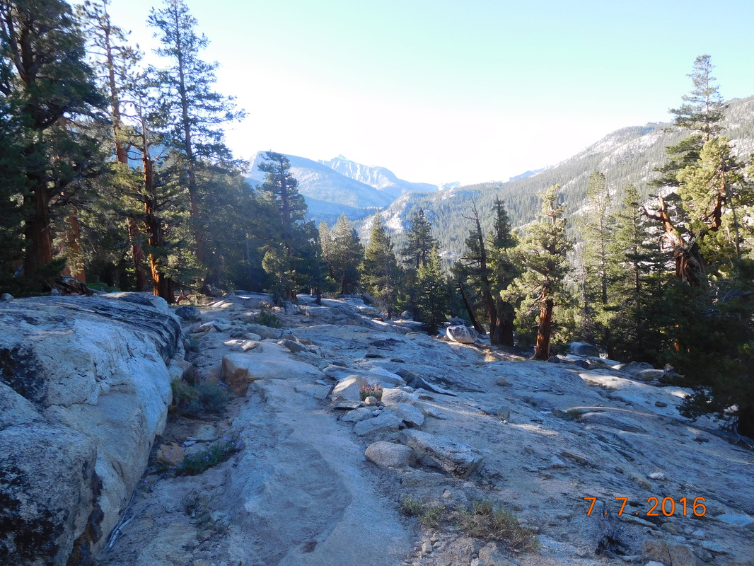 Morning view. Today we didn't mind the climb since there was a reward at the end of the hike, VVR that promises good food, flushable toilets, free first beer, and possibly a bed. After the climb the trail leveled out for a while and then headed down for about 4 miles. Man...I sure don't like long downs. Well, I like them, my knees and legs don't. One good thing about the down hill...there was a PCT sign: 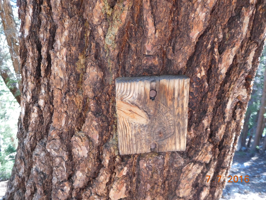 PCT sign of the day. We finally made it down the long hill into a valley with beautiful tall trees: 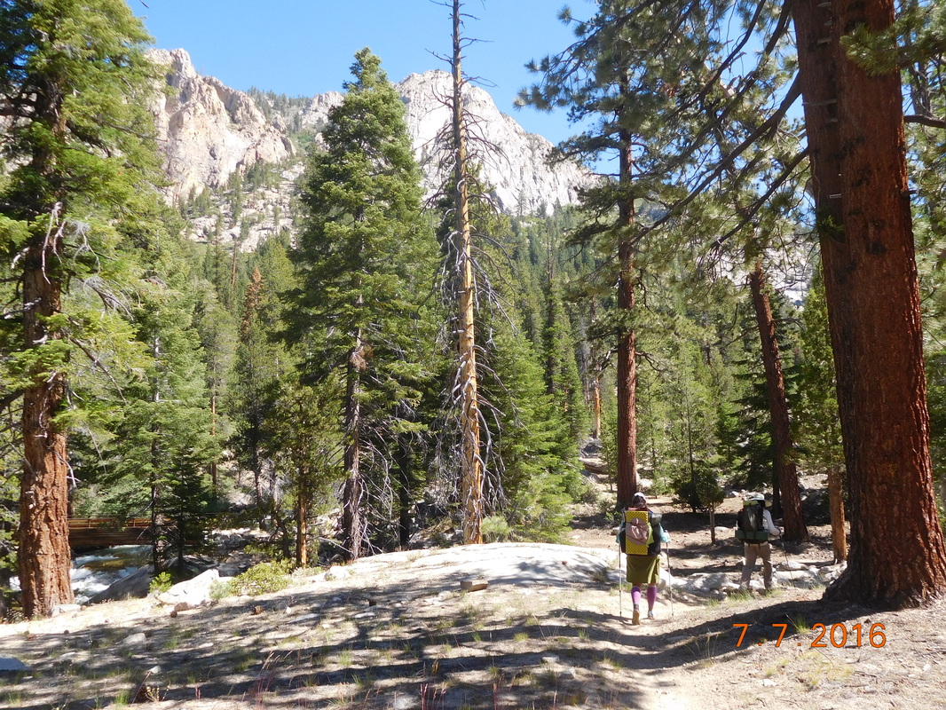 Share Bear and Brad hiking ahead. Finally, just 2.5 hours after starting out we made it to the trail junction to Lake Edison and the ferry: 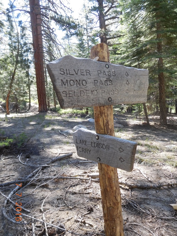 The trail junction we were aiming for. We now had to take this trail 1.41 miles. Knowing that we would have to return the same way, we all hoped for a nice, easy trail. Although there were some ups and downs, it wasn't bad and the trail was beautiful: 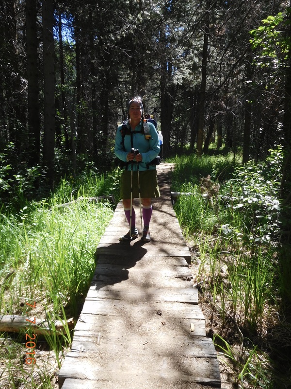 Share Bear on one of many boardwalks. After less than 30 minutes we arrived at the lake. There was a sign that said the ferry ran at 9:45 AM and 4:45 PM...it was now 10:30 AM. I wasn't worried since I talked to different hikers on the trail and they all said they took a ferry at all different times, so I hiked on to the ferry stop. When I got there Share Bear was right behind and asked if I saw the sign. She was worried that we would have to wait all day for the ferry. I told her not to worry, a ferry will show soon. But she was still worried: 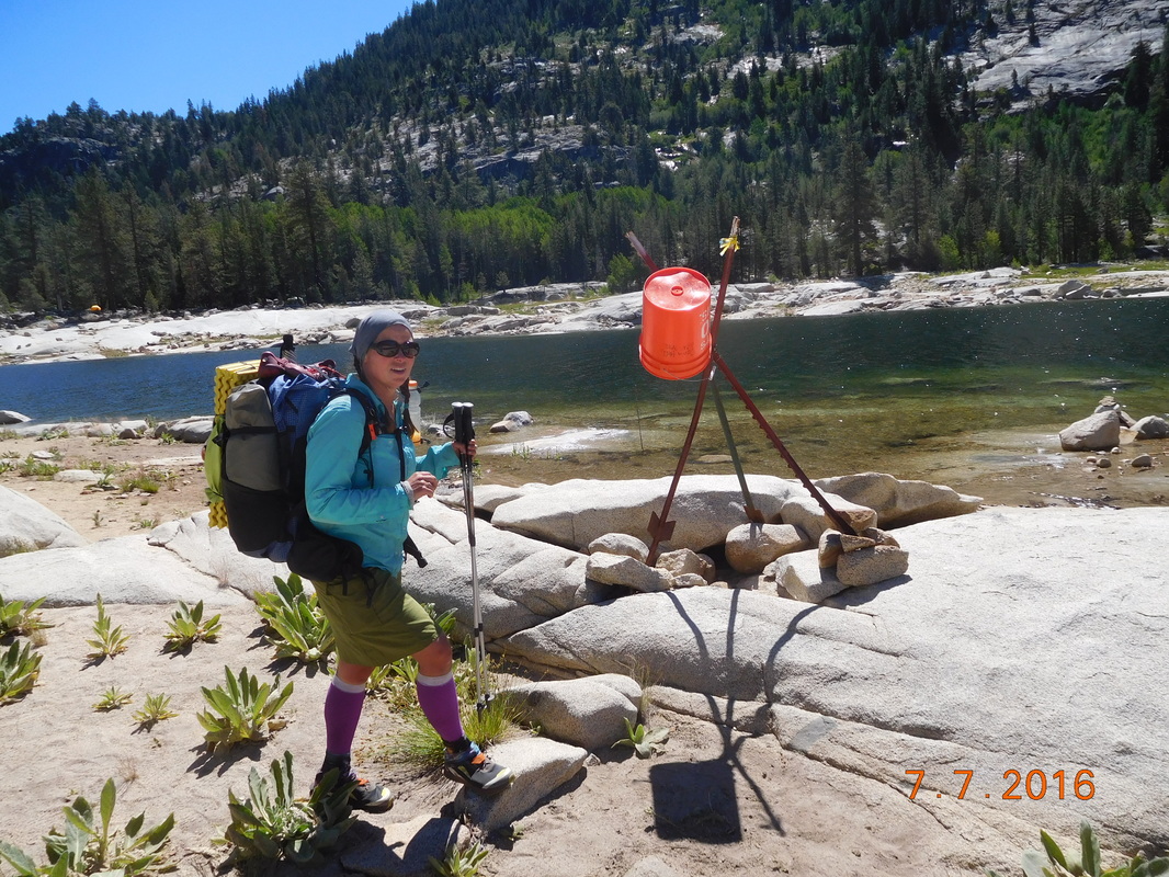 Poor, worried Share Bear. Sure enough, a ferry showed up just 15 minutes later followed by another one 10 minutes after that. The 3 of us loaded into the boat and were off. 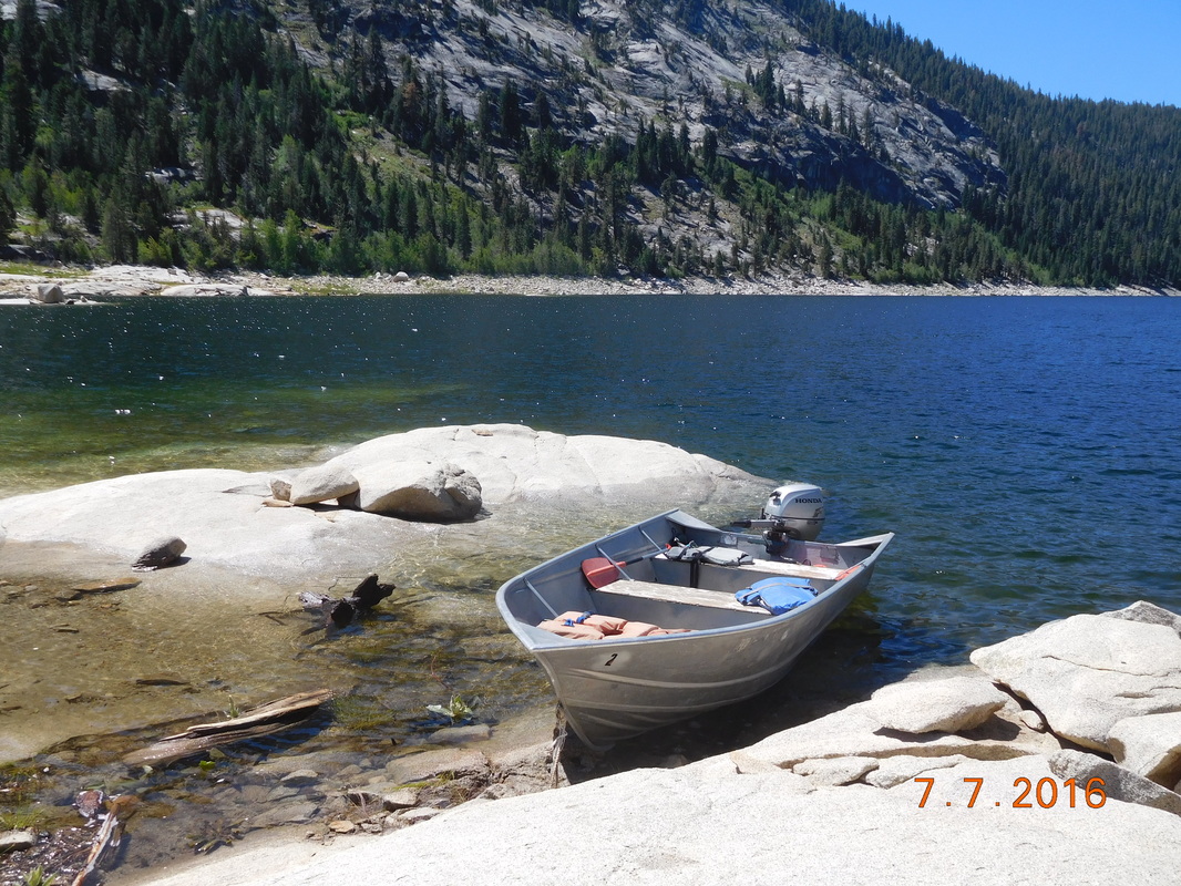 The "ferry" to Vermilion Valley Resort The ride across Lake Edison took about 30 minutes, so we sat back and enjoyed the ride. 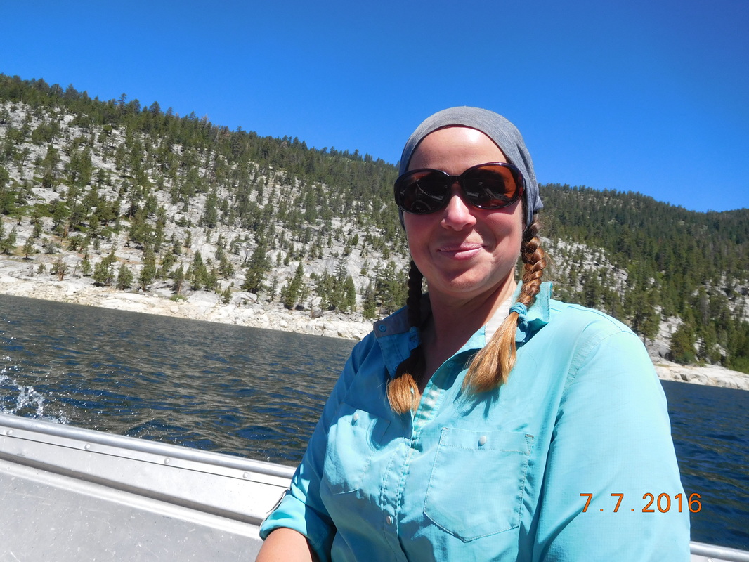 Share Bear headed to VVR. 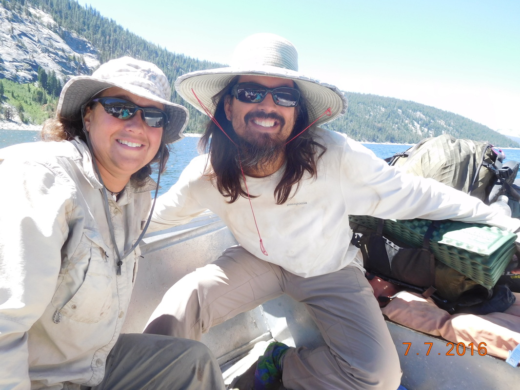 Brad & I enjoying the boat ride. When we were almost there, the other boat passed us and we recognized the 2 hikers onboard as River Pants and Jim. We have been leapfrogging them for the past 7 days hiking, and now they leapfrogged us in a boat...pretty funny. We arrived at VVR and immediately set up a tab. All hikers' first beer is free, but there was no beer since the truck hasn't showed up, so we decided to wait. We shopped the limited store for food to get us to Mammoth Lake in two days. We then checked out the beds and decided they were worth $15 each instead of sleeping in our tents. We spent the rest of the day relaxing in the shade on this little picnic table talking with River Pants and Jim waiting for dinner time at 5:30 PM.  Little, tiny picnic table. Yippee...the beer truck arrived! 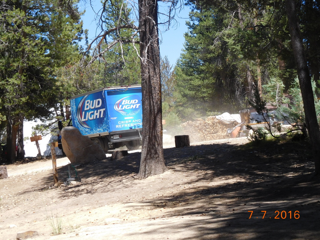 Beer! It was finally dinner time. We were told that we came at the perfect time because they have a guest chef in the kitchen, Fishhead. We never heard of him but was promised that he could cook. The menu had about 8 items. I couldn't choose between the salmon tacos or the fish and chips, so I ordered both. The waiter didn't bat an eye when I ordered two entrees...it must happen a lot with hikers. Here is a picture of my dinner before I managed to finish them both: 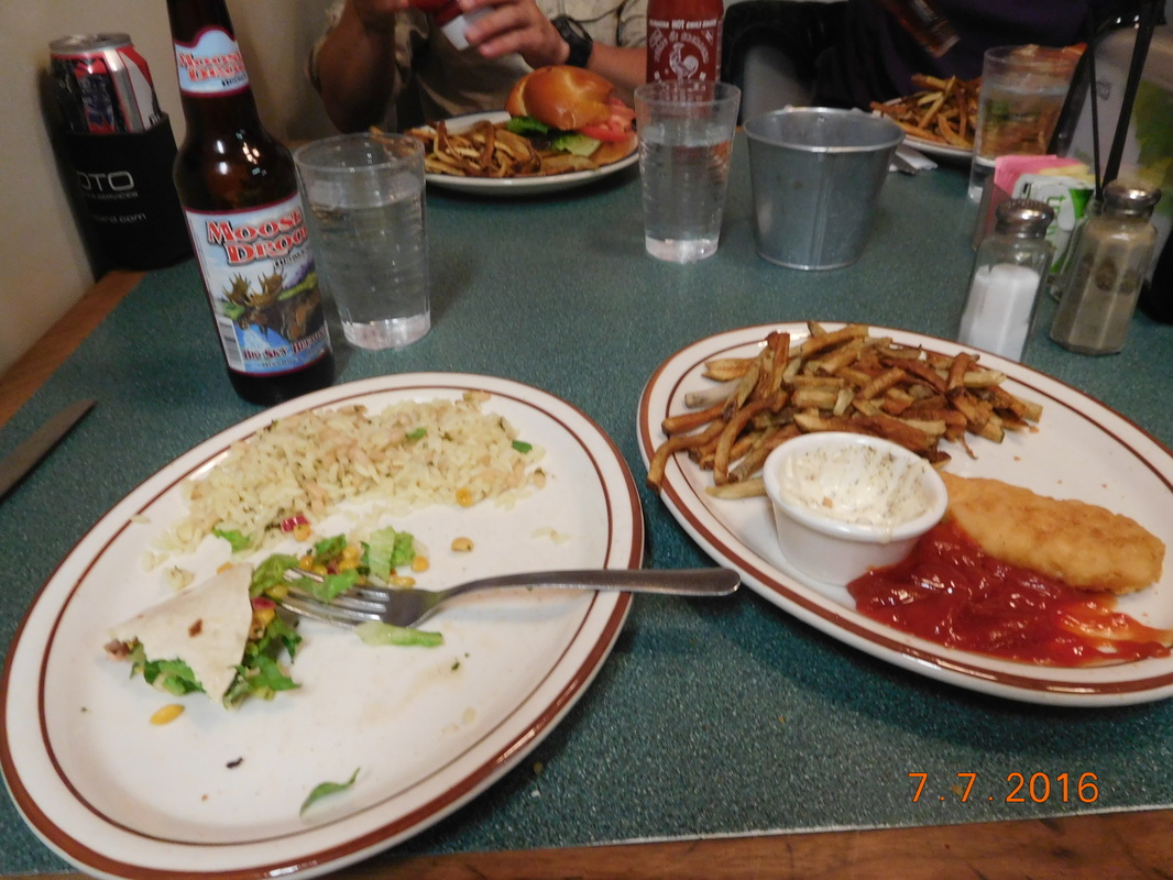 Dinner at VVR. Tomorrow we will eat breakfast here and then hopefully get an early ferry back to the trail. We have 28 miles, and 2 days to hike to Mammoth Lakes where Tim is, so I am anxious to get there. But first, I hope to enjoy sleeping in a comfy bed for tonight. 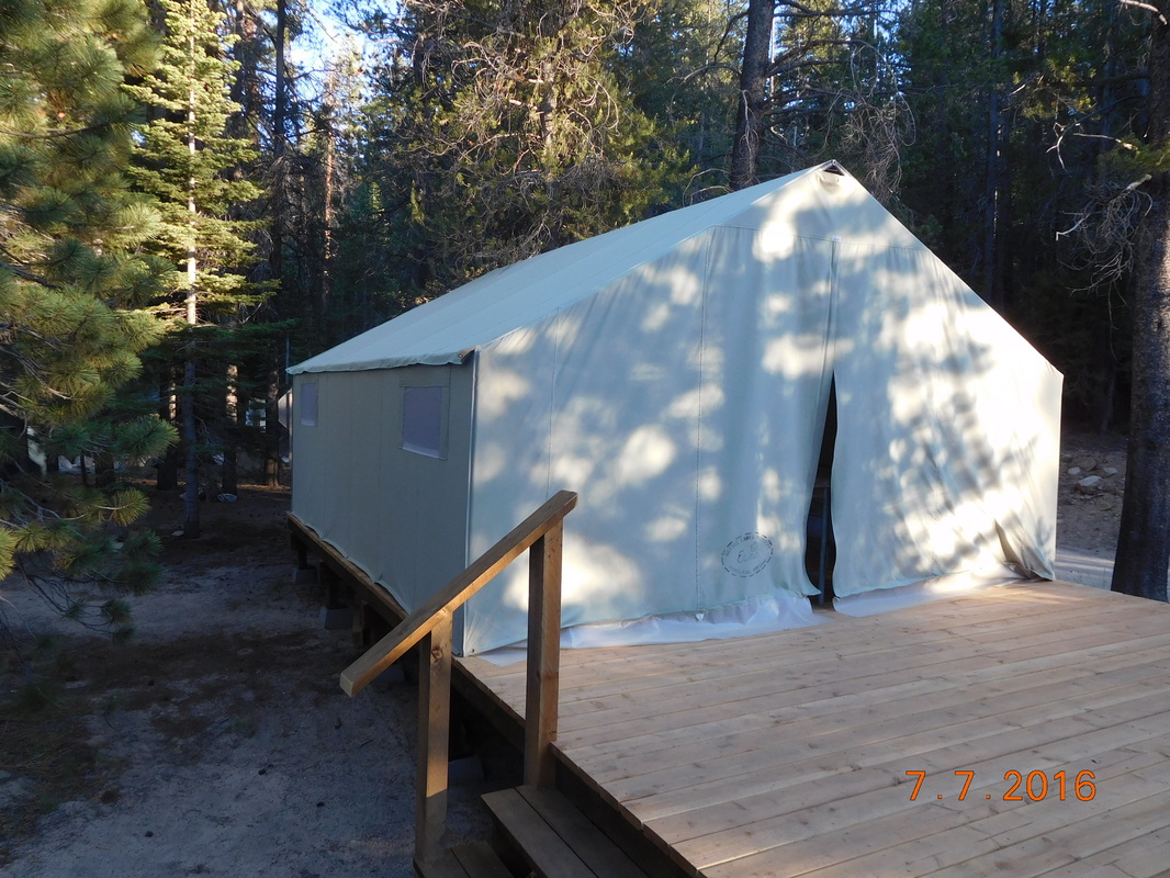 Our tent for the night. Large campsite, near Piute Creek to Campsite by Seasonal Stream Wow...I had an amazing nights sleep. I awake only a couple of times, but fell right back to sleep. I awoke fully refreshed at 6:15...a little late, but feeling great. I quickly got my stuff together and ate breakfast with the group. As we ate, Thunder Pass said goodbye and hiked off. We were ready to go not long after him at 7:49 AM. 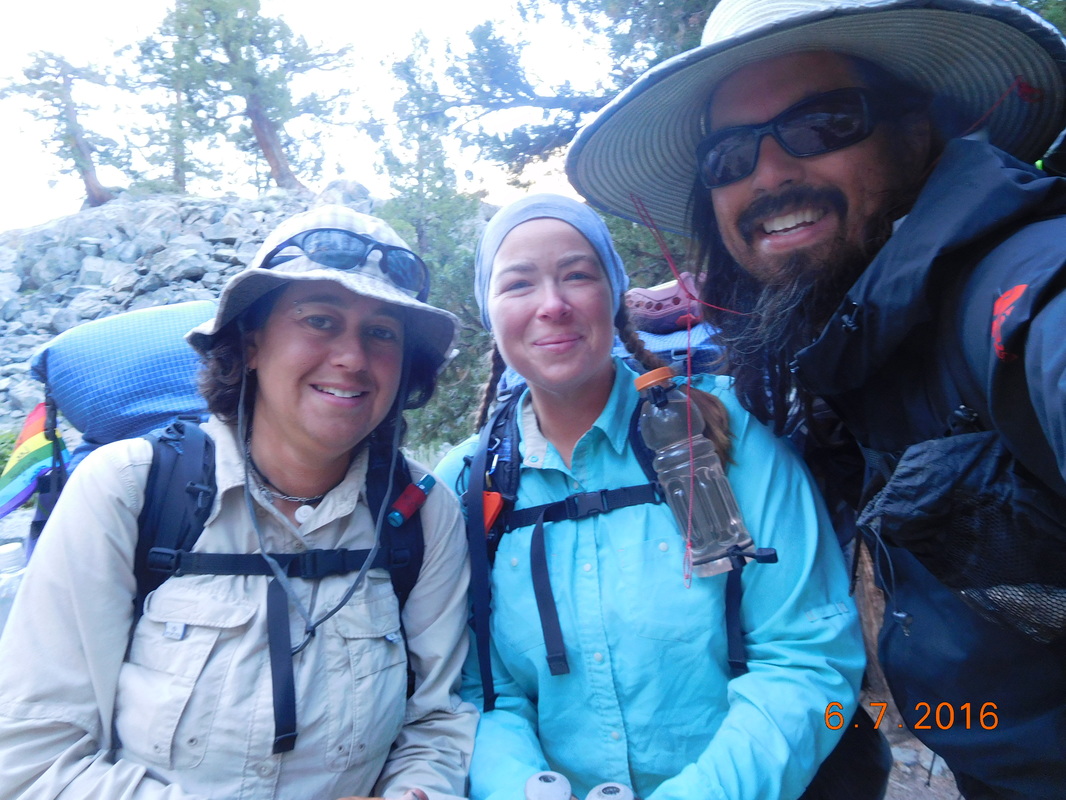 Ready for a day of hiking. Today we cross Selden Pass, supposedly the easiest off all the passes. From our maps, the climb up doesn't look too bad, and after the pass the terrain looks pretty easy. After hiking about 39 minutes we crossed over from Sierra National Forest to John Muir Wilderness: 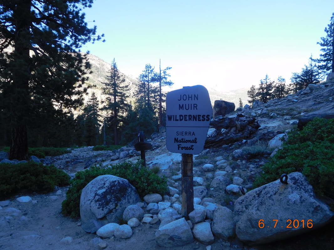 Entering John Muir Wilderness Today should be a great day. And how could it not with this all around us:  Our morning view.  Amazing mountains of the Sierra. As predicted the hike started out with a slight downhill and then the trail started to climb. We hiked about 2 miles of really steep switchbacks where there was no place to stop and take a "shoes-off" break like we wanted. Finally, we came to a river crossing of Sanger Creek and a really nice spot to take a break. While sitting there eating some snacks, Shwetty Balls. A thru-hiker from Sweden, arrived. We met him yesterday during a river crossing. He asked us if we wanted to do his daily dance with him. Throughout his hike, he had people dance with him daily. When he gets home he is going to compile all the days into a video. Of course we said we would dance. He then spent the next 30 minutes teaching us the dance moves abs then set up his phone to record the action.  Schweddy Balls setting up the camera. We then performed the dance and he was then on his way up the trail. That was interesting! We now can't wait to see his compilation video. After the break the trial continued to climb and then leveled out in a beautiful mountain meadow:  Gorgeous Just after 1:00 PM we arrived at Heart Lake less than 1 mile Delk the top of Selden Pass. At this point we couldn't believe that we were going to make it to the top of a pass early afternoon since we have been making it a habit to cross them after 5:00 PM. 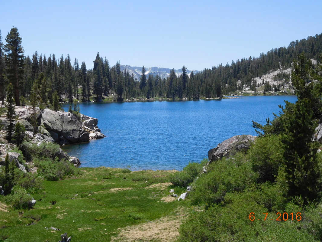 Heart Lake. At this point we were pretty confident that we were climbing up this pass: 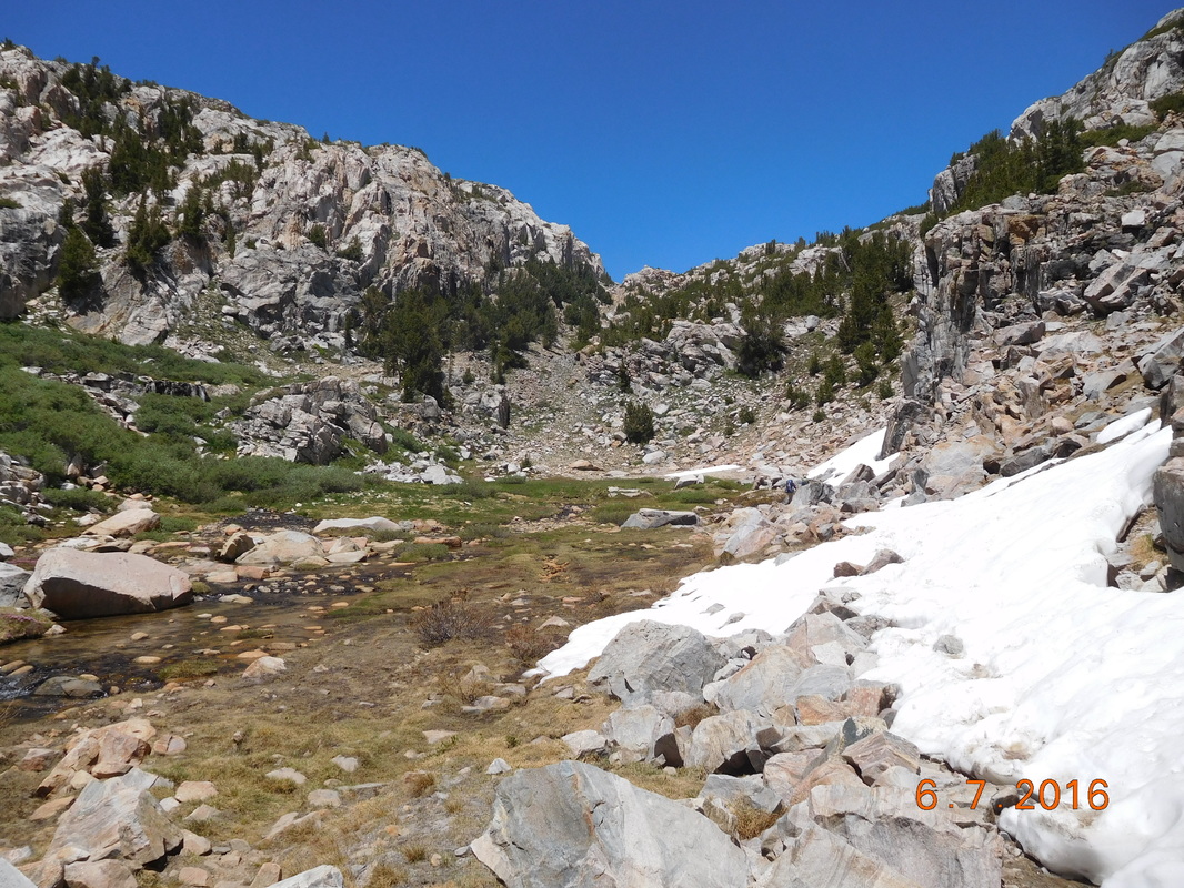 This must be Selden Pass. The last half-mile or so of the climb was pretty steep, but as we had heard, this pass was very easy to climb. There was a little snow, but it was easy to walk around so we didn't bother. We made it to the top of Selden Pass just after 2:00 PM. 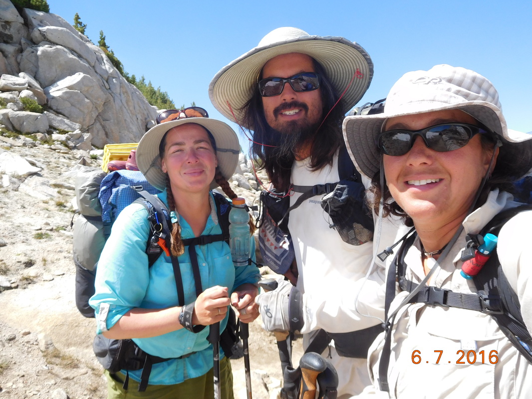 The top of Selden Pass, 10,910 feet 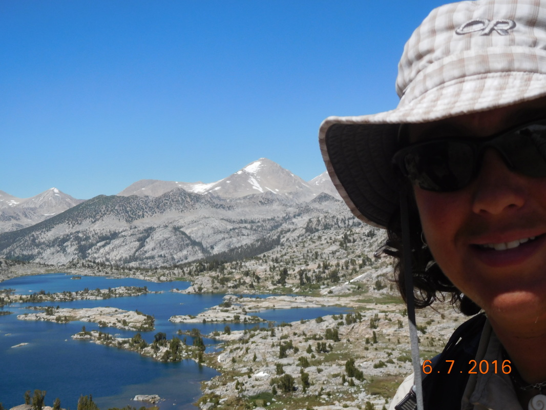 Looking north from Selden Pass At the top were a couple and their 2 daughters plus a friend. The daughters (age 19 & 23) were hiking with JMT. They met up with their parents at Vermillon Valley Resort (VVR, where we will be tomorrow) for them to resupply them. The parents decided to backpack with the kids up Selden Pass and then backpack back to VVR. It was cool seeing the kids wave bye to their parents as they hiked back towards VVR. We headed down from the pass just after 3:00 PM. We still had almost 7 miles to reach our intended campsite for the night. The good news is the trail from this point is a gradual downhill, so we should be able to cover those miles pretty easily. The way down was spectacular, including this creek that we collected and filtered water from:  Creek with flowers and mountains.  Brad filtering water. Not long after climbing down the pass, we arrived at Bear Creek that had no easy way to cross, so we had to ford it. Brad and Share Bear both have camp shoes that they can wear to cross water, but I don't. Share Bear and Brad crossed, and then Brad was kind enough to walk Share Bear's shoes back to me so I could wear them to cross: 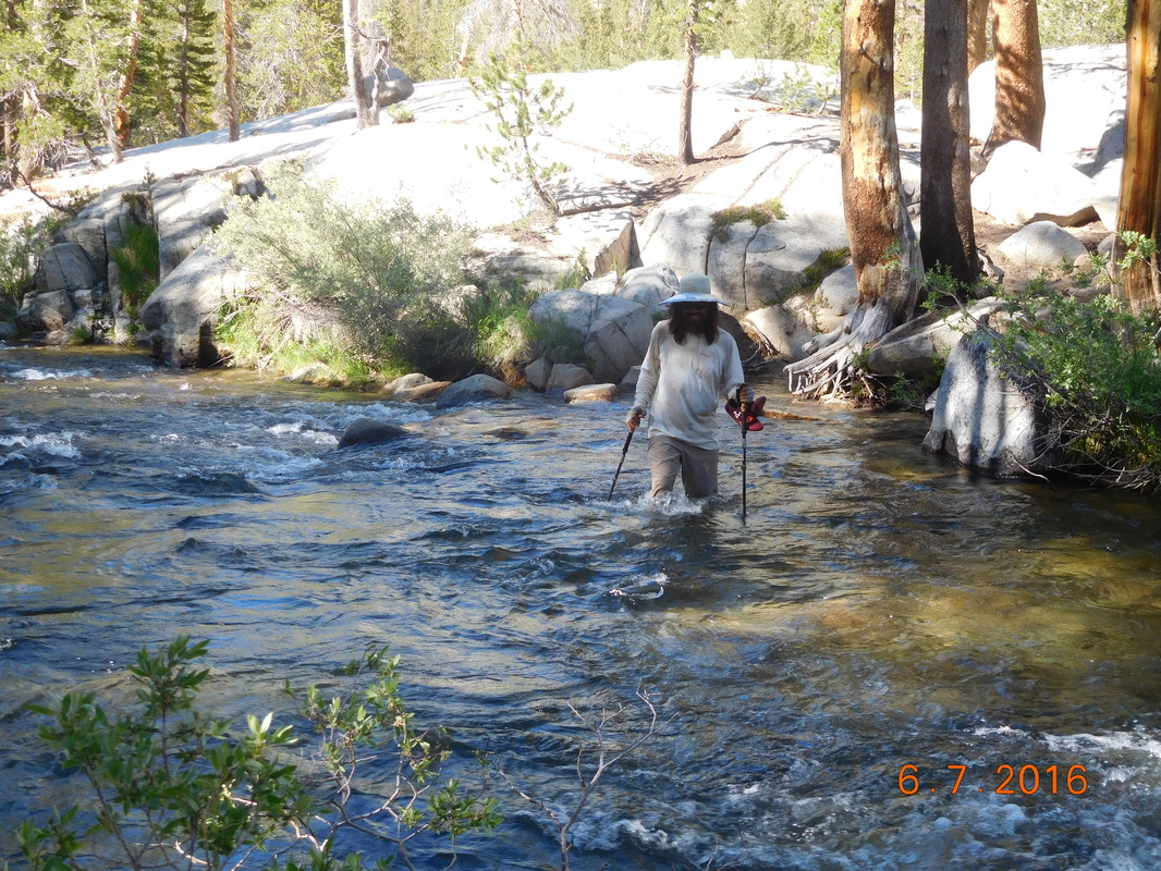 Awesome Brad!! Right after that ford we had to ford Hilgard Branch which was 2 fords close together. They looked easy enough so I was able to go barefoot. Oh...we came across an actual PCT sign today. We were very excited that it said "Pacific Crest Trail" and not "John Muir Trail." 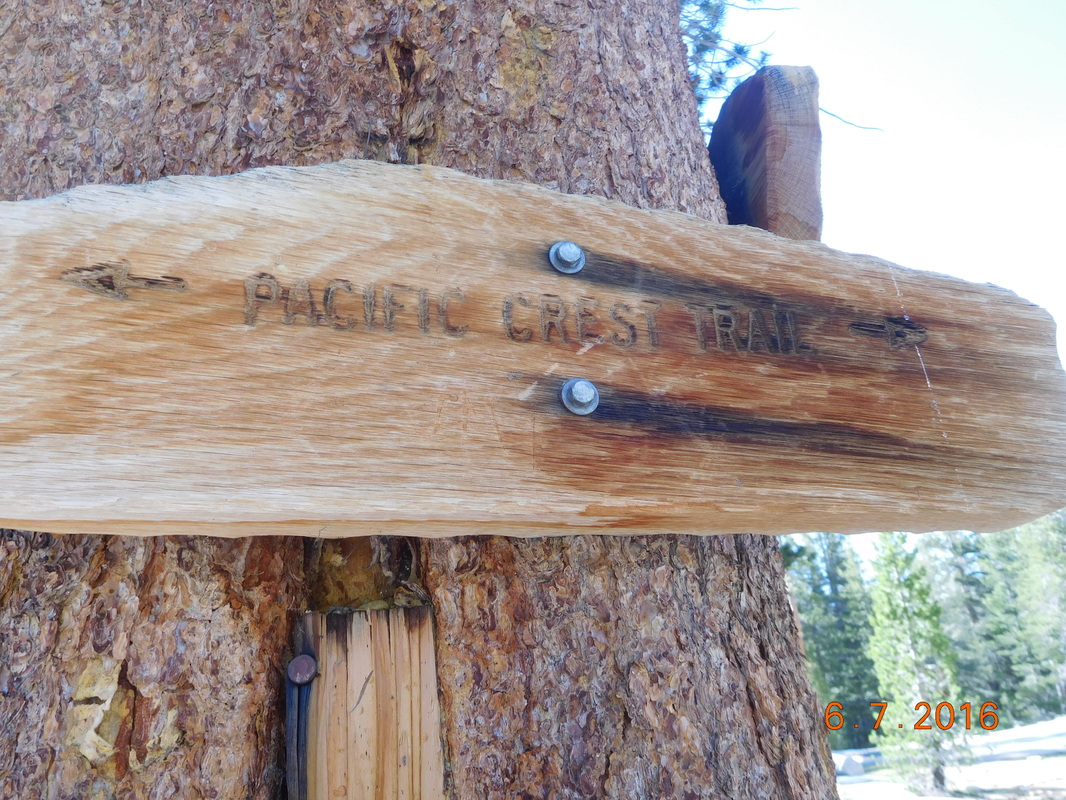 PCT sign of the day. We arrived at where we planned on staying, but there were 2 tents already setup, so we hiked in for 20 minutes more and made it to a really nice place...except for all the mosquitos. It was the worst we had dealt with so far. I cooked dinner and couldn't take my mosquito net off to eat, so I broke one of the backpacking cardinal sins and ate dinner in my tent. The mosquitos sucked, but the campsite was beautiful: 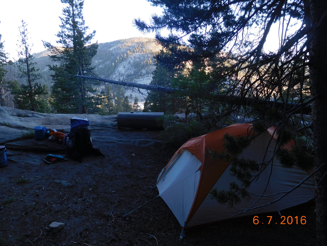 Home for the night. Campsite at Mile 840.60 to Large campsite, near Piute Creek It was really cold last night. Even though I was so tired from yesterday's hike, I had some trouble sleeping. Because it was so cold I slept way inside my sleeping bag, but that kept making me a bit claustrophobic which kept waking me. I finally had some really good sleep from 4:00 AM till I awoke at 6:15 AM. I peaked out of my tent and Brad and Share Bear were still in theirs, so I laid back down and relaxed. We usually all rise at 6:00 AM, but after getting into camp late last night, plus it being really cold this morning, plus no one wants to put on our cold, still wet shoes, everyone is staying put inside their tents. Finally at 6:30 I thought I better get moving, so I got my stuff together and left the tent. There was frost on my rainfly, so it must have been below freezing last night. Tonight will be warmer since we will be hiking down below 9,000 feet today...something to look forward to. Finally Brad and Share Bear emerged from their tents. We broke camp, ate breakfast, and we're ready to hike at 8:00 AM. 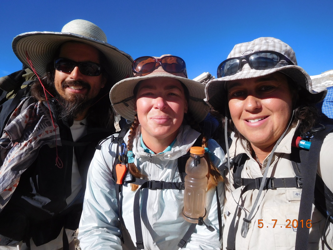 Ready to hike. Today seems like a day off since we don't have a pass to climb over and it looks like the terrain is going to be mostly a gradual decline from our current 11,435 to 8,077 feet. There is one river crossing that has us a bit worried because we have heard that the water level could be chest high. But, before worry about that, we are enjoying the view as we left our campsite: 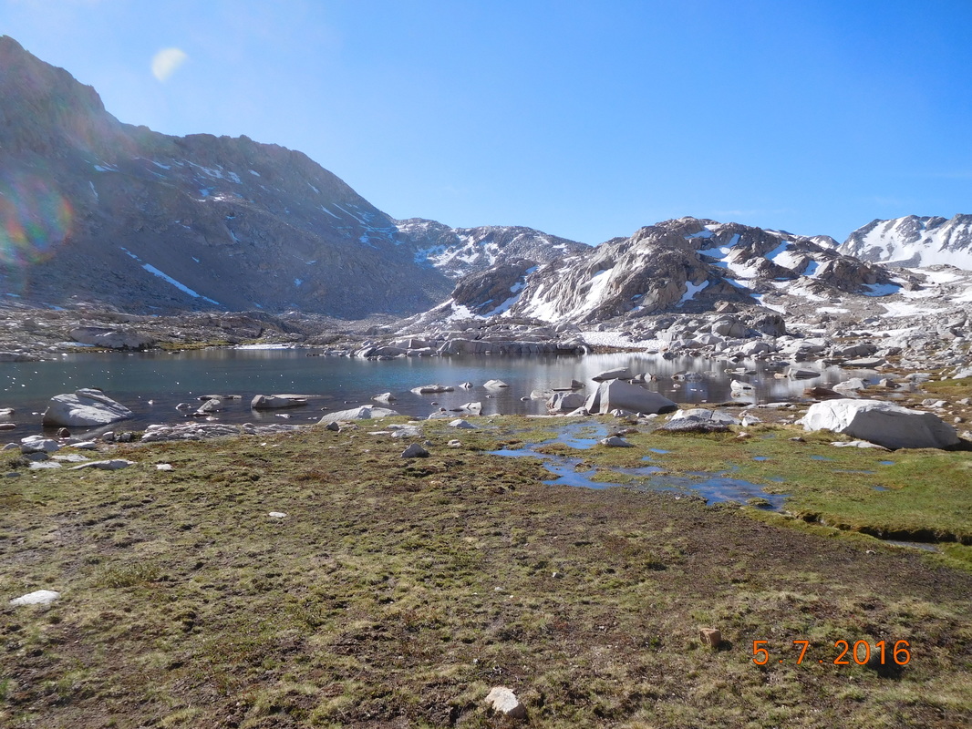 The high Sierra. As we hiked, the trail was covered with water from snow melt. We usually walked around it, or jumped rocks that others put in the path. We got to one section that walking around wasn't possible and there wasn't any stones, so Share Bear decided to jump over it. The first jump was a success, but the second she slipped head over heels and landed on her backside and, like a turtle, couldn't get up. Brad came to the rescue and helped her up. Here is the aftermath of her slip...a wet bottom and the socks she had drying were now covered in mud. 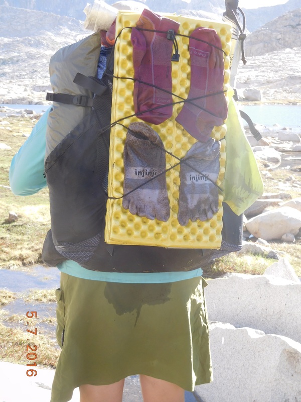 Share Bears accident. We continued hiking past Sapphire Lake with still water that allowed for an incredible reflection of the mountains above:  Sapphire Lake. After about 3 hours of hiking, Share Bear needed a break, so we stop along Evolution Lake. It was a beautiful area, but the mosquitoes were out in full force. Brad dresses to avoid them:  Brad armored up against mosquitoes. This was our view during the break with the trail going right along the lake:  Evolution Lake. After much descending we decided to break for lunch just before McClure Meadow. I was pretty happy that I got to cook and eat last nights mac & cheese since I ate today's lunch for dinner last night. During this time I also finished last nights blog since I was way too tired and cold to complete it last night. After a pretty long lunch break, we arrived at McClure Meadow...beautiful...  McClure Meadow We were now close to the deep water crossing we have heard about. Just before the crossing we came across this sign: 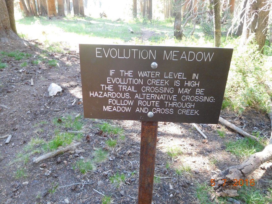 Warning I declared that we take this alternate route since I wasn't looking forward to chest high water that could get my backpack wet. The others agreed, so off we went. We very shortly arrived at Evolution Creek that looked tame and wonderful. I just took off my shoes and walked across it with the deepest part being thigh-high. 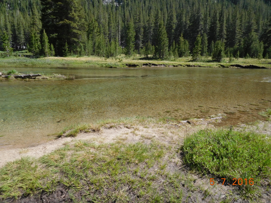 Evolution Creek crossing. After the crossing we continued on the alternate route back to the trail where we saw the actual trail crossing...glad we took the alternate! 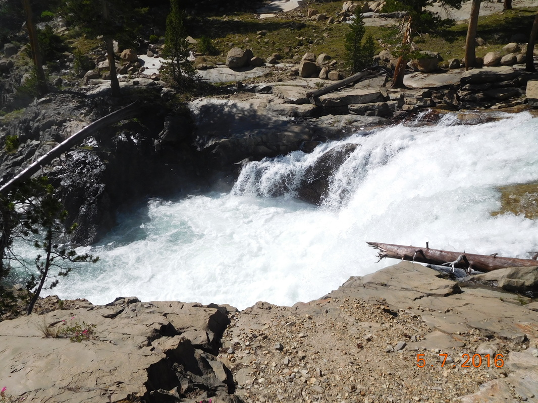 Evolution Creek in full swing. Just kidding...although this is the same Evolution Creek further down creek, the actual crossing looked quite tame, just very deep. We made the right decision by taking the alternate. Continuing down the trail the scenery did not disappoint.  Looking down a valley from above. Oh...I keep telling you how difficult this trail is to hike on, so I took a picture to show you: 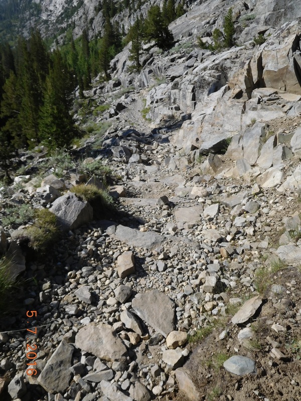 Yes...this is the trail. About 2.5 miles before we stopped for the night we crossed this cool wooden bridge that crosses the South Fork San Joaquin River: 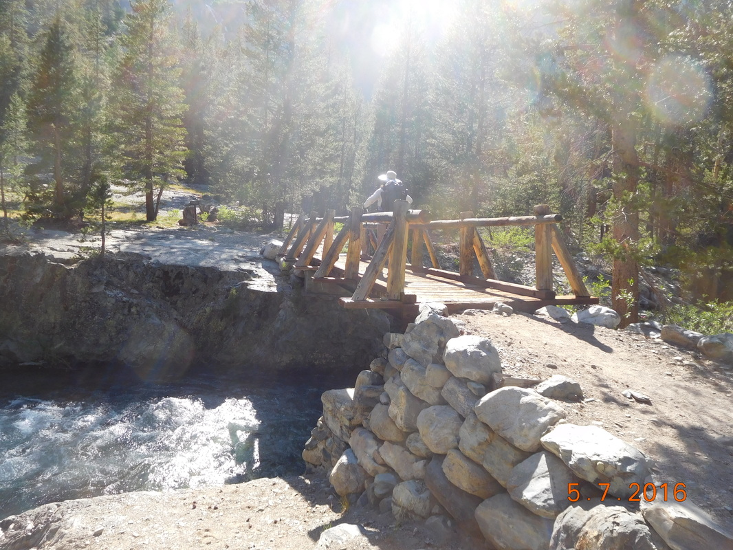 Brad crossing a bridge. After crossing the bridge I called for a "backpack-off" break. My back was killing me. Having to carry this darn bear canister is not fun! It doesn't fit in my bag horizontally, so I have to carry it vertical which throws the balance of my bag off...not very good for the back. After about 10 minutes we started back on the trail for the last 2.5 miles of the day. Not too much fun for me, but I was able to keep up anyway. 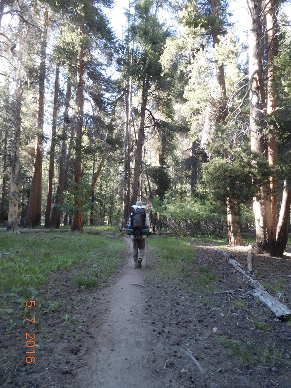 Following Brad close behind. Luckily I had some awesome views to look at to try to keep my mind off my aching back. 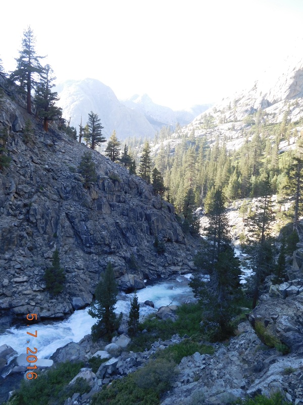 Trail above raging river. Finally, before 7:00 PM we found a really nice campsite. Thunder Pass was here already eating dinner. By the time our tents were setup and we were ready for dinner, he was already in his tent. This site is so nice. There is the sound of the river, a deer walked right through our site as we are dinner, the temperature is perfect, and my tentsite feels pretty flat. All of this should make for a great night. 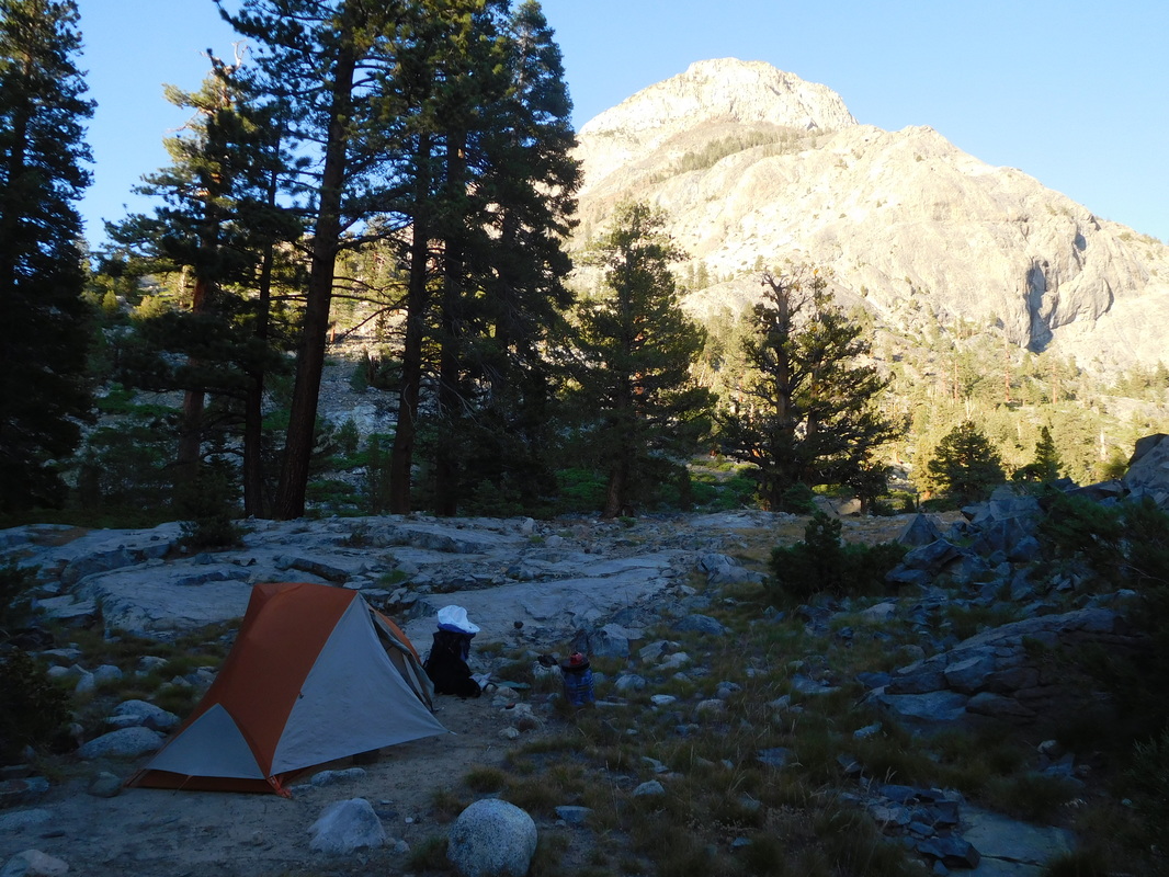 A great tent site. Large campsite, 200 feet south of trail, toward Palisade to Campsite at Mile 840.60 Happy Independence Day! After a hard downhill hike yesterday I was able to sleep very well. I woke just after 6:00 AM and quickly got my stuff together. Today we hike up and over Muir Pass which consists of a 11.12 mile climb that gains 4,146 feet. We are now 14.5 miles from the pass, plus we then have 2 more miles to get to our planned campsite for the night. At this point this plan seems really hard to accomplish, but we will give it our best shot. We all quickly ate breakfast and were ready to go just after 7:30 AM. 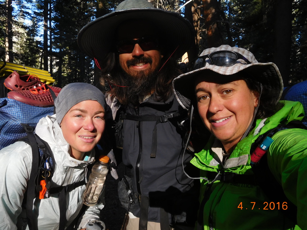 Ready for a long day of hiking. The day started out like an obstacle course with multiple river crossings and climbing over trees blocking the trail. Here is a picture of the most perfect rock setup we have seen for a river crossing: 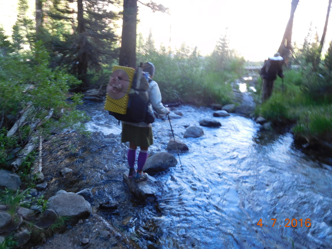 Perfect skipping rocks. After 3.25 miles of downhill hiking we arrived at a trail junction that we know marked the bottom of the down and the start of the long 11.12 mile climb up Muir Pass. Here is where we met up with Thunder Pass and Mountain Home. Thunder Pass is the guy that passes us as we waited out the thunder storm 0.25 miles from the top of Forester Pass...thus the name. Mountain House bought a years supply of Mountain dehydrated meals...this his name. They both decided to tag along with us for a little bit. It was now 9:30 AM. When we got to the first river crossing and took "too long," Thunder Pass decided to go ahead. After another 3.5 miles we arrived at a steel bridge crossing a creek. It looked like a great place to do some laundry and put out feet in the cold water. Thunder Pass was here already doing the exact same thing. After about 1 hour we all knew it was time to continue heading up towards the pass. Check out this valley we are climbing up: 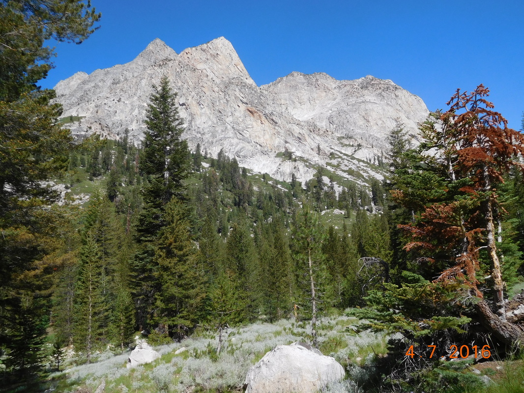 Amazing. Sometime around 1:00 PM we stopped for lunch and hung there till 2:15 PM. In hindsight we probably should have cut lunch a bit short. After lunch we continued up to Muir Pass. While hiking I noticed this rock some adorned with teeth: 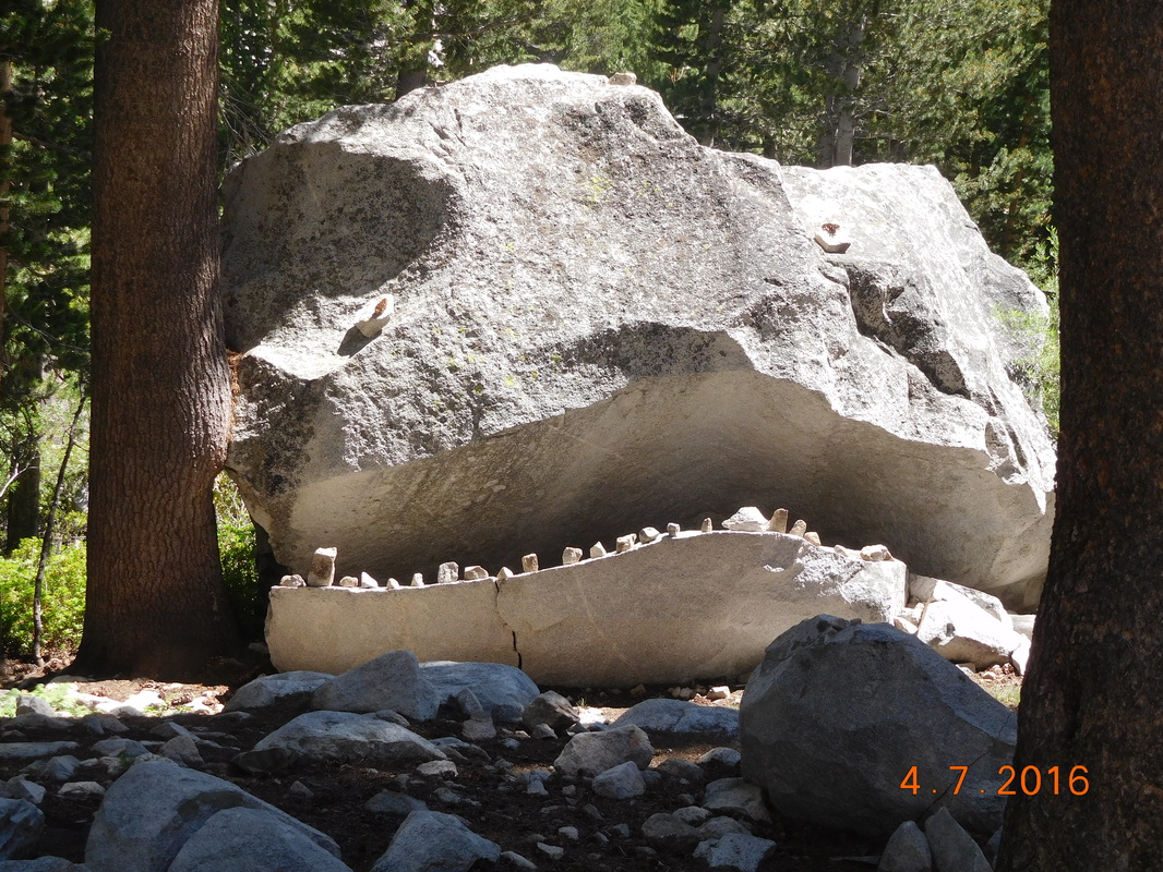 Crazy monster rock. The trail followed a river and the climbing got pretty steep as it passed by multiple waterfalls: 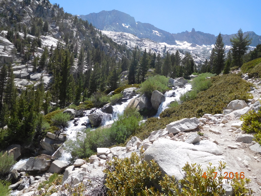 Steep trail near waterfall. 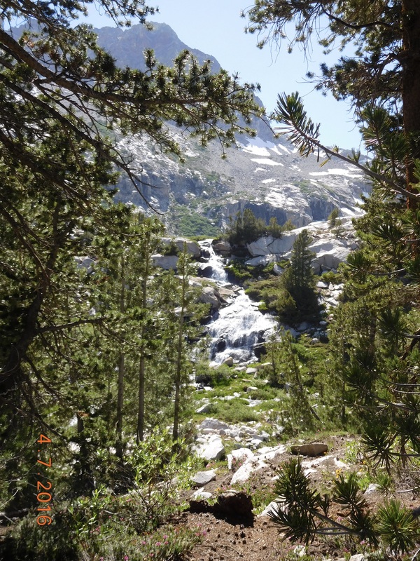 Another waterfall along the trail. As we go closer to the pass more snow appeared and there were more streams and rivers and lakes formed by the snowmelt. At this point we all managed to keep our shoes dry, but then Share Bear attempted this leap the Brad succeeded in doing: 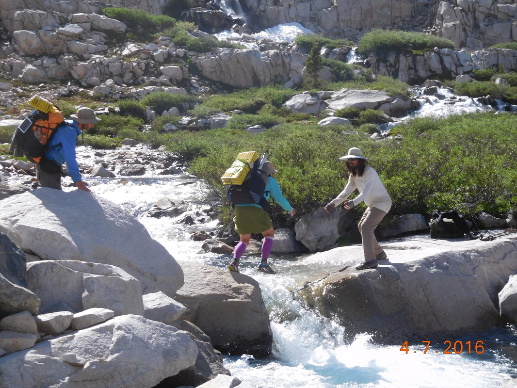 Share Bear leaps as Brad catches and Mountain House watches. Share Bear made it, but barely. I decided to find a different route around and wound up jumping rocks halfway across and then ran out. At this point I just went all in and walked through the water shoes and all. Not to worry...I wasn't alone with wet shoes for long. Soon after the others has no option but to jump in as well: 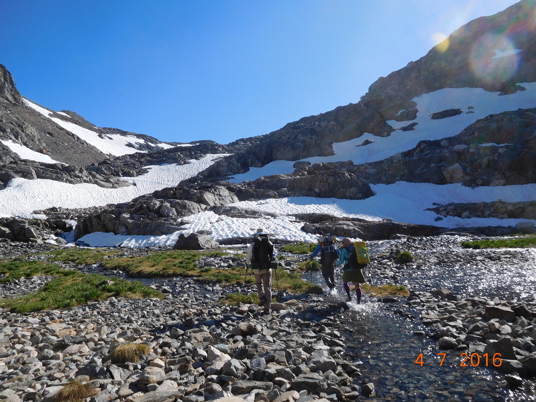 Everybody's shoes are now wet. A bit higher and the snow fields appeared. Now our feet were wet and cold, not a good combination, but we were working hard and keeping warm.  Brad putting in microspikes to cross snowfield. With all the water and snow the trail was nowhere to be found, so we bushwhacked our way towards the pass although we didn't know where the pass was. We just knew it was somewhere up there:  We need to get up there somewhere. We studied the mountain abs noticed snowfields that have footprints along them. That must be the way to go. So we made our way from snowfield to snowfield.  Another snow crossing. Finally we saw footprints heading straight up to pass, so up we went.  Self-portrait "Heading up to Muir Pass" We then saw the silhouette of the stone hut on top of the pass: 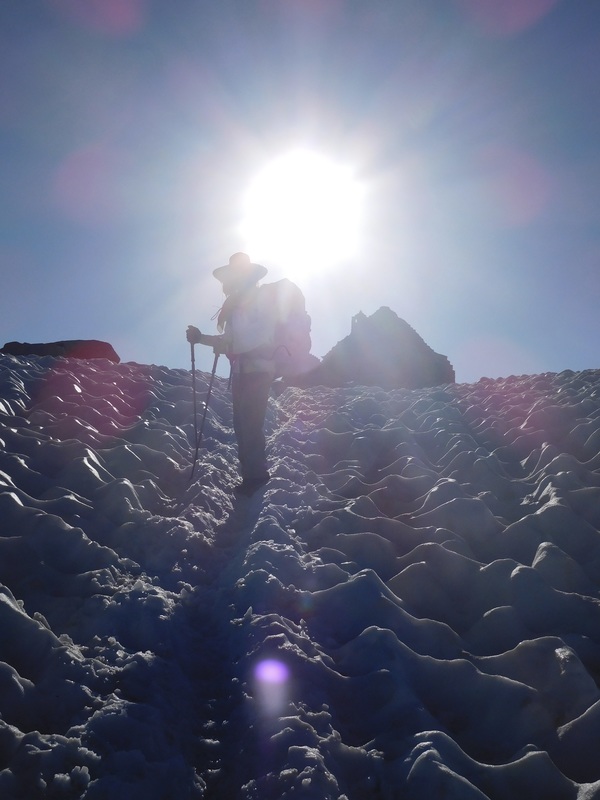 Brad coming up to stone hut. We made it I the top just before 7:00 PM, 9.5 hours after starting the climb this morning. 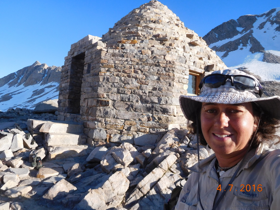 Self-portrait "Muir Pass Stone Hut" 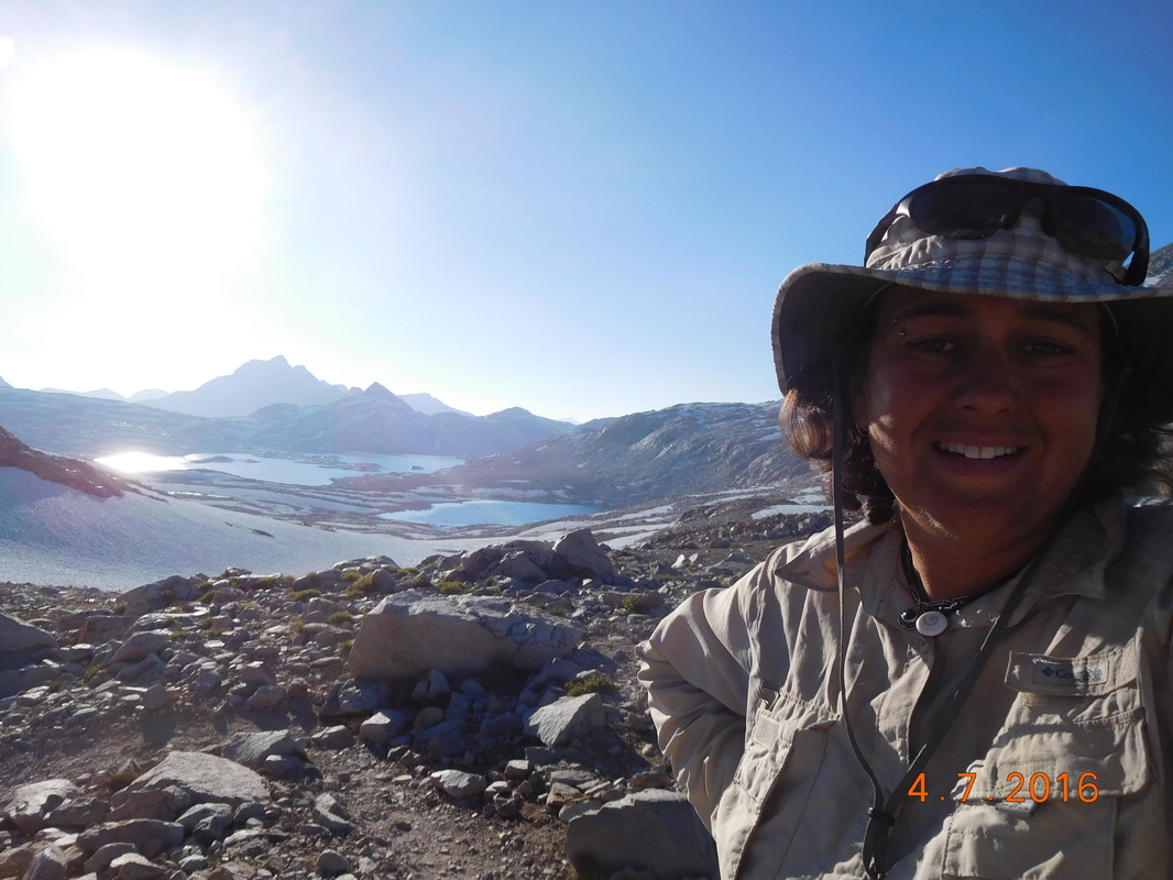 Self-portrait "Looking out from Muir Pass"  We made it to Muir Pass, 11,974 feet. 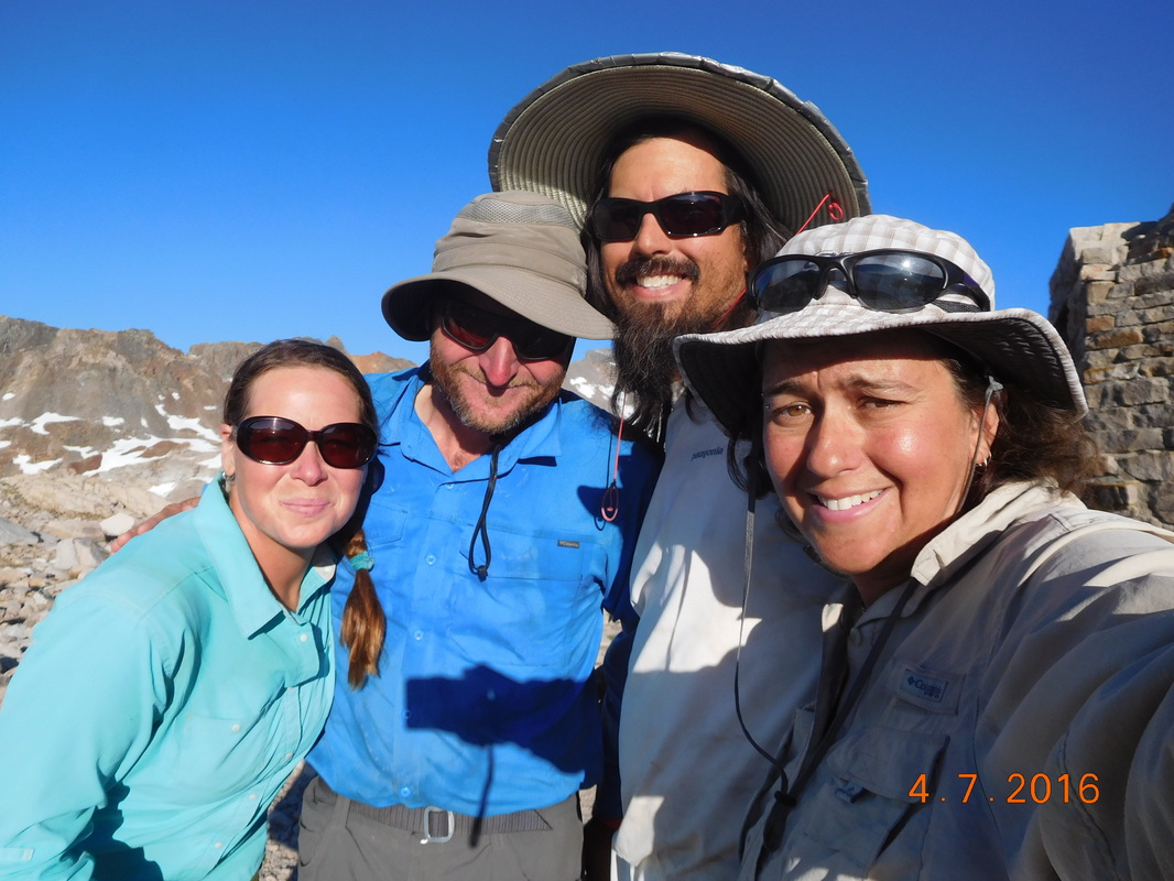 Share Bear, Mountain House, Brad, & I on top of Muir Pass Our celebration had to be cut short since we now still had 2 miles to the closest tentsites and sunset is about 1.5 hours away. As we departed the pass so did many others with the same thoughts in their head. The way down wasn't easy either. The trail again was covered with snow or water, so we had to feel our way down through snowfields and boulder fields which was not very easy, especially with wet, cold feet.  Sun cups in snowfield.  Lake McDermand  Wanda Lake. As we descended we saw other hikers stop at the first flat spot and pitch their tent. We were all quite nervous that where we wanted to camp would be full. We arrived close to the planned stop and there were a few sites that would work, but wasn't the best. We decided to continue on in hopes that the sites will still be available. As we hiked down, another hiker was headed up. Him and his wife camped by us a few nights ago. He wanted to make sure that we didn't settle for the sites we just passed because there are sites up ahead where him and his wife stopped. You have to love the awesome people on the PCT! So, at 8:20 PM, about 20 minutes before sunset, we arrived at our campsite. I set up my tent and couldn't wait to get in it and take my wet shoes and socks off. Instead of cooking dinner, I ate tomorrow's lunch of tuna on a tortilla since it was quick and easy. I got in my tent, peeled off my shoes and socks, dried out my feet, and jumped in my sleeping bag. We are at 11,435 feet so I know it will be a cold night. I was so cold and tired that I only got partway through this blog entry. I am sitting here at lunch the next day finishing it up. So, as said a few days ago in a similar situation...until tonight.  Amazing alpine campsite. Lake Marjorie to Large campsite, 200 feet south of trail, toward Palisade CreekThe temperature last night was perfect for sleeping. It was a bit chilly, but not too cold. I woke around 5:30 AM and was happy that I had 30 more minutes to sleep. I was then awoken by Share Bear at 6:00 AM which is rare since I usually wake up in my own. It was still cold enough in the morning that I didn't want to leave the sleeping bag, but as usual, nature calls and motivates me to get going. After breaking camp, eating breakfast, and collecting and filtering water, we were ready to hike at 7:40 AM. 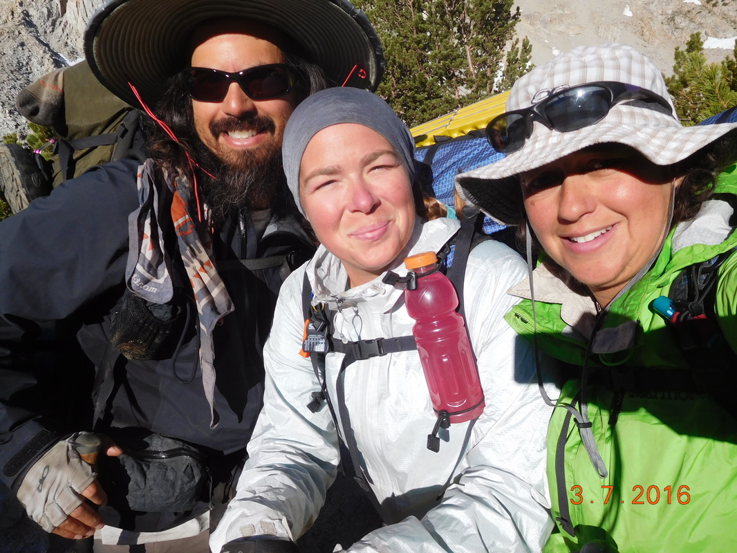 Ready to go. We walked up the hill from the campsite and got back on the trail. From there we had a great view of the lake we spent the night on: 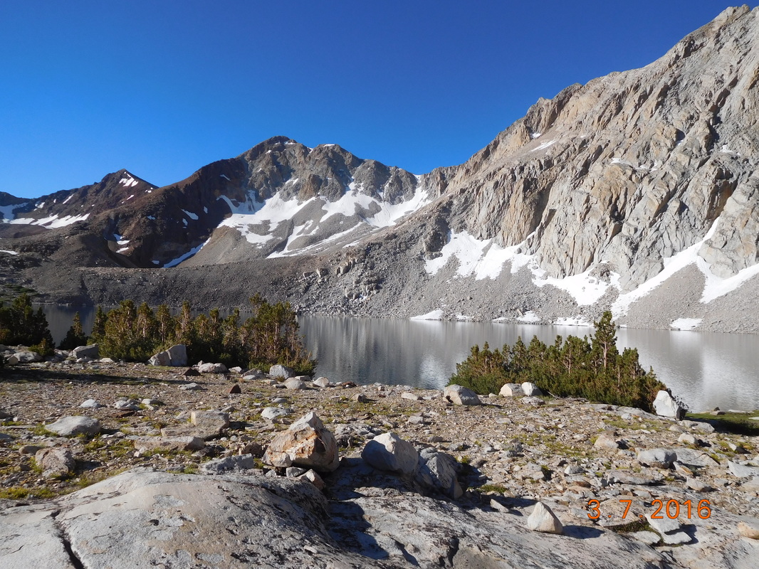 Lake Marjorie A half-hour later we entered a meadow abs spotted a marmot warming itself on a rock. 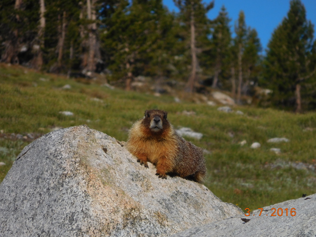 Cute Marmot getting warm This morning we cross what in supposed to be one of the worst rivers to cross. We expected to get pretty wet, but when we got to the river we noticed a log just up from the trail. It wasn't the easiest log crossings, but we all managed to get across unscathed. 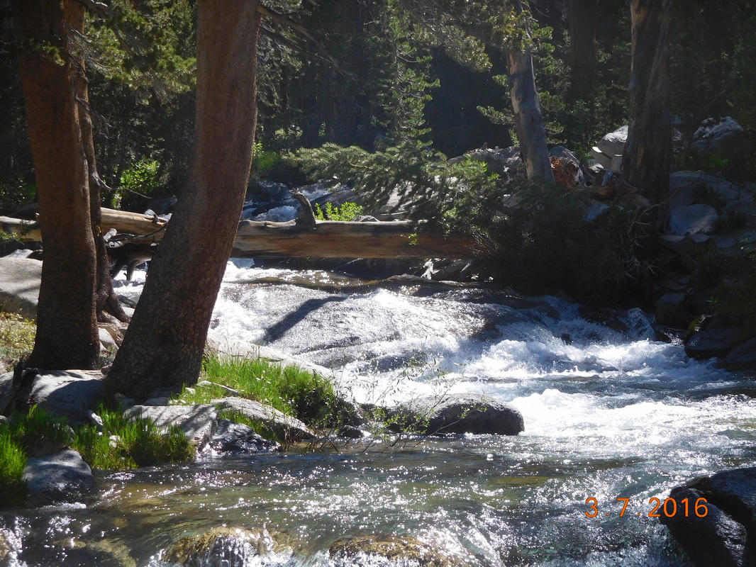 Not too bad of a river crossing. With that out of the way, we began the 5.5 mile climb up to Mather Pass. From the maps and notes we have, this pass isn't going to be as bad going up as Pinchot Pass we did yesterday. First off, the climb is 2 miles shorter, and we climb just over 2,000 feet instead of yesterday's climb of over 3,700 feet. It wound up that the climb up wasn't too bad nor was the scenery around us. 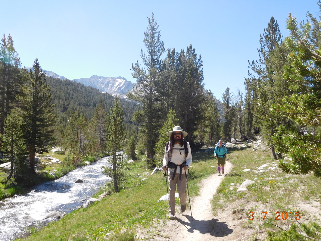 Brad and Share Bear climbing towards Mather Pass 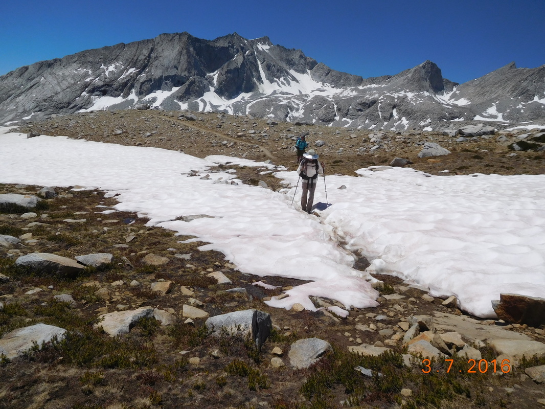 Brad negotiating a snow field The weirdest part of this pass is that we hiked towards mountains, but had no idea which way the trail was taking us and which pass we were going to hike up. 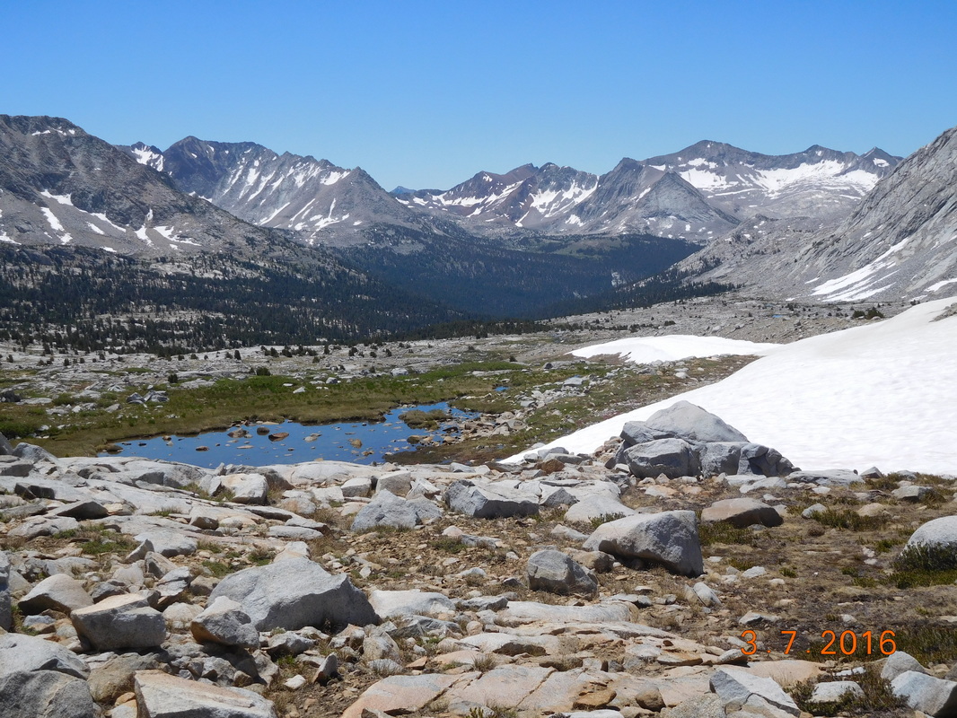 Where are we going over? We headed straight towards the mountains and then made a hard left up a switchback. Ahh...we get it now...wait...what...we are going up there? The switchbacks looked pretty steep from where we looked up, but it was only about 1 mile left, so I pushed it. I made it to the top just after 1:00 PM and Brad and Share Bear followed close behind. 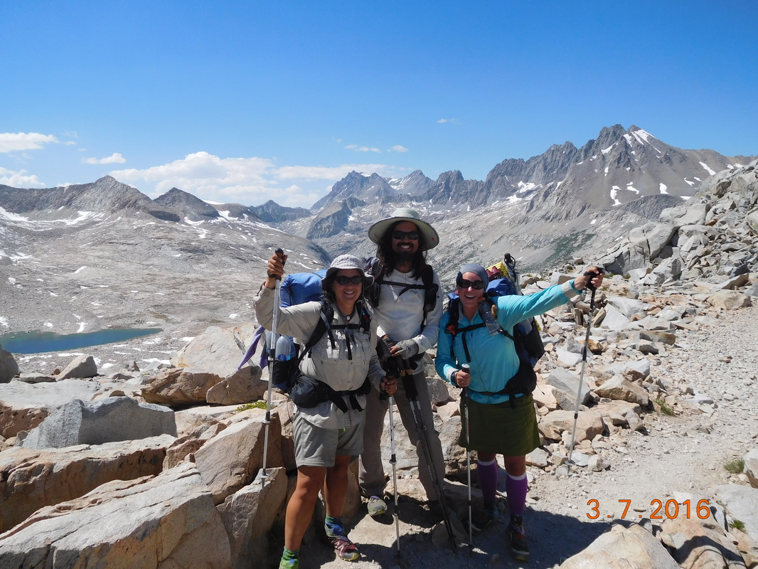 At the top of Mather Pass, 12,096 feet 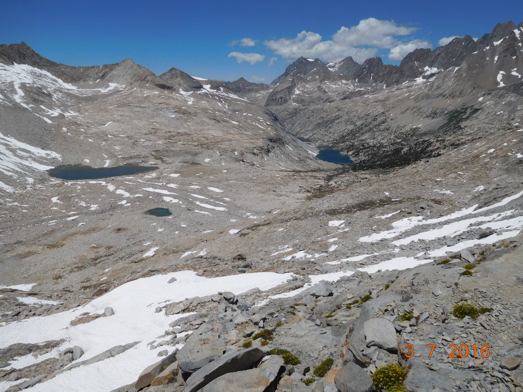 Mather Pass looking north. 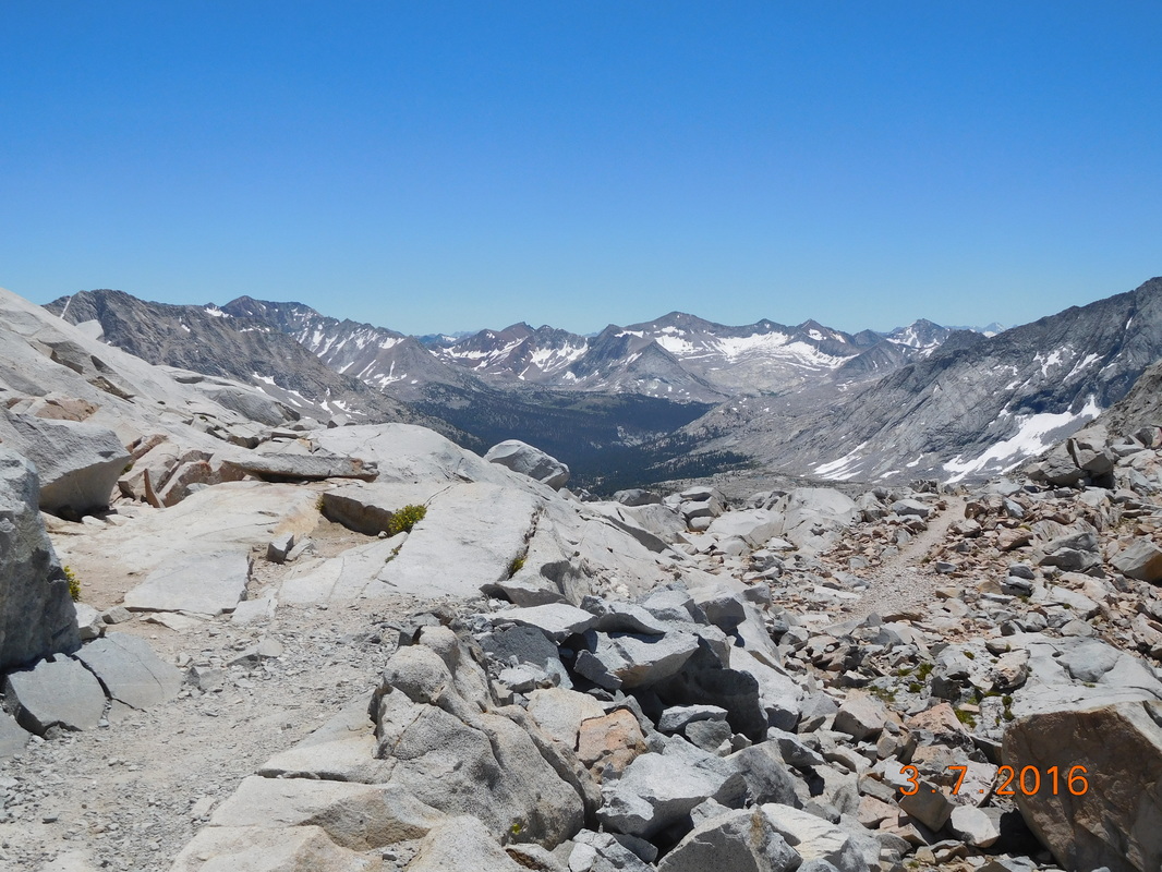 Mather Pass looking south. We haven't eaten lunch yet, so we made ourselves at home on top of the pass. Even though we were over 12,000 feet, the wind was calm and the sun felt great. 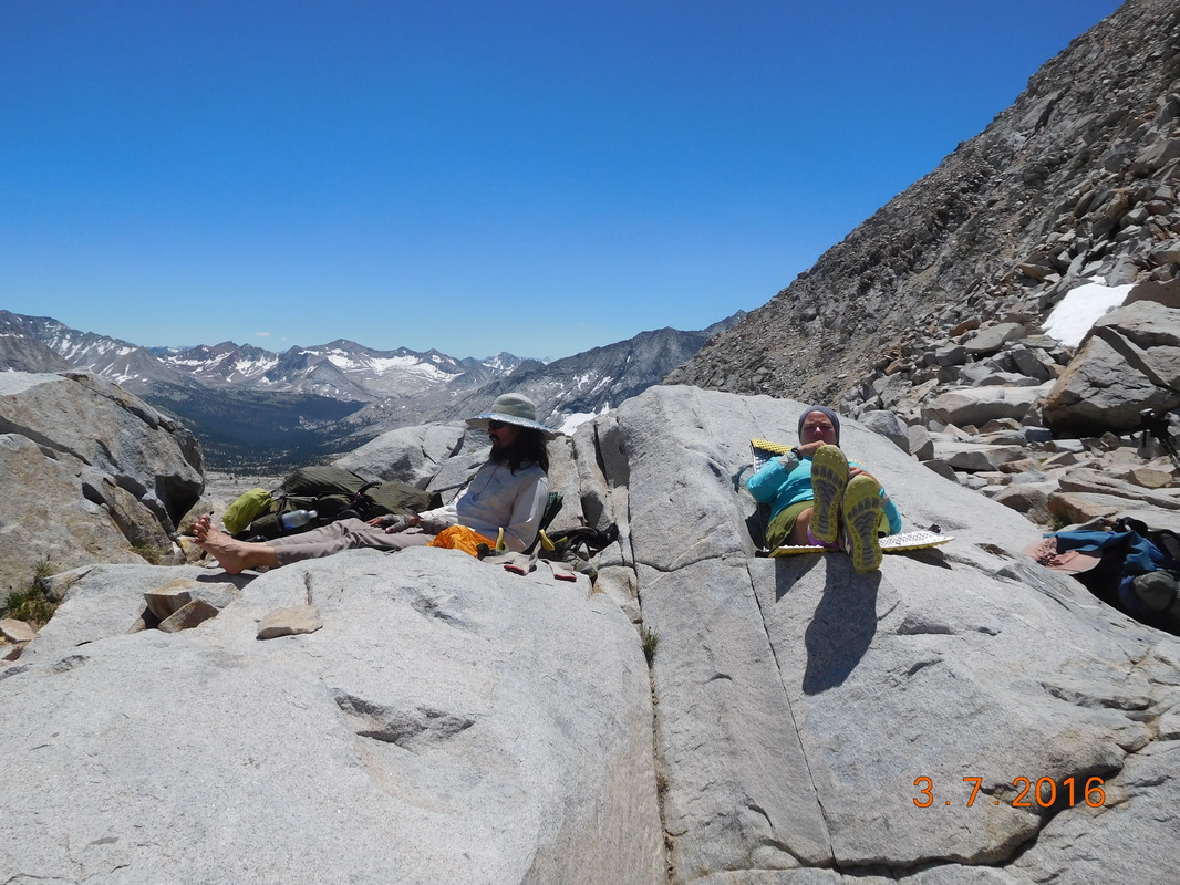 Taking a break on Mather Pass. It was pretty fun hanging out up there watching people cross from both sides. We met a guy from Australia that is going south on the JMT. We met Sweet Virginia who is a PCT hiker, but flip-flopped and is currently going southbound. She flip-flopped when she made it to the top of Pinchot and looked over the other side and the snow scared her. So, she turned around and went back down. She decided to jump to mile 1500 and hike southbound from there. When we saw her she had only about 10 miles to go to get to the top of Pinchot Pass, where she turned around. We wound up spending way too long on the top of that pass, and finally left there after 3:30 PM. We now had just over 7 miles to hike to get to our planned campsite for the night. Under normal conditions this wouldn't be too hard, but this is the Sierra Mountains, so it's not normal. In this 7 miles we had to descend 3,424 feet, meaning steep downhills, meaning probably averaging no more than 2 miles per hour, meaning we will be getting into camp late. We started down, and just as expected it was really tough going. It was steep and rocky and bouldery, and parts had turned into a waterfall due to snowmelt, and parts were covered by ferns so you couldn't even see the trail, and parts were a very steep staircase. Wow...the trail through the Sierra is not easy, but it is so beautiful when you can look up from the trail and look around. 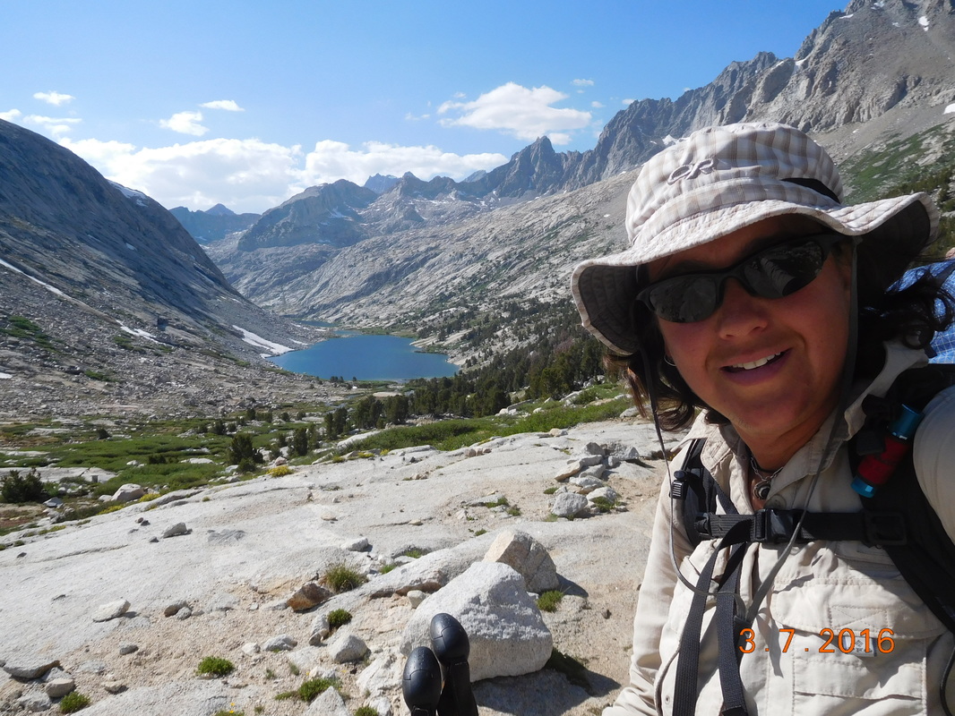 Hiking down Mather Pass 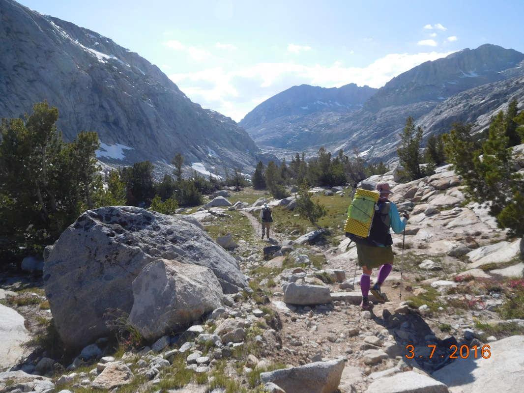 Share Bear & Brad hiking down the challenging trail. 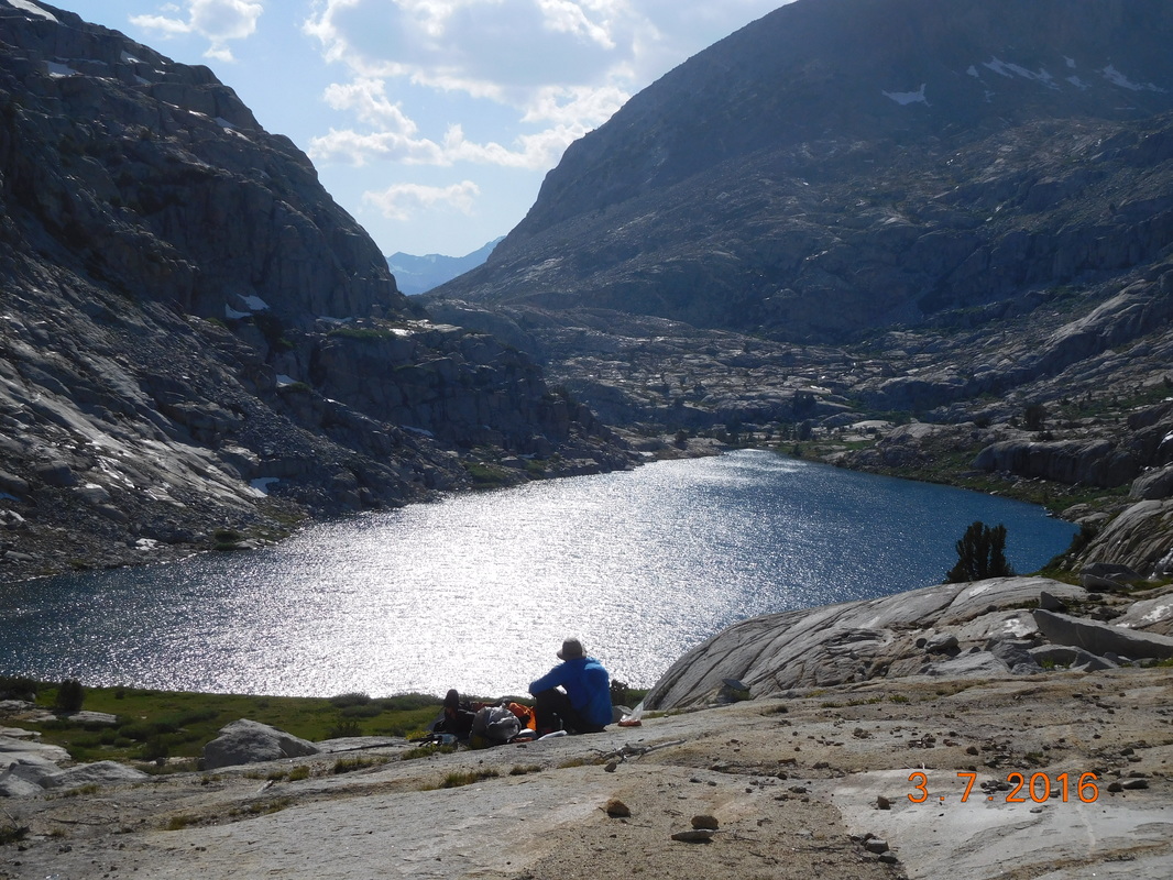 Mountain House cooking dinner with a view. 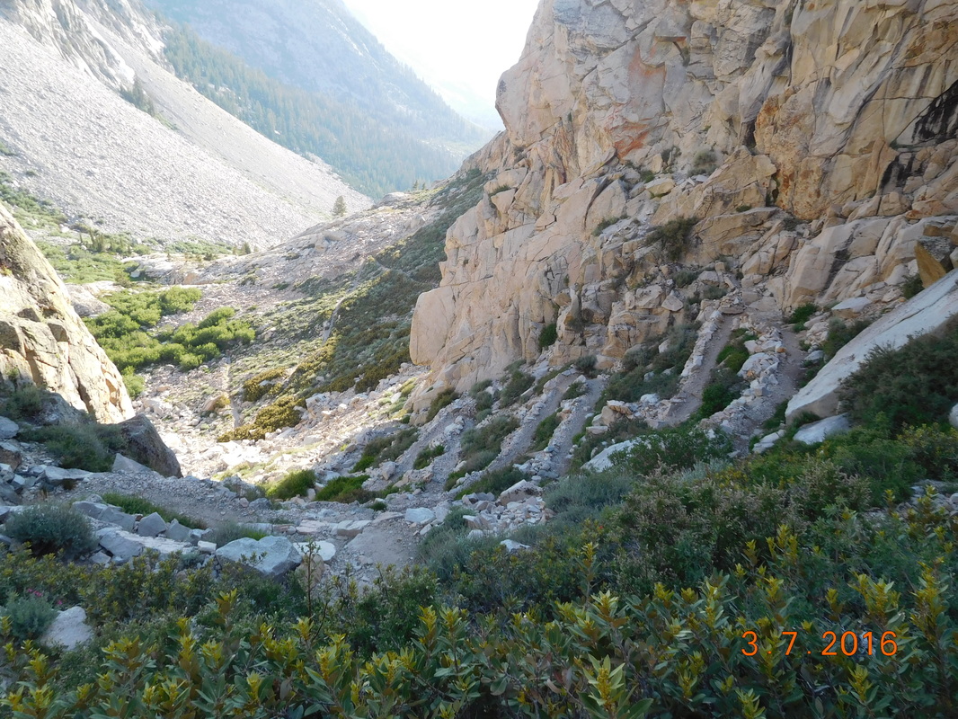 Looking down on the crazy switchbacks. Finally, around 7:30 PM we made it to the campsite. We were tired and hungry so quickly pitched our tents and sat for dinner. As we wound down we realized that this campsite was awesome. It was right on a stream with large pine trees and nice flat tentsites. As we cooked dinner a deer wondered into our area not even caring that we were there. Today was difficult, but we don't want to be anywhere else. 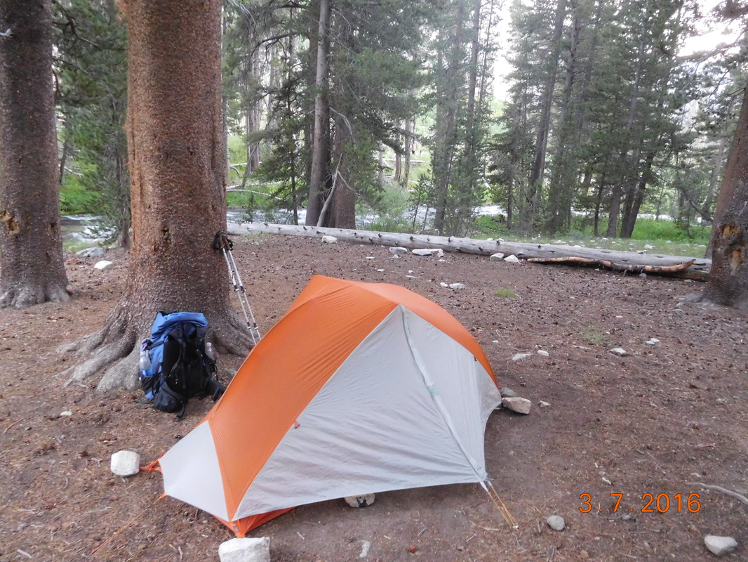 My home for the night. Middle Rae Lake to Lake Marjorie Wow...what a day! I don't know how I have the energy to lay in my tent and work on this blog tonight, but I'm going to give it a try. The day started out great. After a good night sleep, I awoke just after 6:00 AM. After breaking camp and eating breakfast we were ready to go at 7:45 AM. 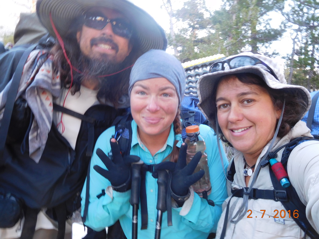 Ready to hike. I can't believe how beautiful the lake is that we camped on last night. The water was so still this morning that I was able to get these incredible reflection shots: 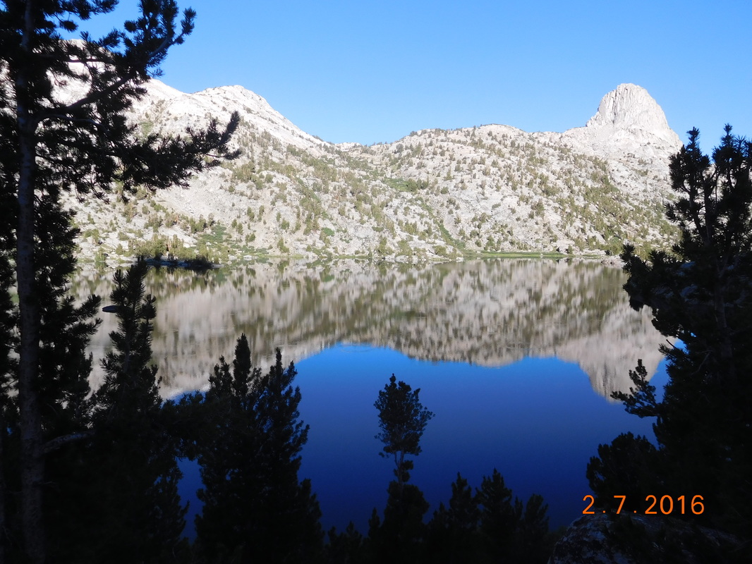 Reflection in Rae Lake 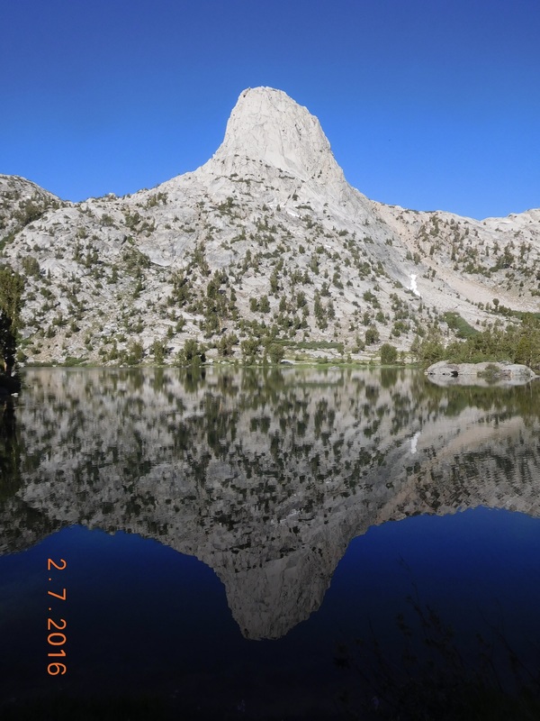 Wow! Today's hike consists of a 6.26 mile down followed by a 7.38 mile up to Pinchot Pass. ending with a 1.5 mile downhill to our planned campsite for the night. I don't think that I mentioned it in a blog yet, but 27 miles ago the PCT joins the John Muir Trail (JMT). They stay together for another 150 miles or so. During this time there are no PCT signs, only JMT signs. Here is the nicest one we have seen so far: 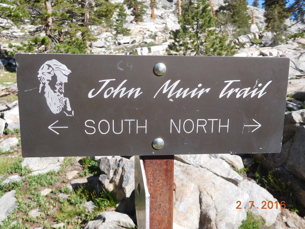 JMT sign of the day. Going down the 6.26 miles was not easy, but the scenery was amazing: 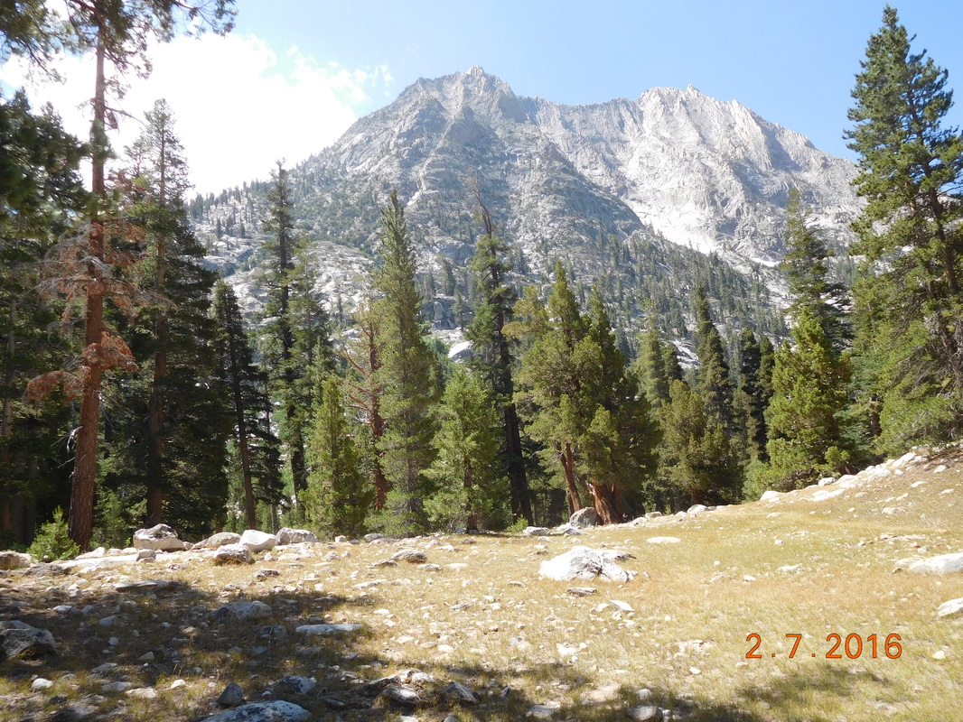 View as we hike down the trail. We usually stop for a break after 5 miles. Today we decided to push it to the bottom of the hill and arrived there around 11:30 AM. It was a bit earlier than we usually have lunch, but since the hike is uphill from here we figured we should have lunch for the energy needed to climb. We took about 1 hour for lunch and then headed back on the trail. First we have this cool suspension bridge to cross: 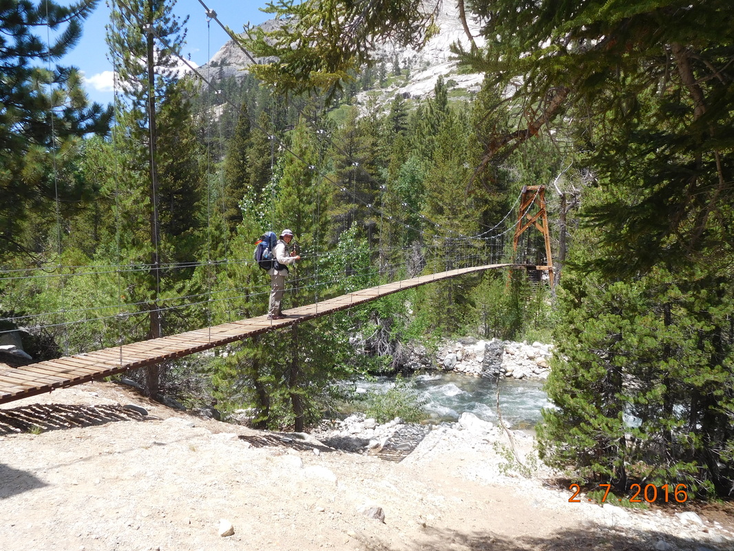 Me headed over the bridge. 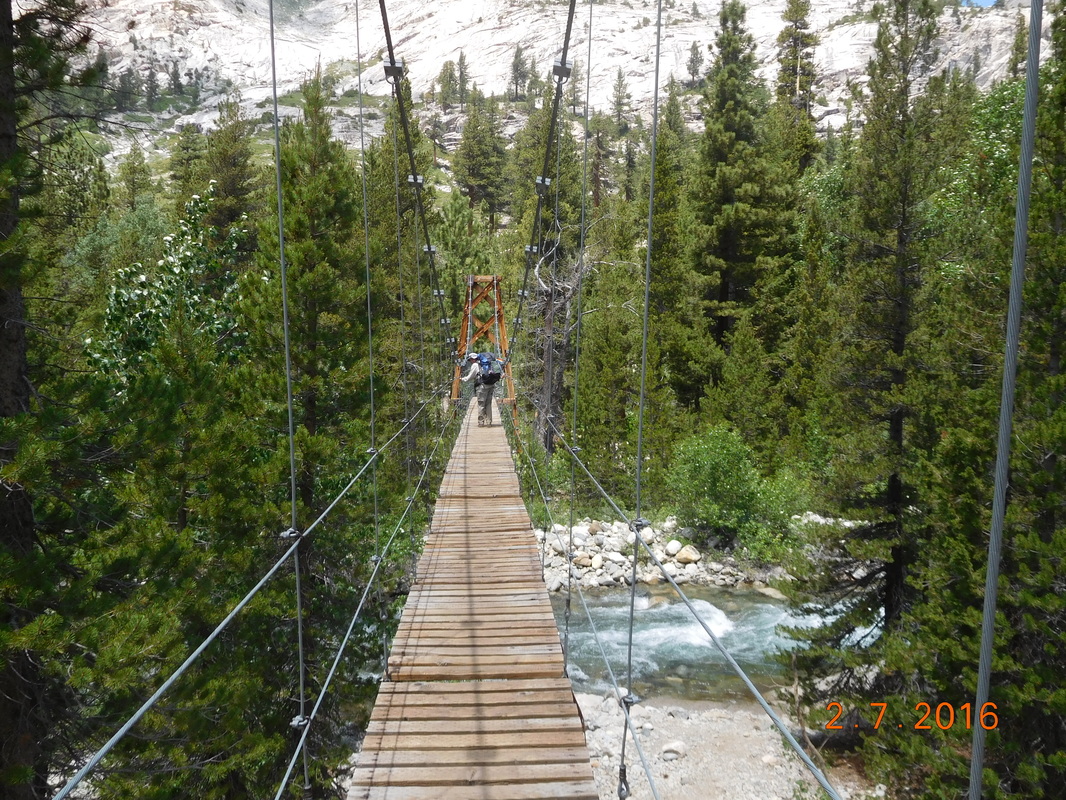 Almost over. It was a bit scary walking over that bridge. It swayed with every step I took, so I was pretty happy when I was across. Just a quarter mile later we hit the next milestone...800 miles!!! 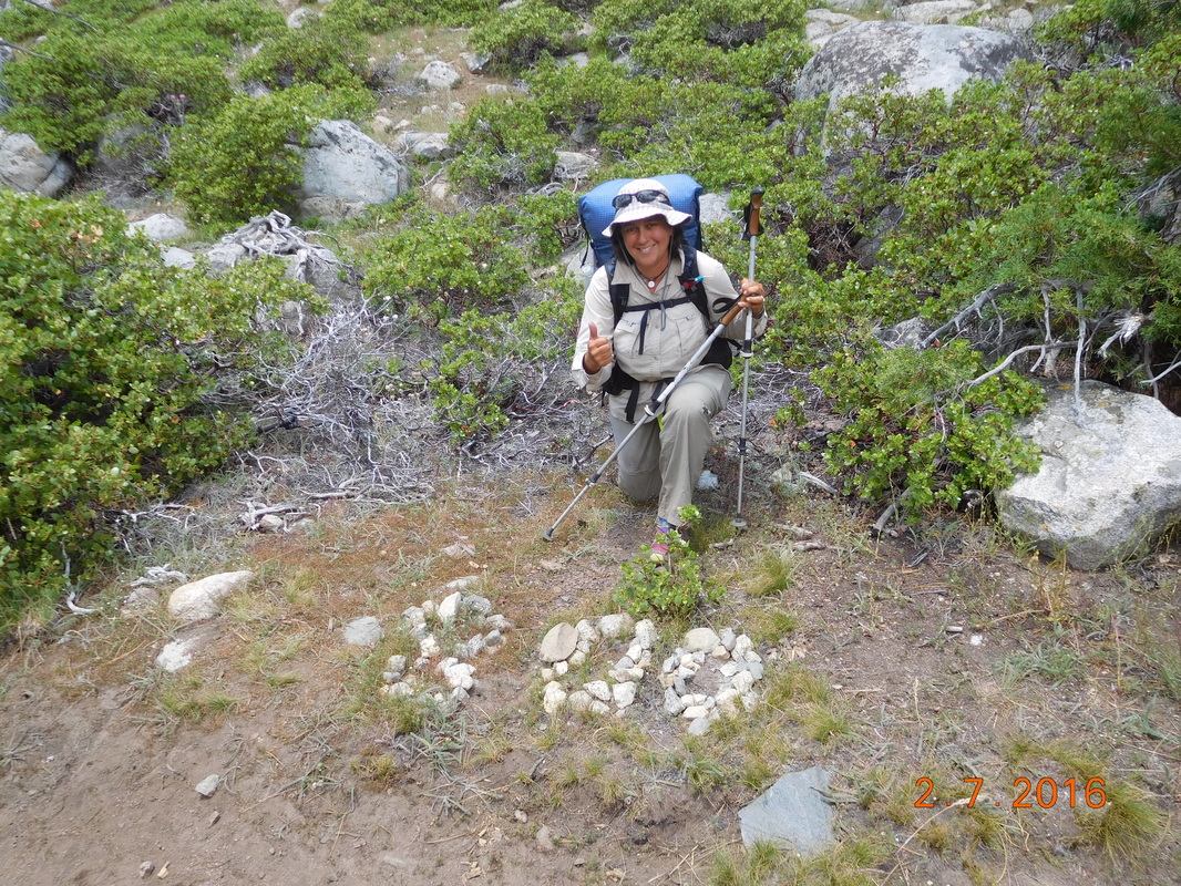 800 mile pose.  Proof I'm standing at the 800 mile point on the PCT. The 7.38 mile climb was relentless. It started out steep and kept getting steeper. For the first 3 miles or so it followed a raging river. This part is called "waterslide." 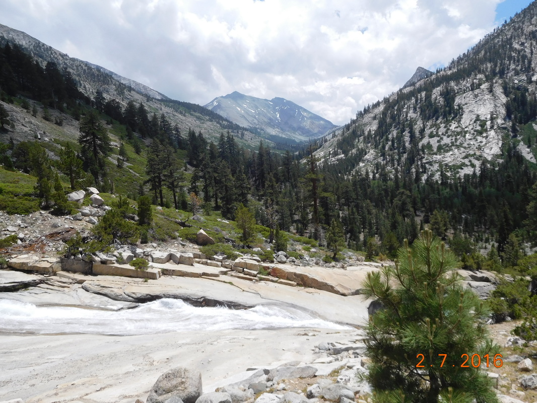 Waterslide. As you could imagine, many breaks were had on the way up. 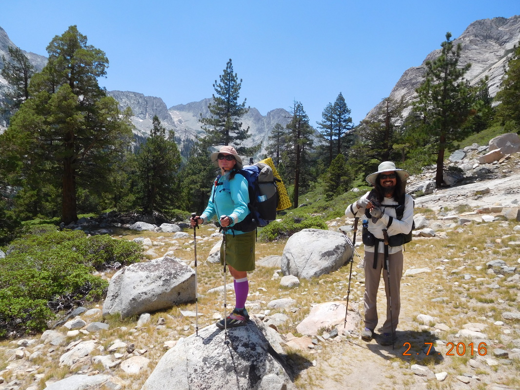 Share Bear and Brad taking a break from climbing. Here is an amazing shot of a waterfall. It looks like I am standing on it, doesn't it? That is because we had to cross it at this point, so I stopped in the middle and took a picture. 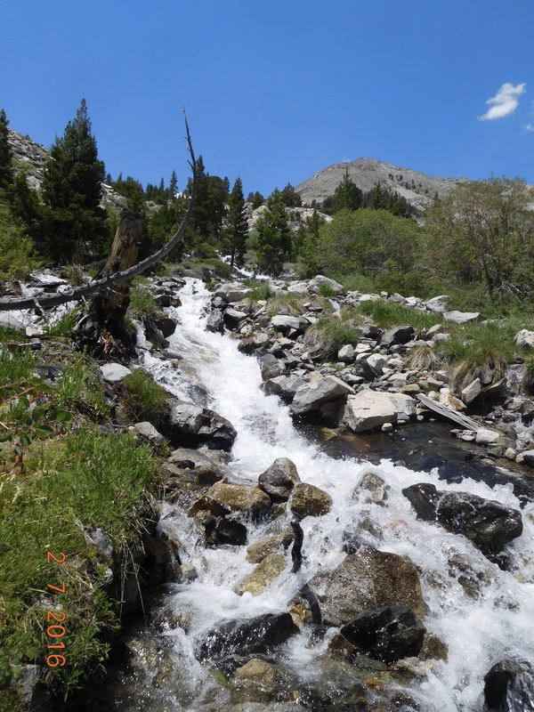 Looking up at waterfall. Here is a great picture of the river with mountains in the background: 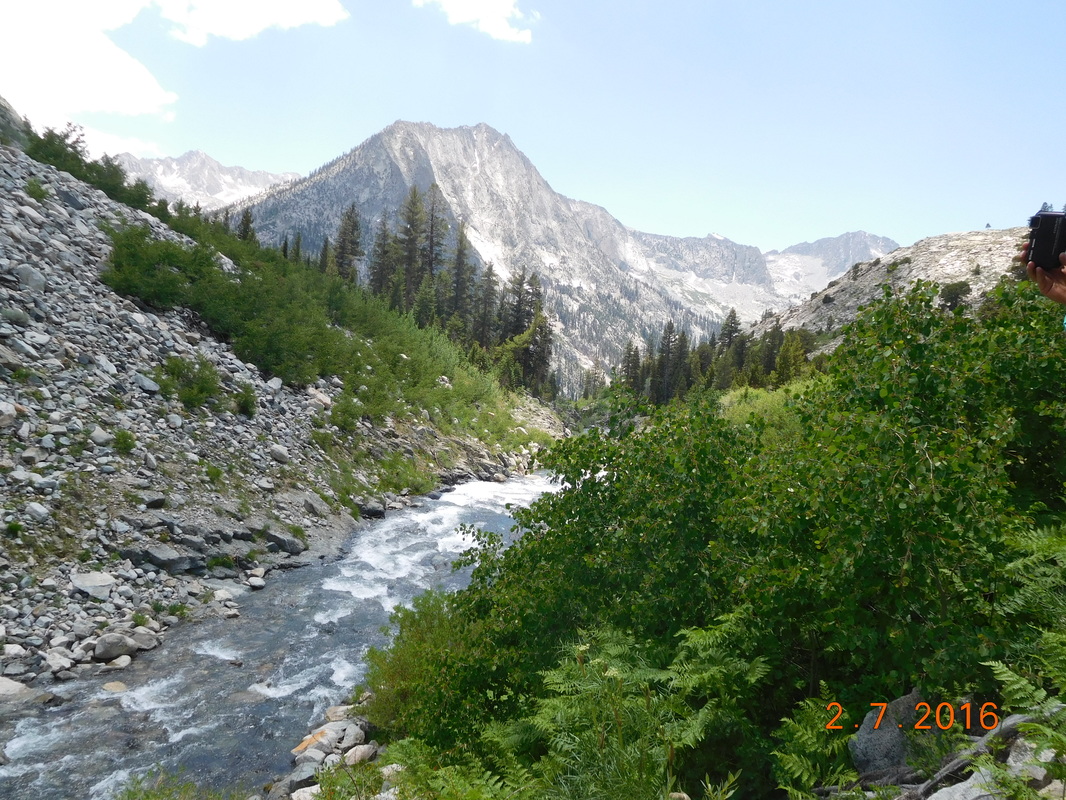 Great view. And here is a view of the trail climbing up to Pinchot Pass: 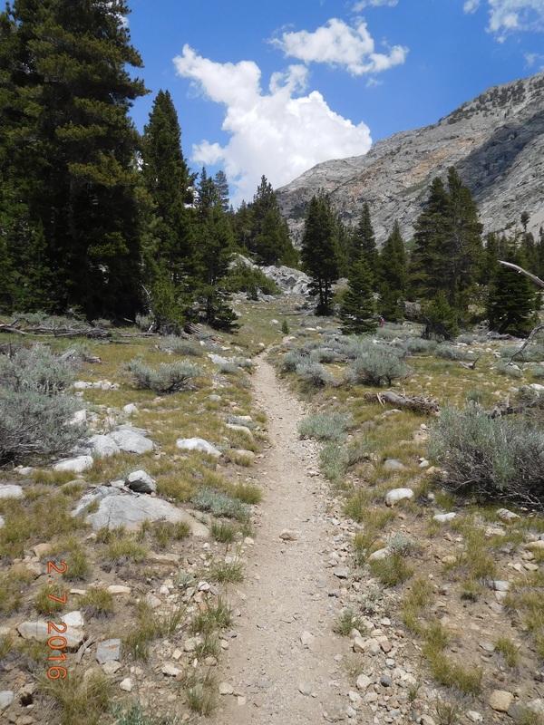 The beautiful PCT/JMT And yet another picture of a waterfall: 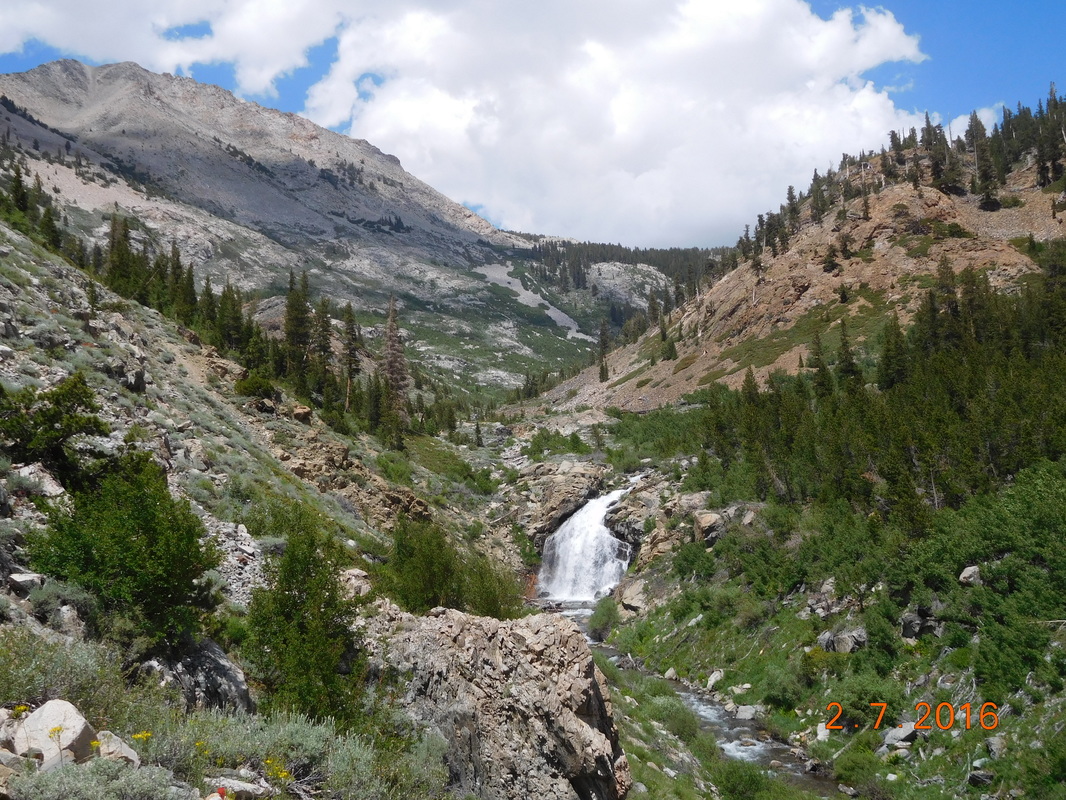 Waterfall view. We kept climbing and climbing. We started this climb at 8,532 feet and the pass is at 12,142 feet. That is a lot of feet we have to gain. So we climbed and rested and climbed and breathed heavy and climbed. We were headed towards these mountains, but still had no idea where the trail was taking us and where the pass was. 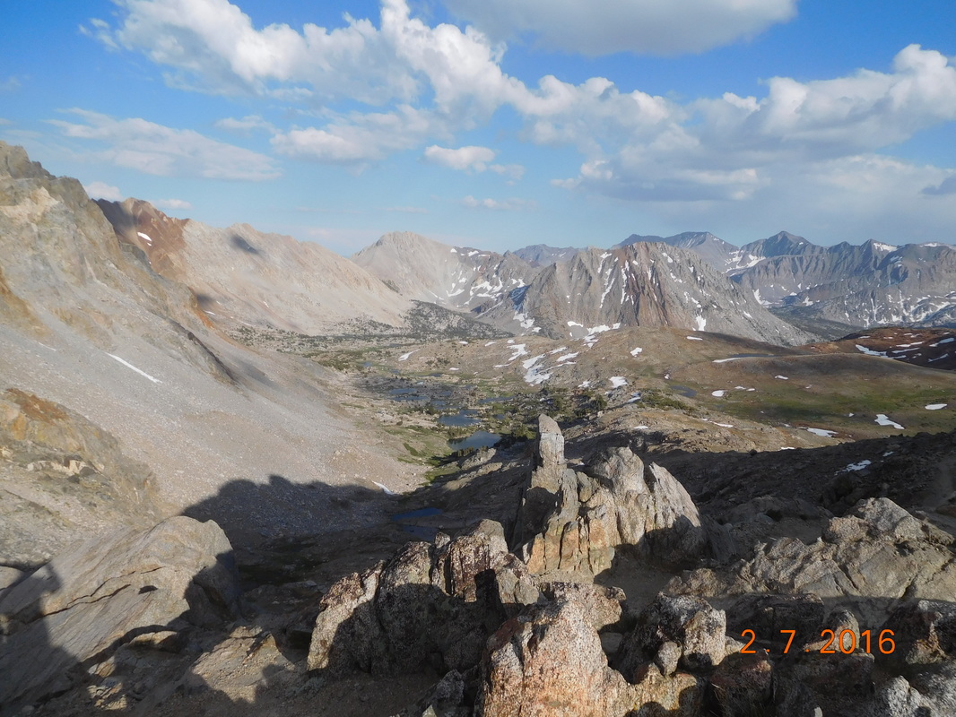 We are going over a pass somewhere there. Finally, after some steep switchbacks we made it to the top of Pinchot Pass just after 6:00 PM and 5 hours of climbing. The pass tops out at 12,142 feet.  At the top of Pinchot Pass  View to the south of Pinchot Pass as Brad and Share Bear make it to the top.  View to the north of Pinchot Pass  Our exhausted look at the top of Pinchot Pass  We made it to Pinchot Pass, 12,142 feet. We were extremely tired at the top, but we still had 1.5 miles to our planned campsite, so after too short of a break we headed down the north face of the pass. We could see Lake Marjorie down below us...this is where we are camping. Even though it was one 1.5 miles and downhill, it felt like it took forever to get there. Finally, just before 7:30 PM we made it to our amazingly beautiful campsite. We all quickly...well, as quickly as we had the energy for...set up out tents, cooked and ate dinner, and jumped into our tents. We are at 11,158 feet, so It should be a cold night, which will be perfect for sleeping after another very difficult day of hiking. Tomorrow we have another pass to cross, but it shouldn't be as hard as today...so, until then I leave you with this picture of my incredible tent site. I almost can't believe I am here. 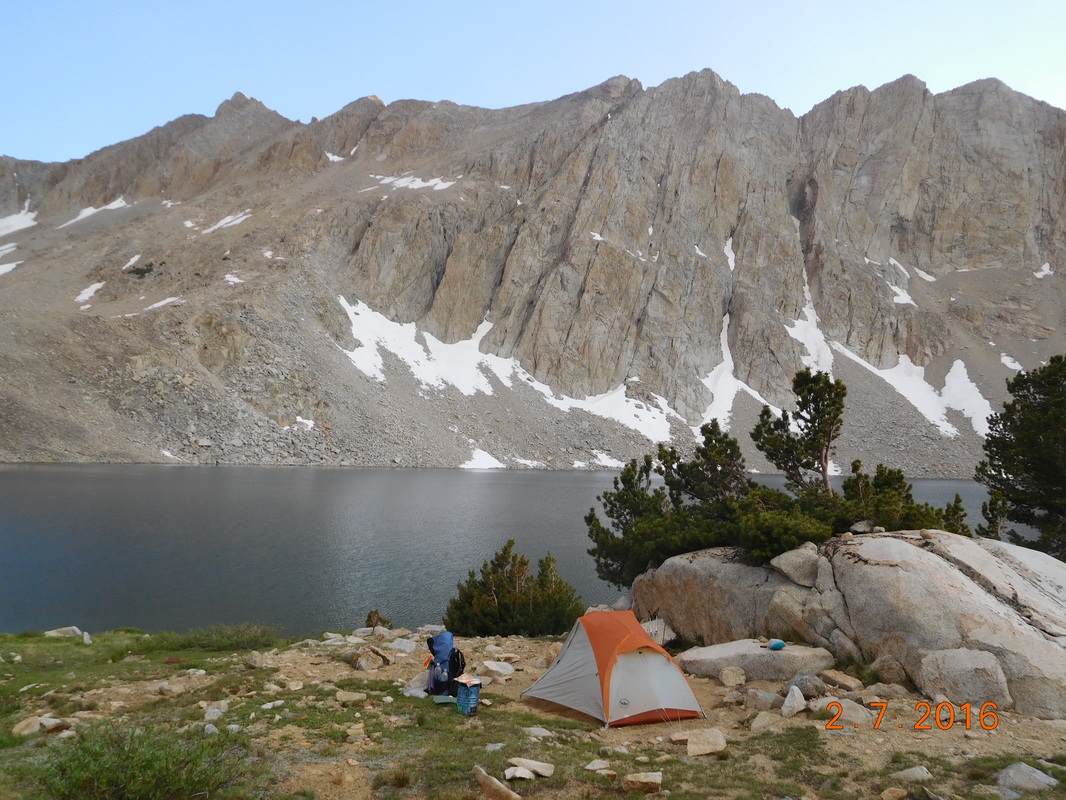 No words can describe this tent site. |
 RSS Feed
