Highway 20, Rainy Pass to Highway 20, Rainy Pass (Staying in Winthrop)
We woke at 7:00 AM in the hotel room. From that point I didn't have a good feeling about today. We are going to get back on the PCT and try to head north to the border. All that stands between us and Canada is 61.47 miles. Under normal conditions this should take us under three days to hike, but today the conditions are not normal. We know there is a foot of snow at 6,500 feet and much of the remaining trail hangs out between 6,000 and 7,000 feet. We also know if the snow really is that deep it can take us 5-6 days to complete the 30 miles. We aren't sure we can do it, but we have at least see it for ourselves and give it a try.
Aviator and Kodachrome met us in the parking lot at 8:00 AM and we were off to Mazama to pick up Sunshine. After getting Sunshine, shopping a bit at the outfitter in town, and warming up in the Mazama Store, we were headed to the trailhead around 10:30 AM. By 11:00 AM we were ready to hike.
Aviator and Kodachrome met us in the parking lot at 8:00 AM and we were off to Mazama to pick up Sunshine. After getting Sunshine, shopping a bit at the outfitter in town, and warming up in the Mazama Store, we were headed to the trailhead around 10:30 AM. By 11:00 AM we were ready to hike.
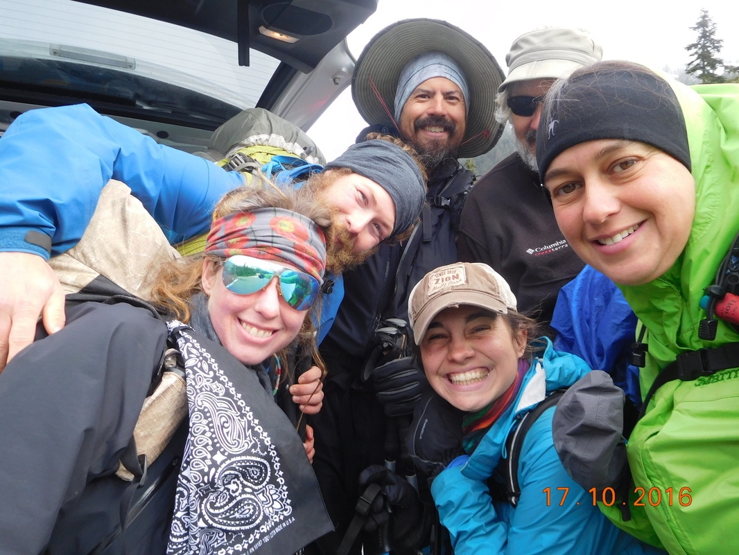
Ready to hike with Aviator, Kodachrome, and Sunshine
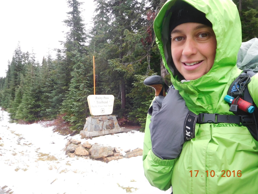
Trailhead
The whole time in Mazama I still didn't feel good about this. I have never hiked in snow deeper than my ankles plus, I was worried about my feet being cold & wet for the next 5 days. As soon as we started hiking I started to feel better. The trail was in pretty good condition with little snow. There were some puddles, but nothing we couldn't walk around. OK...this isn't bad. We climbed a bit and the snow got a little deeper, but no problem. Plus, there are footprints in the snow on the trail, so someone is ahead of us cutting a path in the snow. Hopefully they are thru-hikers and we can just follow their footprints. Suddenly the snow was deeper and then it was halfway to my knees. I kept going though since I was able to step in the footprints ahead of me.
Then, two guys were coming towards we on the trail. They are sponsored trail runners trying to promote trail running in Washington. They were trying to get to Canada and then turn back and run the PCT from Canada to the border of Oregon, but when the snow got to their knees they turned back. At this point the others caught up to me and it was decided by all, except Sunshine, that we should head back. We had made it to mile 2,591 and we weren't going to make another PCT mile past that point.
Then, two guys were coming towards we on the trail. They are sponsored trail runners trying to promote trail running in Washington. They were trying to get to Canada and then turn back and run the PCT from Canada to the border of Oregon, but when the snow got to their knees they turned back. At this point the others caught up to me and it was decided by all, except Sunshine, that we should head back. We had made it to mile 2,591 and we weren't going to make another PCT mile past that point.
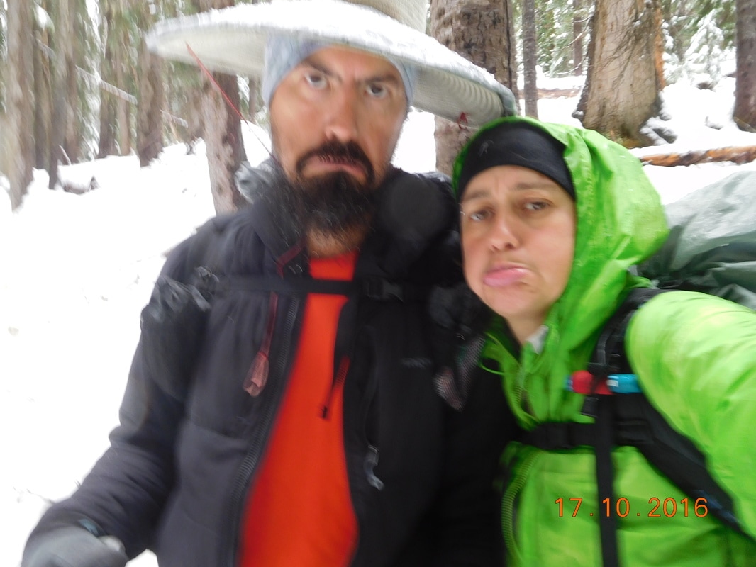
Not too happy about turning back
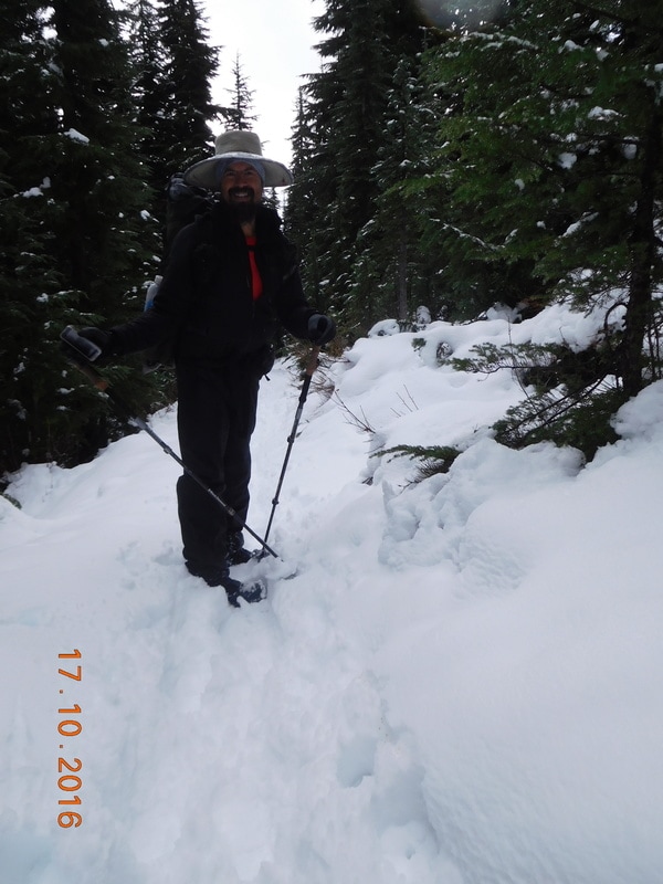
Lots of snow
We were all upset, but Sunshine was in disbelief. Brad and I turned back as the others out on more clothes for the downhill journey back to the trailhead. We made it down, but it was another 20 minutes till Aviator and Kodachrome made it. They told us that Sunshine almost had a meltdown and they had to convince her to turn back with us...she did not want to quit. Finally Sunshine made it and Tim showed up 20 minutes later to pick us up.
When we got back to Mazama the others decided to take an alternate to make it to Canada. At this point I was unsure what I wanted to do. We headed back to Winthrop, stopped for pizza, and returned to the hotel room. All this without discussing our next plans. I received a text from Aviator saying that they were all doing an alternate, lower route to Canada leaving tomorrow. Sunshine and Sherlock were going to walk the highway to the trailhead starting around 9:30 AM to keep their continuous footpath, and the others are getting a ride to the trailhead. I went to sleep still not knowing what we were going to do.
I guess we will see in the morning. Until then...
 RSS Feed
