Campsite near Milk Creek to Campsite near Miners Creek
It was another cold night...I'm starting to sound like a broken record...I assume all the remaining nights on trail are going to be cold. Funny story...I woke sometime after going to sleep and looked at my watch. It said 4:05. I was like, "What?!!" It can't be 4:05, I feel like I just went to sleep and plus, there is no way I slept till 4:05 without waking up earlier. I was baffles and looked at the watch again...4:06...I just didn't get it. After lying there thinking about it I realized that the watch was showing the chrono mode and not the time. Aha...the time was 1:15 AM...still impressive that I slept for almost 4 hours before waking up.
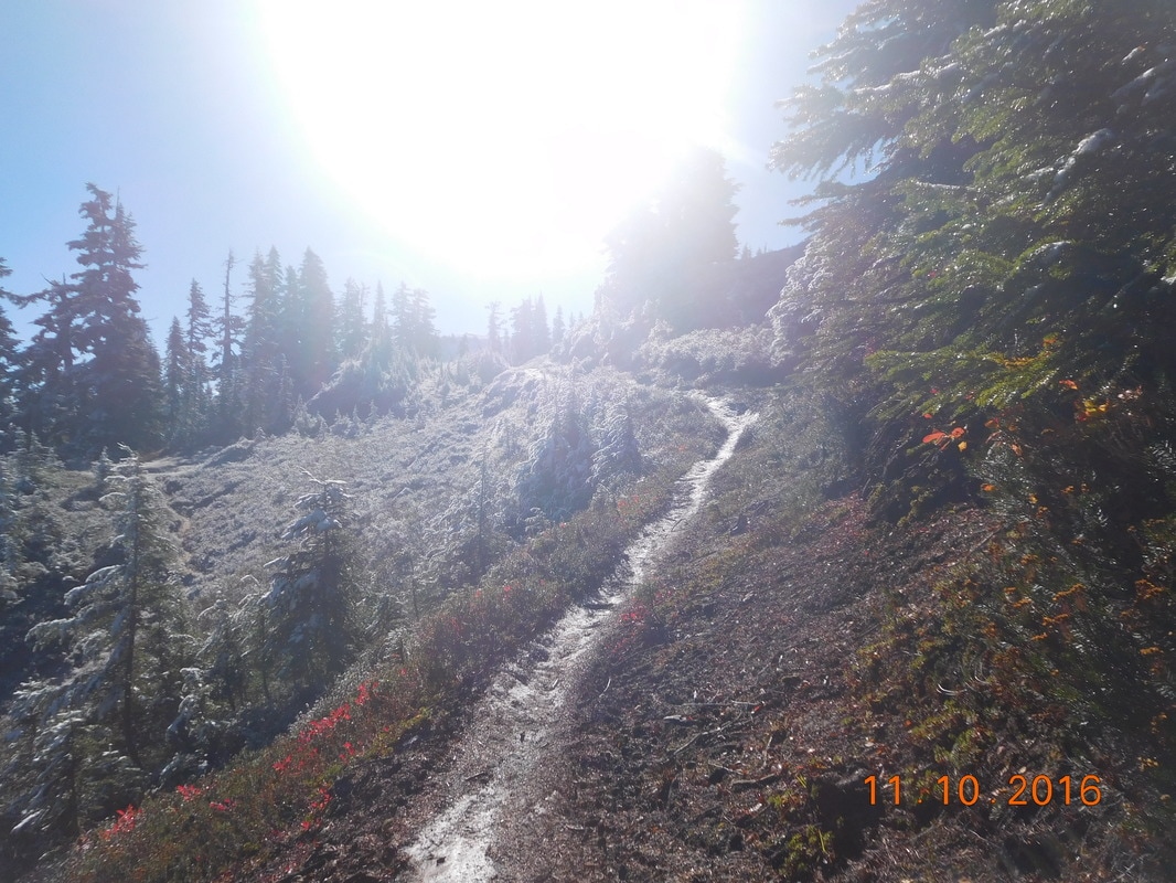
Anyway, the alarm went off at 5:30 AM and it was freezing. We had to get up, but it was so hard. What was even harder was putting on my wet socks and shoes. Within 20 minutes of putting them on my toes were going numb...we have to hurry up and get going so I can warm up my feet. We were finally ready to hike at 7:42 AM.
Anyway, the alarm went off at 5:30 AM and it was freezing. We had to get up, but it was so hard. What was even harder was putting on my wet socks and shoes. Within 20 minutes of putting them on my toes were going numb...we have to hurry up and get going so I can warm up my feet. We were finally ready to hike at 7:42 AM.
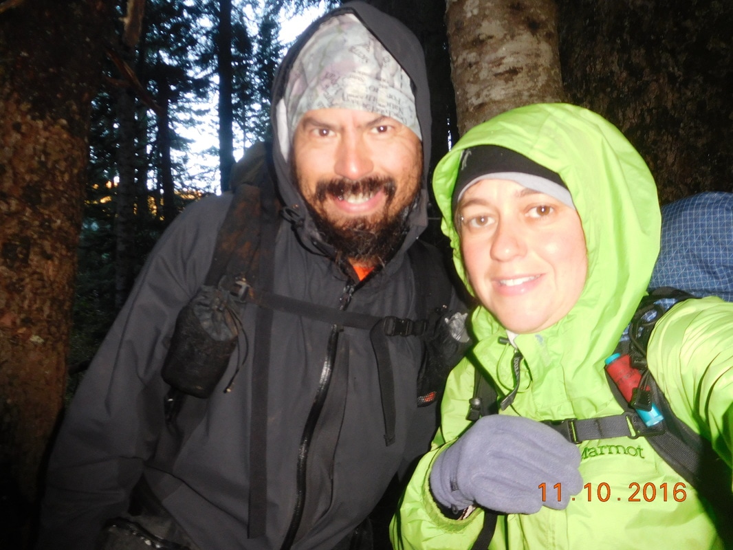
Ready to hike
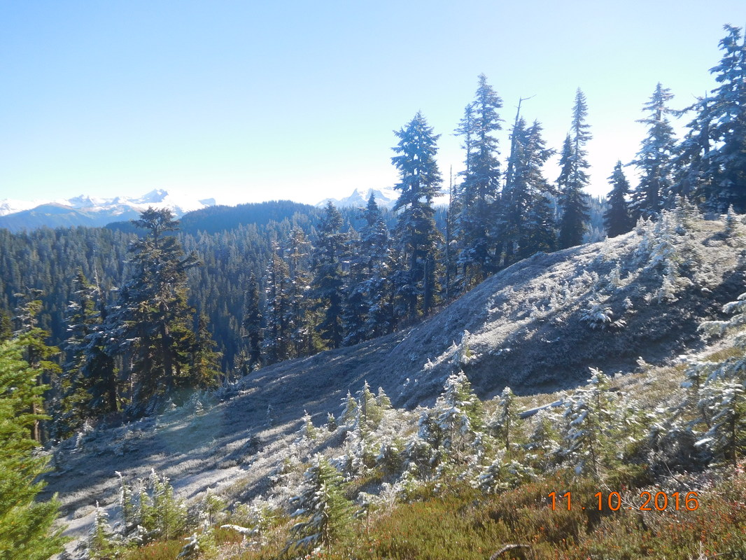
I was never so happy to have a huge hill to climb first thing so I can get my feet warm. I climbed as fast as I could hoping my feet would gain feeling back. Slowly my right foot started feeling warmer, but my left still had a ways to go. Finally, after over 2 hours of climbing, both my feet felt fine. What an awful 2 hours though. The only good part was that it was finally blue skies. The first in what feels like a very long time. With the blue skies came incredible views:
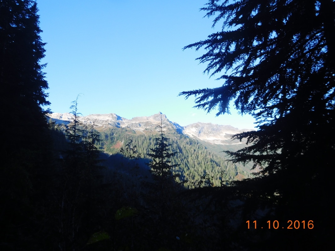
Morning view
View of the Cascade Mountains
Of course with blue skies come cold, crisp air. This section of the trail was covered with frozen leaves:
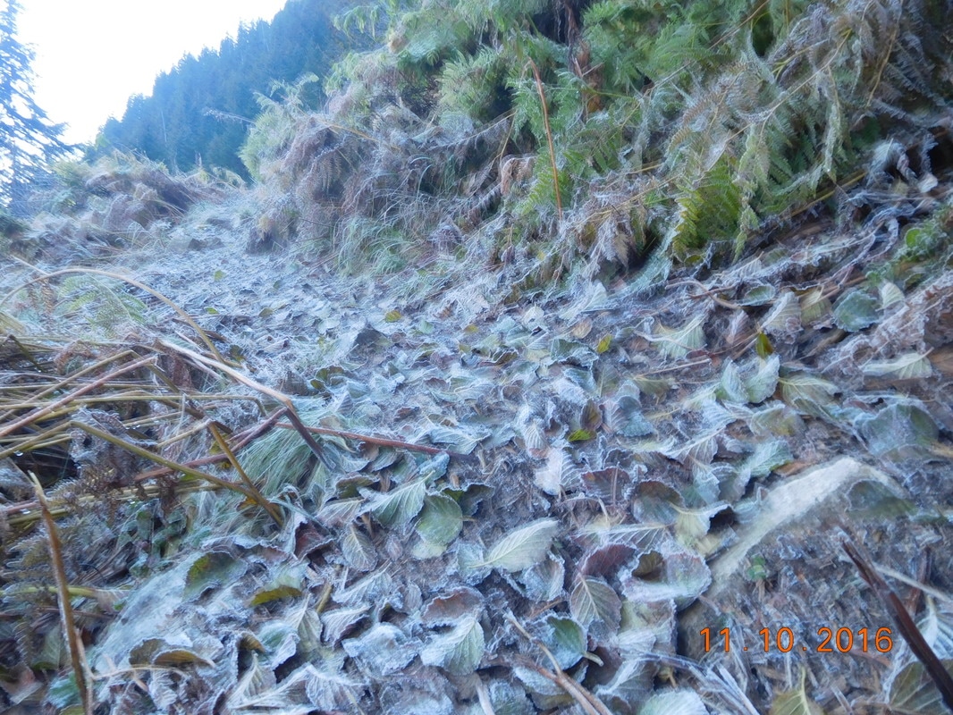
Frozen leaves on the PCT
As we climbed higher the trail was frozen with snow and ice.
Ice covered trail
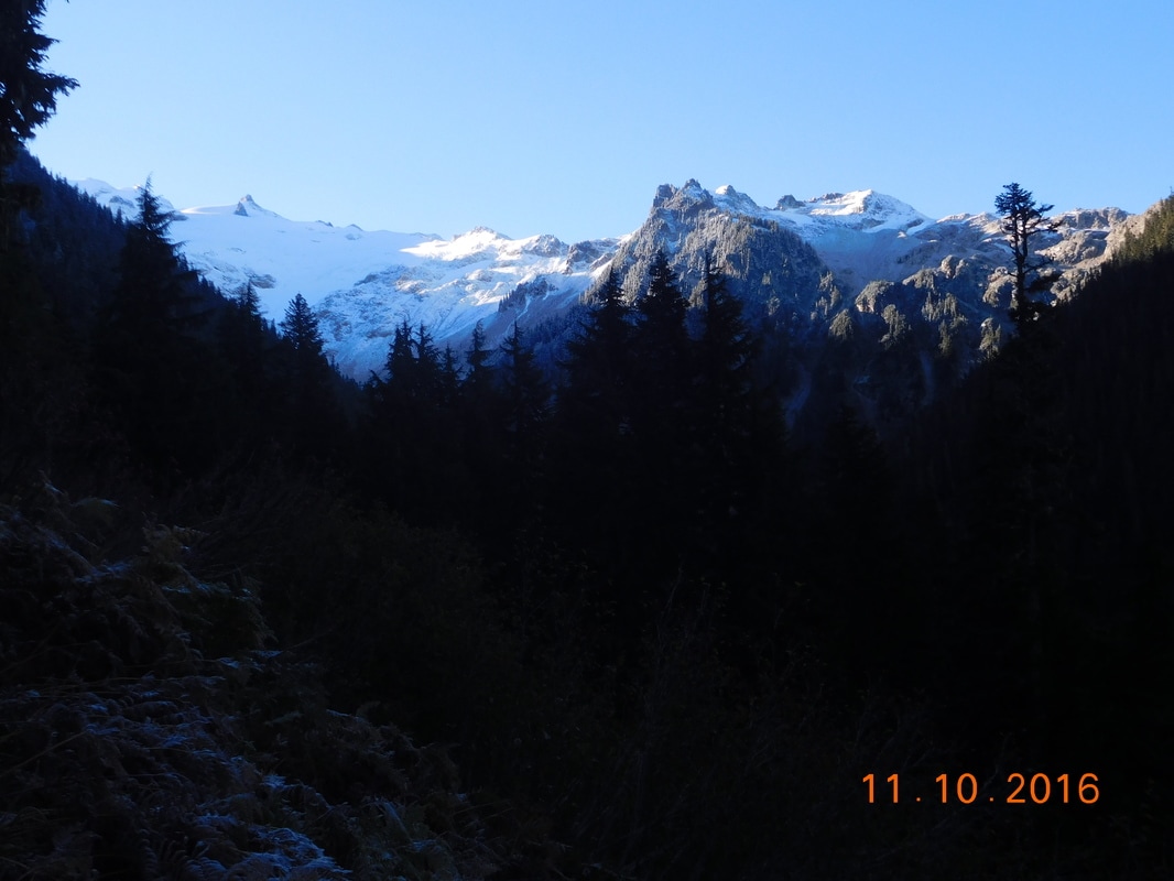
Easy does it up to over 6,000 feet with spectacular views:
Beautiful winter scene
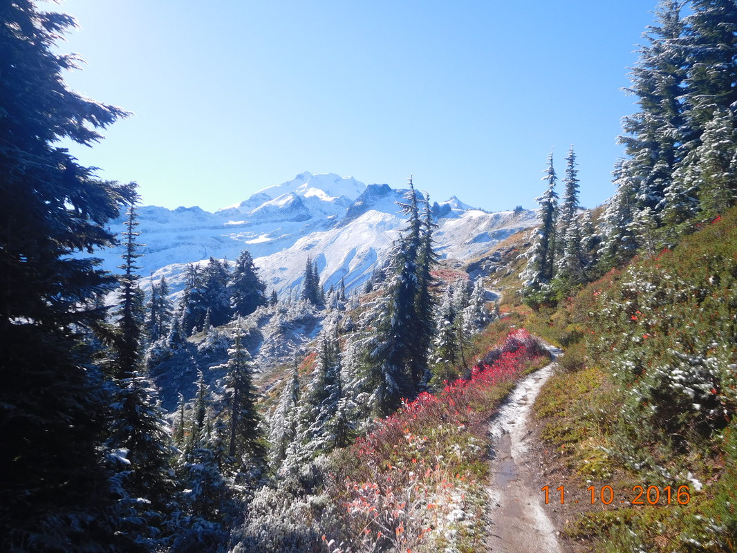
Glacier Peak
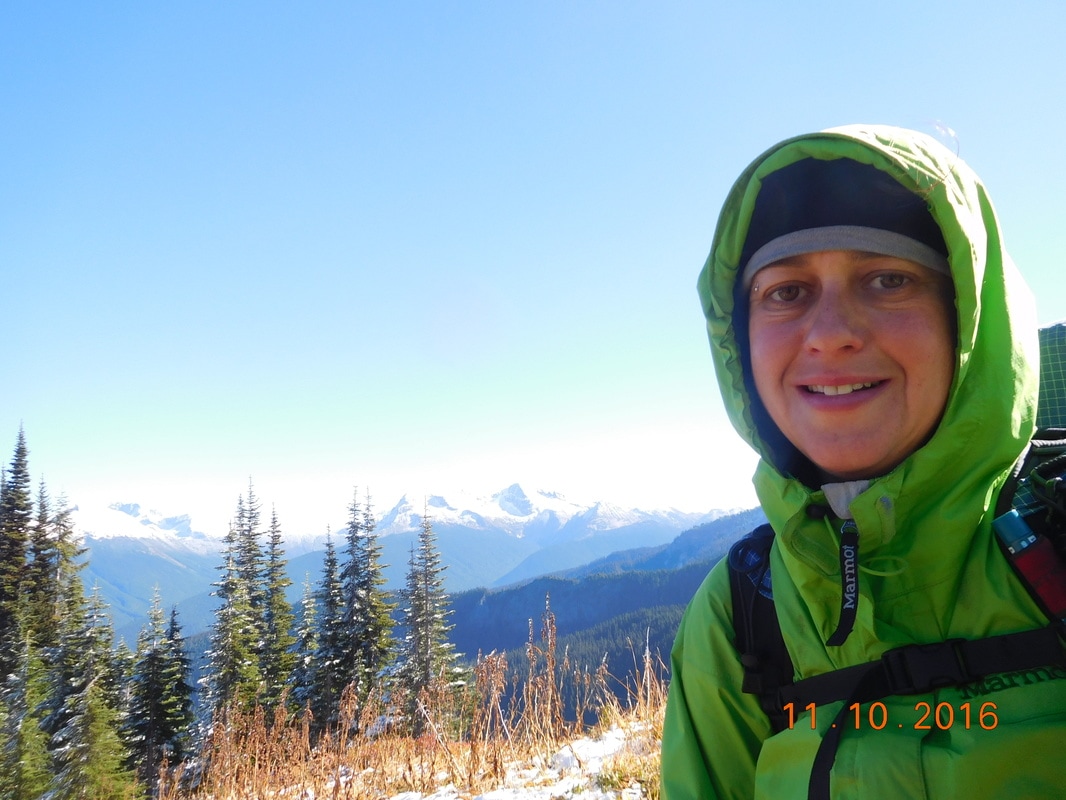
Self-portrait "Cascades in the background"
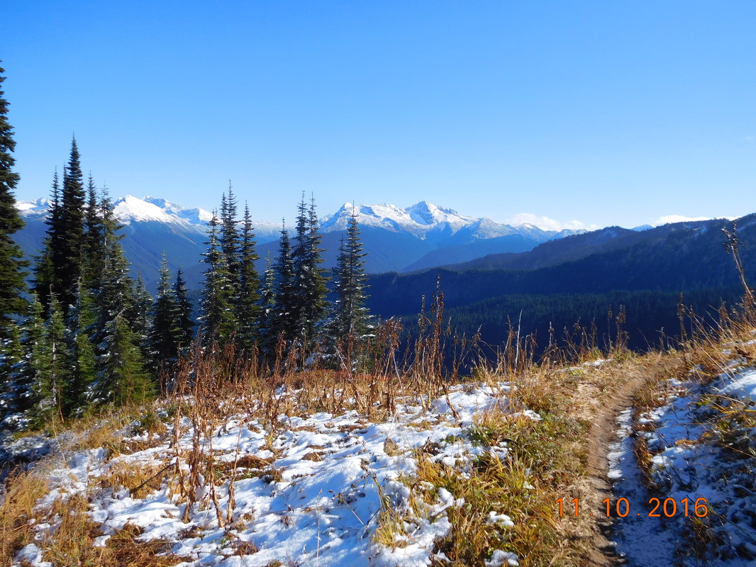
So beautiful
We made it to the top before noon and made our way down. For the entire rest of the day we were under the cover of thick forest. It was so unfair that we finally have blue skies and we barely got to enjoy it. Oh well...at least it's not raining, or worse, snowing, so I'm not going to complain.
Just before 3:30 PM we came to a trail junction. This is where the old PCT and the new PCT meet. Back about 10 years ago a bridge was washed out and hikers had to use a log to dangerously cross the Suiattle River. 5 years ago they replaced the bridge, but placed it 3 miles upstream to a more sturdy location. This added about 5 miles to the PCT. Many hikers take the old PCT route to save these miles, but not us...we are sticking to the actual PCT...plus, I HATE log crossings.
The cool thing about the new PCT is that it goes through an old forest with some huge trees:
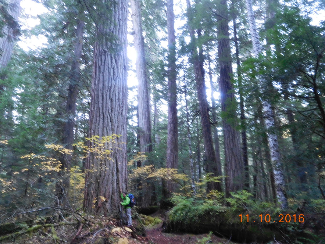
That's a big tree
We didn't see any other hikers on the new trail making us think that we are the only ones that did it and didn't take the shortcut.
There was this cute PCT sign in the new trail once we crossed the river:
There was this cute PCT sign in the new trail once we crossed the river:
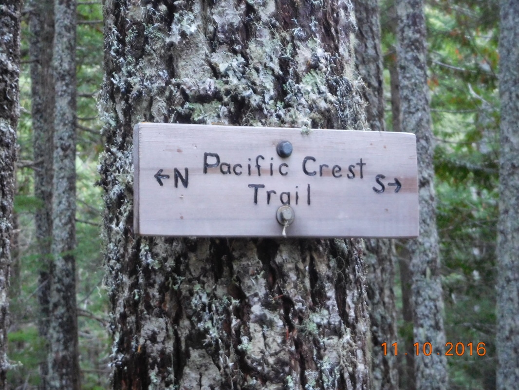
PCT sign of the day
The good thing about us being the only ones on the new PCT is that we didn't have to worry about anyone taking our planned campsite. After hiking nearly 20 miles we crossed a bridge over Miners Creek and there, right above the trail, was a nice flat campsite with plenty of room for Brad and I. What a great day of hiking! Tomorrow we have a similar day with a climb first thing and then down the rest of the day. Hopefully the sky will remain blue so we can enjoy some more views. Until tomorrow...
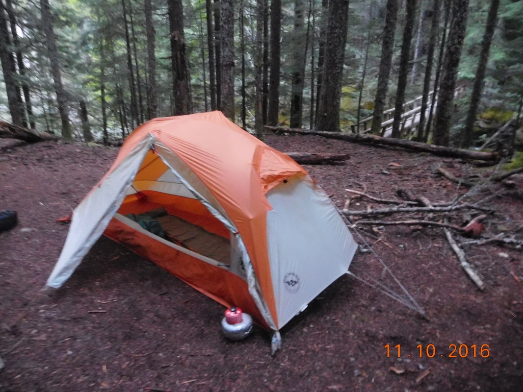
Home for the night with bridge in background
 RSS Feed
