Campsite under power lines to Campsite at mile 1174.46
I slept so well last night. I didn't put the rain flap on my tent and the temperature was perfect for sleeping. The only annoyance was a darn bird that perched on the power line above us and let off a crazy caw at 5:45 AM, 15 minutes before I had to wake.
I laid there for 15 minutes till 6:00 AM and then laid there longer waiting to hear Share Bear start moving first.
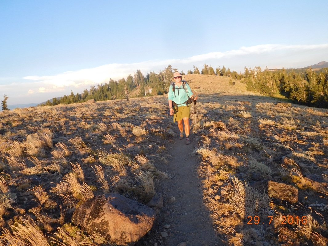
After finally getting up and moving we were ready to hike at 7:18 AM.
I laid there for 15 minutes till 6:00 AM and then laid there longer waiting to hear Share Bear start moving first.
After finally getting up and moving we were ready to hike at 7:18 AM.
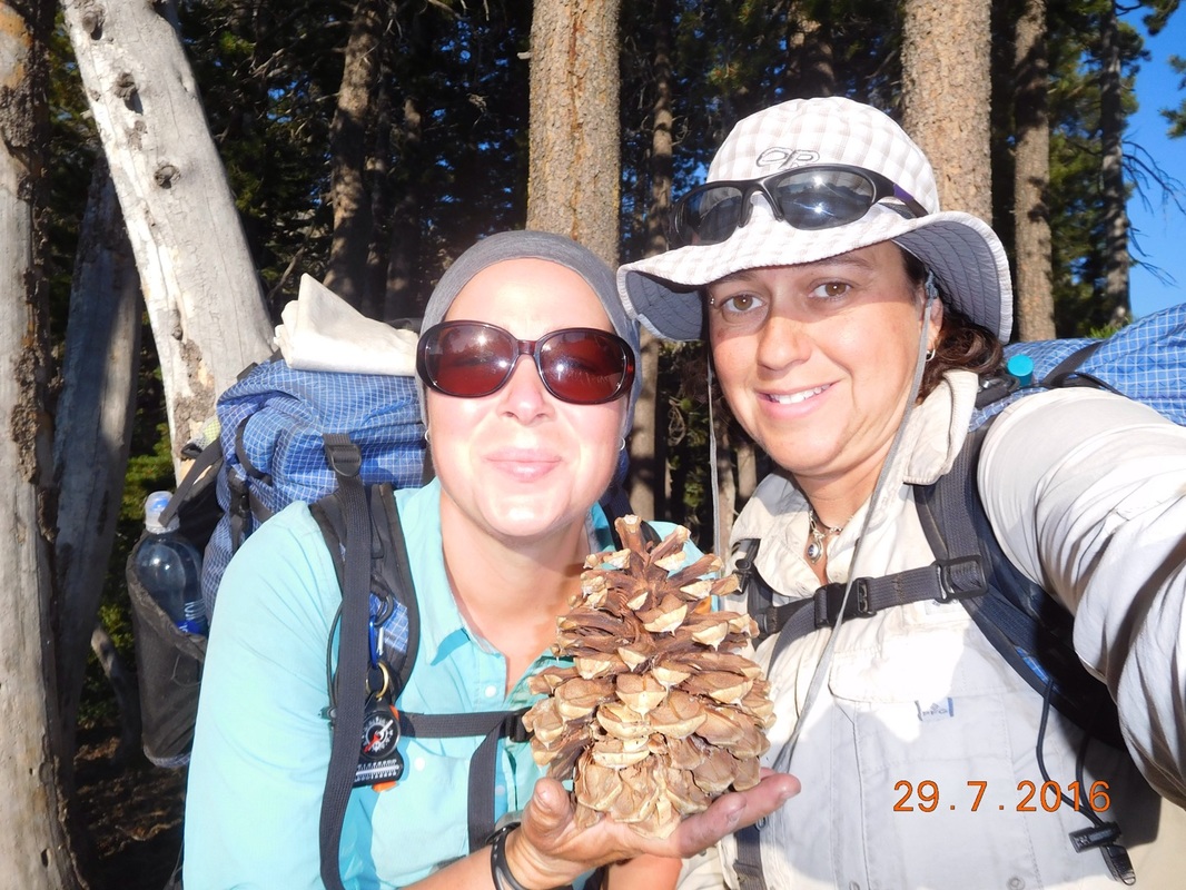
Ready to hike...but leave that pine cone behind!
Today we are meeting Tim and Brad at a rest stop on I-80 to get our food for the next 2 days. The rest area is 3.44 miles away and they plan on being there at 9:00, so we better get going.
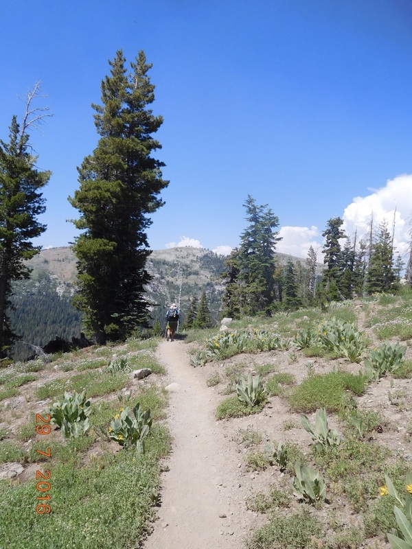
Of course today's hike starts out by climbing a hill.
Of course today's hike starts out by climbing a hill.
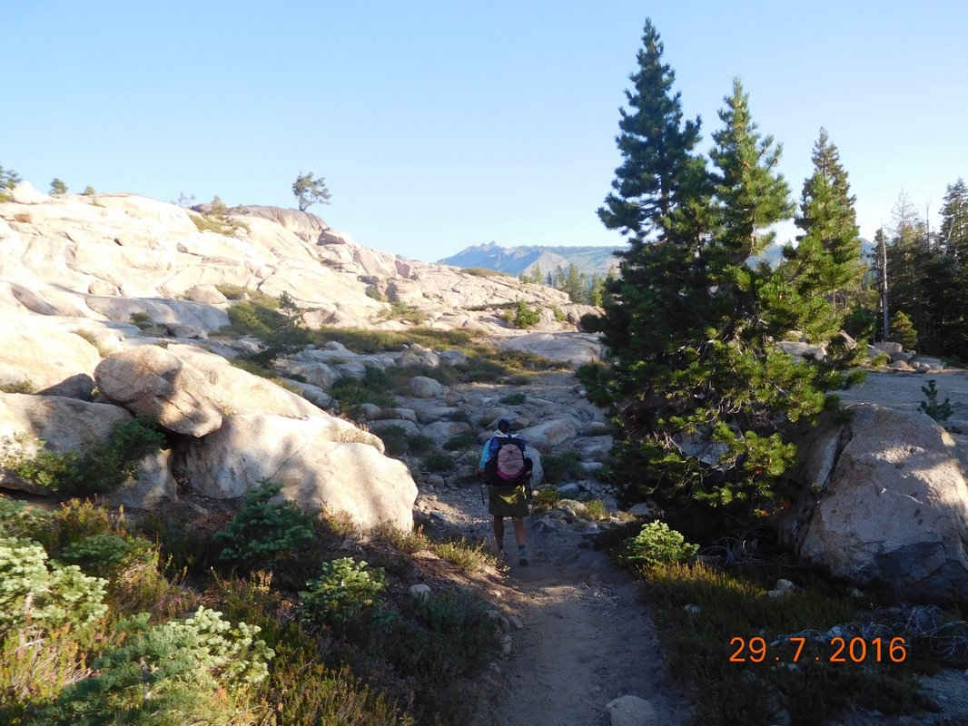
Share Bear leads the way up the hill
How exciting...another interstate crossing. It's been a while since we crossed one of these.
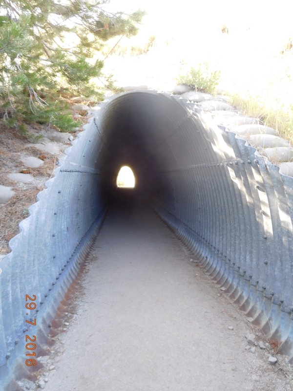
Tunnel under I-80
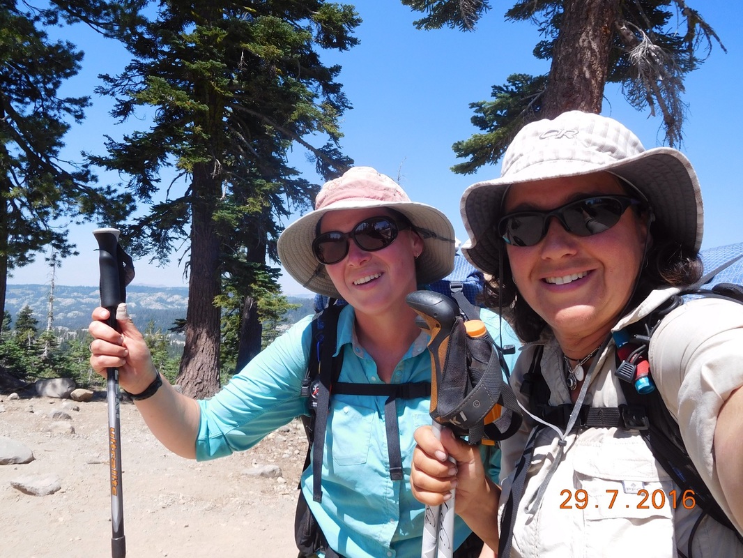
Besides our food for the next 2 days, Tim also brought us hard-boiled eggs, cold Gatorade, and some fruit. We hung out at that rest area for almost 2 hours...way to long, especially since we plan on hiking 20 miles today and it was already 10:40 AM and we still had 17.20 miles to hike.
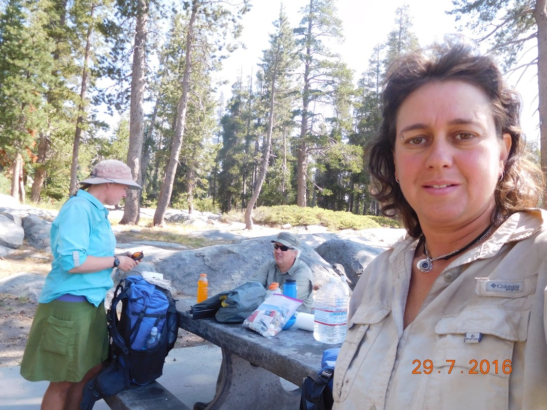
Hanging at the I-80 rest stop
We were finally able to leave. Right out of the rest stop we had Castle Pass to climb. At 11:38 PM we arrived at the top.
Castle Pass celebration, 7,928 feet
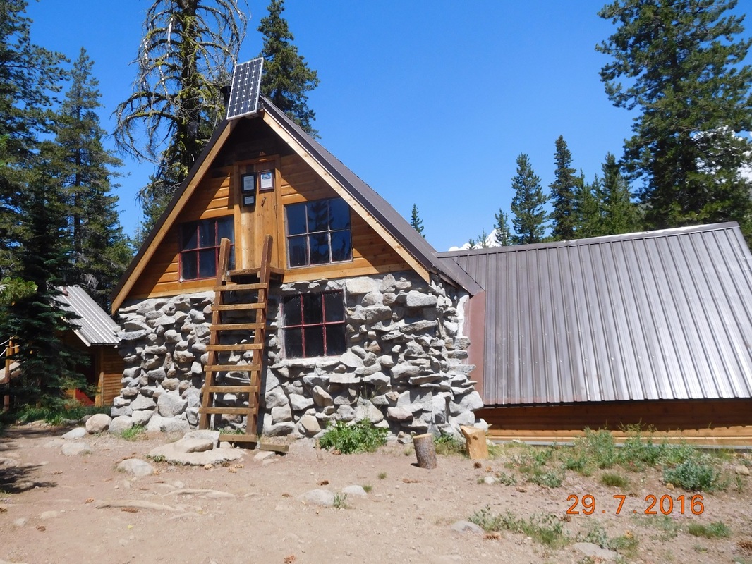
Less than one mile after leaving the top of Castle Pass we came across Peter Grubb Hut, a shelter supported by the Sierra Club, that hikers and cross-county skiers can use.
As I was taking my photo, Share Bear tried to take one as well. She decided she had to back up to get the entire hut in the photo. Well, she backed right into a rock and fell backwards over it. Since my camera was out to take a photo of the hut, it was out and ready to take a photo of Share Bear on her back:
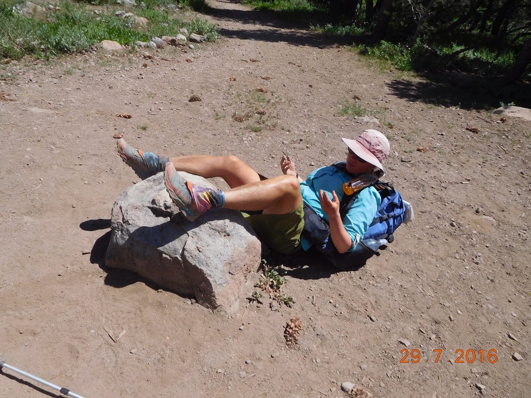
Sorry Share Bear
By the way, she was fine. The backpack broke the fall.
After getting up and stuff, we entered the hut to check it out. To enter, you climb the ladder and enter through the top door. This photo that was hanging on a wall shows why the door is way up high:
After getting up and stuff, we entered the hut to check it out. To enter, you climb the ladder and enter through the top door. This photo that was hanging on a wall shows why the door is way up high:
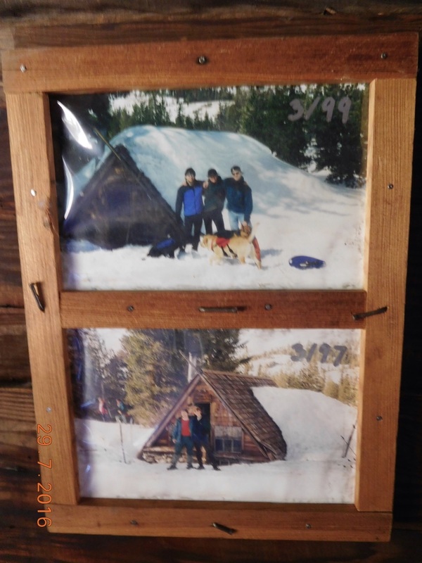
That's a lot of snow
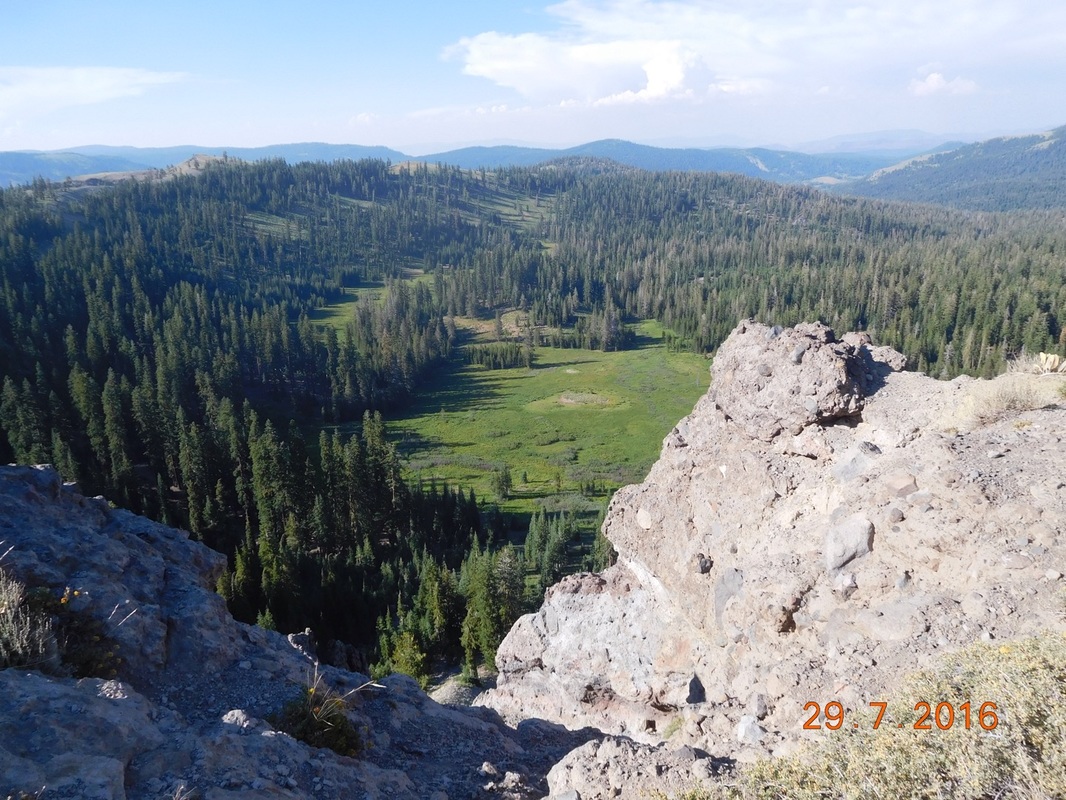
After wasting time hanging in the hut, we were really falling behind schedule, so we continued on. We stopped for lunch at 1:15 PM and stayed put for 1.5 hours. It was now 2:45 PM and we still had 10.5 miles to hike. Are we going to make it?!? At least the scenery was nice:
Share Bear ahead on the beautiful PCT
After another climb we wound up here:
Wonderful
And then at 5:40 PM. 3 hours after our lunch break, we still had over 5 miles to hike. We thought that by 8:30 PM we should make it to camp.
Three miles later we stopped to collect water. This is supposedly the last water for 7 mile. Since we are camping in just over 2 miles, we will have a dry camp, so we need water. A leaving with 2 more liters of water, we crossed a dirt road and came across this cool PCT sign. The emblem is stamped into the wooden post:
Three miles later we stopped to collect water. This is supposedly the last water for 7 mile. Since we are camping in just over 2 miles, we will have a dry camp, so we need water. A leaving with 2 more liters of water, we crossed a dirt road and came across this cool PCT sign. The emblem is stamped into the wooden post:
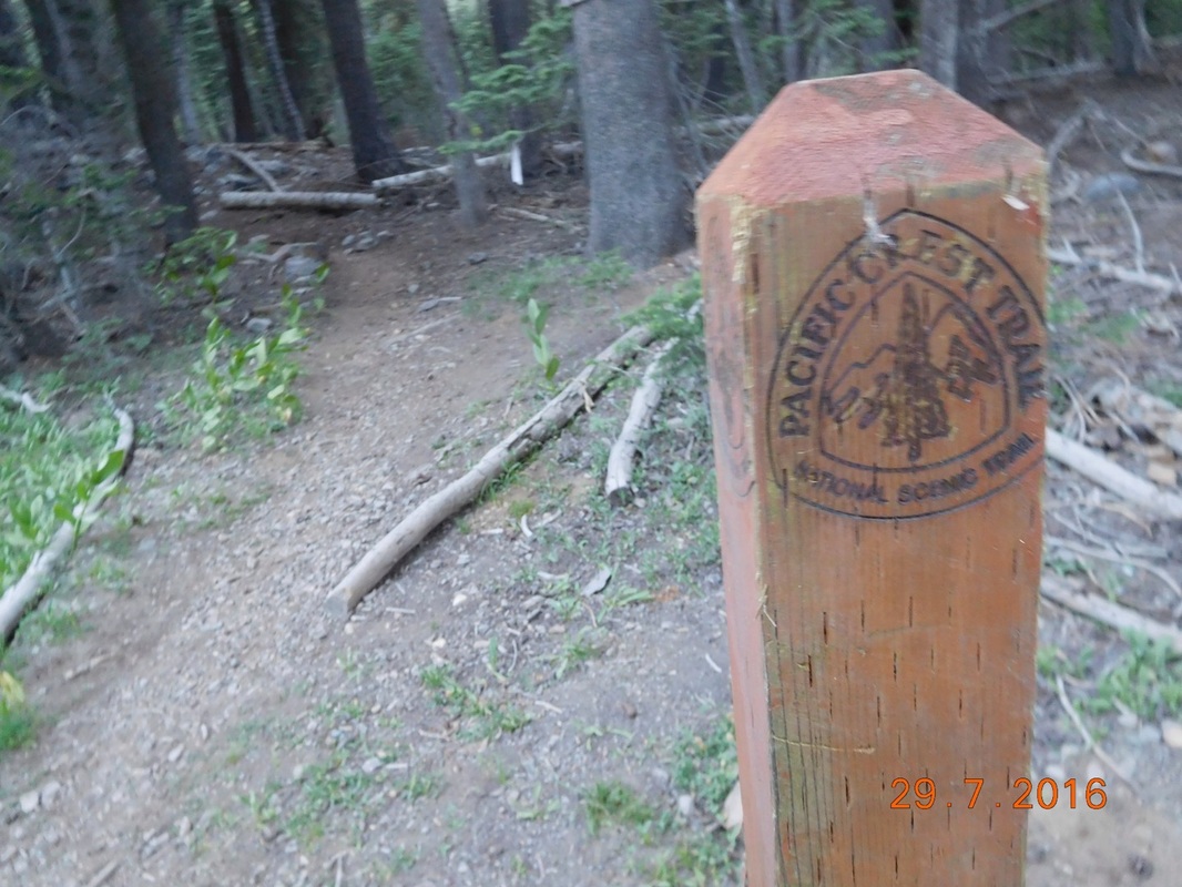
PCT sign of the day
The next 1.5 miles was up almost 650 feet...just what we need at the end of this long day. Even though the climb was hard, the view when we got to the top was well worth it.
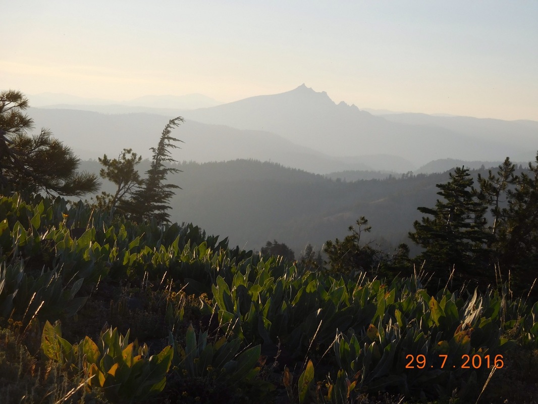
View from the top
Share Bear arriving at the top
Finally, just before 8:00 PM we made it to our campsite. We quickly set up our tents and ate dinner. All I wanted to do at that time was get in my tent and lay down. I was so done after today's hike.
Tomorrow Tim and Brad are meeting us 5 miles in at a dirt road crossing which will allow us to slack pack the last 15 miles tomorrow into Sierra City. If this works out I will be so grateful to Tim and Brad. So, until tomorrow...
Tomorrow Tim and Brad are meeting us 5 miles in at a dirt road crossing which will allow us to slack pack the last 15 miles tomorrow into Sierra City. If this works out I will be so grateful to Tim and Brad. So, until tomorrow...
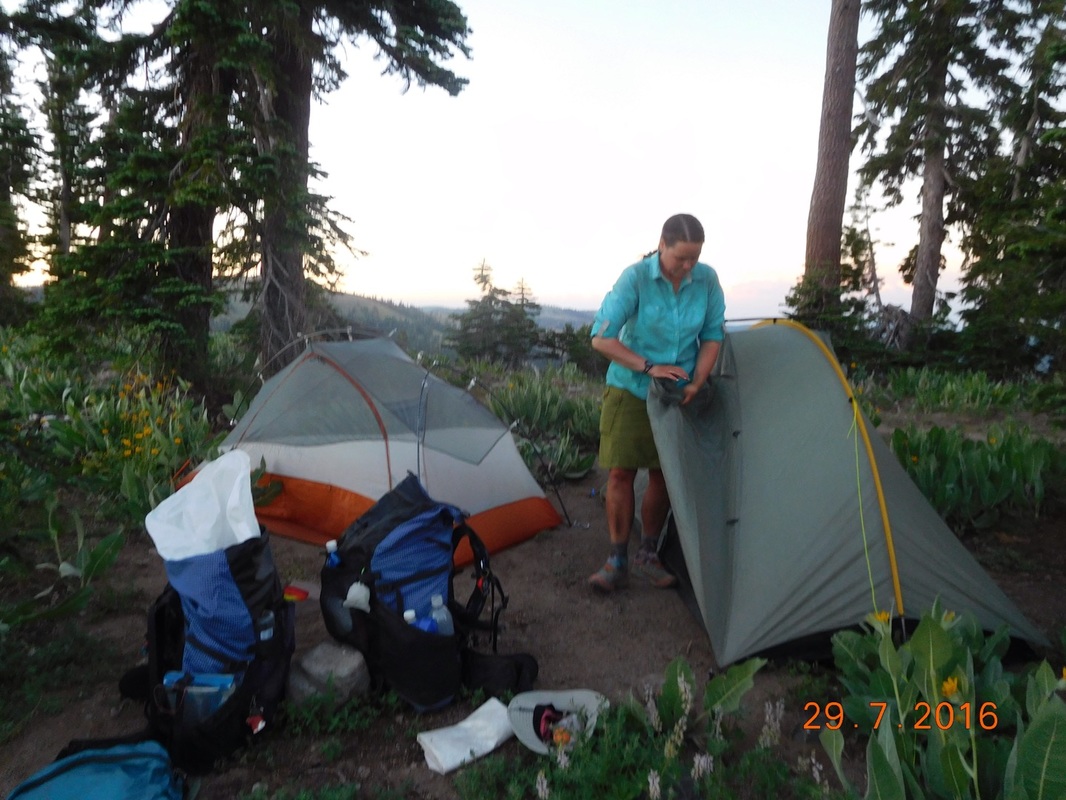
Our home for the night is close quarters

The view from inside my tent
 RSS Feed
